
Friday
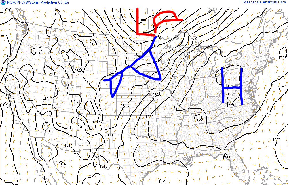
The high pressure system over the Ohio Valley that brought beautiful and pleasant weather to the Mid State region this week will slowly weaken allowing for warm, moist air to return on southerly winds. This will send our high temperature to 89 degrees today. Dew points will slowly climb into the mid 60s which will make it feel a tad stickier than it has all week.
Below is a graphic showing the effect of the dew point on your life

Saturday And Sunday
This southerly flow will continue this weekend allowing temperatures to climb into the low 90s both Saturday and Sunday. Dew points will be in the mid to upper 60s making it feel just a bit uncomfortable, but not oppressive like we saw last weekend. We will have to watch out for a few pop showers and thunderstorms with the increase in heat and humidity but nothing significant is expected.
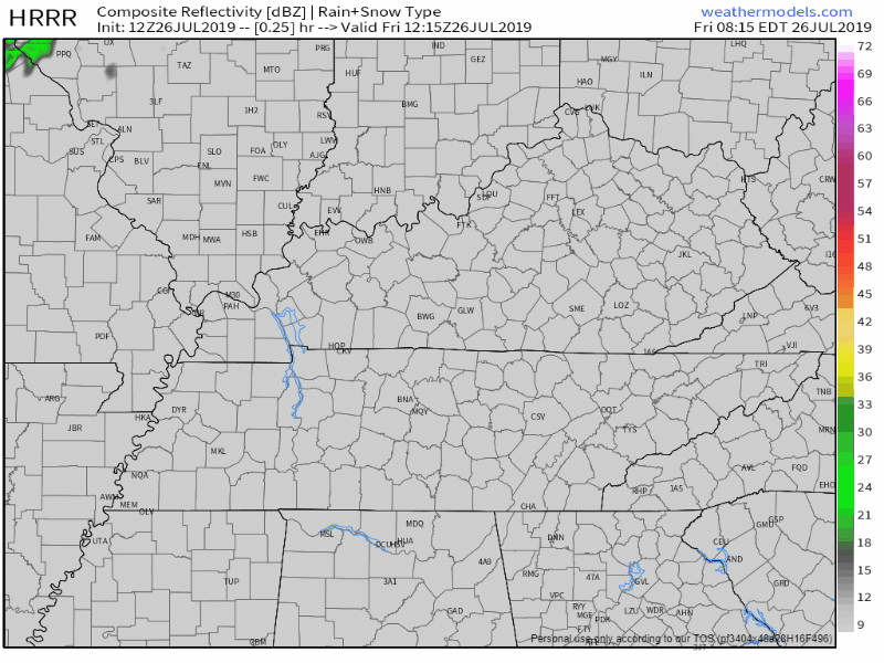
Here is the latest HRRR model which shows just a few pop up showers or storms late Saturday afternoon, again we do not expect anything significant.
Next Week
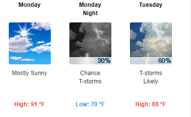
Monday will continue to be warm and humid ahead of a cold front that will push through Tuesday and Wednesday. This front may stall across the state providing daily chances for showers and thunderstorms. This is what the National Weather Service has to say:
Likely showers and thunderstorms return to the forecast by Tuesday with the western part of Middle TN seeing scattered storms Monday night.
The front that brings the thunderstorms looks like it could get hung up on the Appalachian mountains giving middle TN /especially the Cumberland Plateau and south/ several days of diurnal thunderstorm chances lasting into next weekend.
This is the latest NWS forecast for early next week:
Have a great day and be sure to check back for updates!

Categories: Forecast Blogs (Legacy)
You must be logged in to post a comment.