
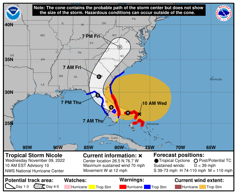
Two stories for today. First, Nicole will be making landfall on the east coast of Florida in the next 24 hours. If you have interests in Florida and need more info on impacts there, reference the National Hurricane Center.
As Nicole makes a hard right, impacts (rain) will overspread The Appalachians, with heavier rain in east TN, less in west TN. We, of course, are in between. There is expected to be a sharp gradient of rain coverage and amounts on the western edge of the rain. Each frame below is a different computer model illustrating rain accumulation. Notice how the placement of the heavier rain shifts slightly.
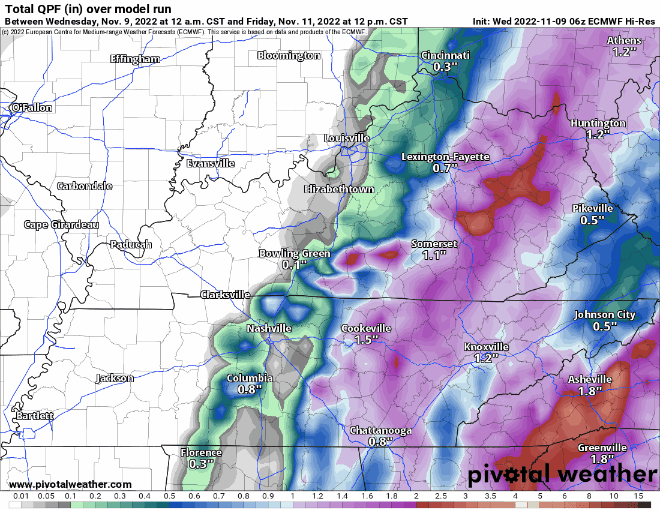
None of them show the heavier rain reaching us. However, we do anticipate some rain. Generally less than in inch beginning pre-dawn Friday morning and continuing through a good part of the morning.
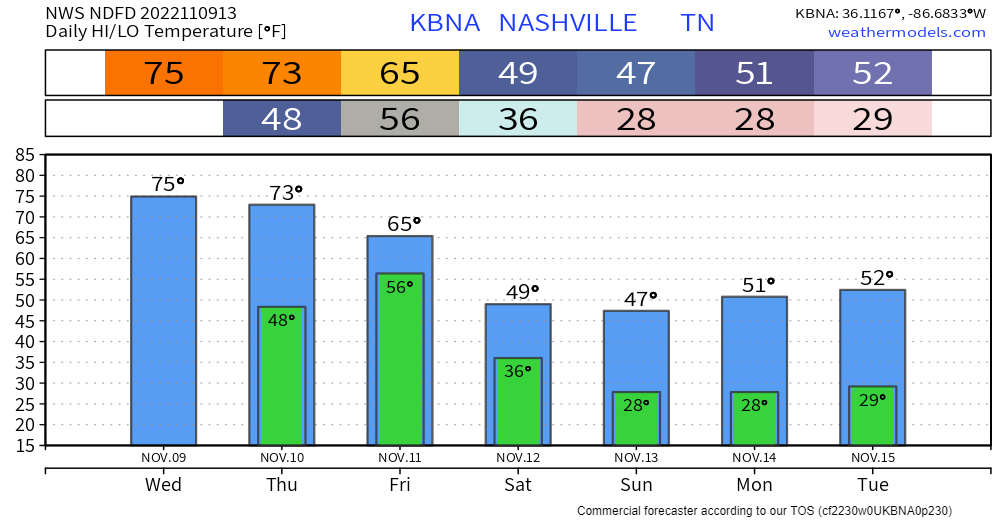
Temperatures
Back to reality. The remnants of Nicole are coinciding with the arrival of a strong cold front barreling in from the west. Friday night we drop into the 30s. Saturday and Sunday we don’t get out of the 40s for highs.
Quick References:
Weather changes constantly.
Follow @NashSevereWx on Twitter for any changes to this forecast.
Live coverage during tornado and severe thunderstorm warnings.

Look good.
Support the mission.

We are 100% community supported. No ads. No subscription fees. Keep it free for everyone.


Categories: Forecast Blogs (Legacy)
You must be logged in to post a comment.