
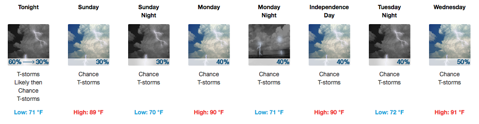
Welcome to July!

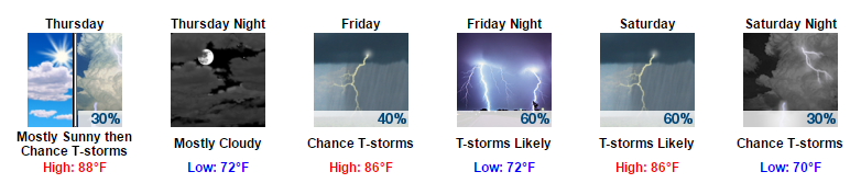
Storms This Afternoon, Exiting By Evening
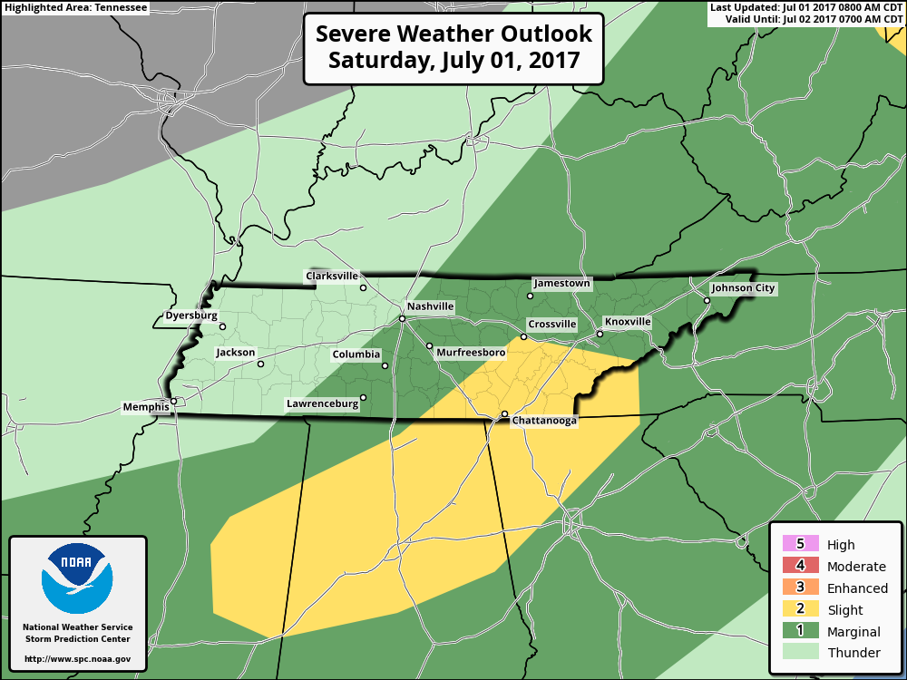
UPDATE as of 5:00PM CDT: The eastern half of both Davidson/Williamson remain under a “Marginal Risk” (1 out of 5) for damaging winds and some hail.
We’ve seen several showers and thunderstorms impact Davidson/Williamson counties today, some with ~40 mph wind gusts. More could develop through the evening, so we will be monitoring radar for developments.


You must be logged in to post a comment.