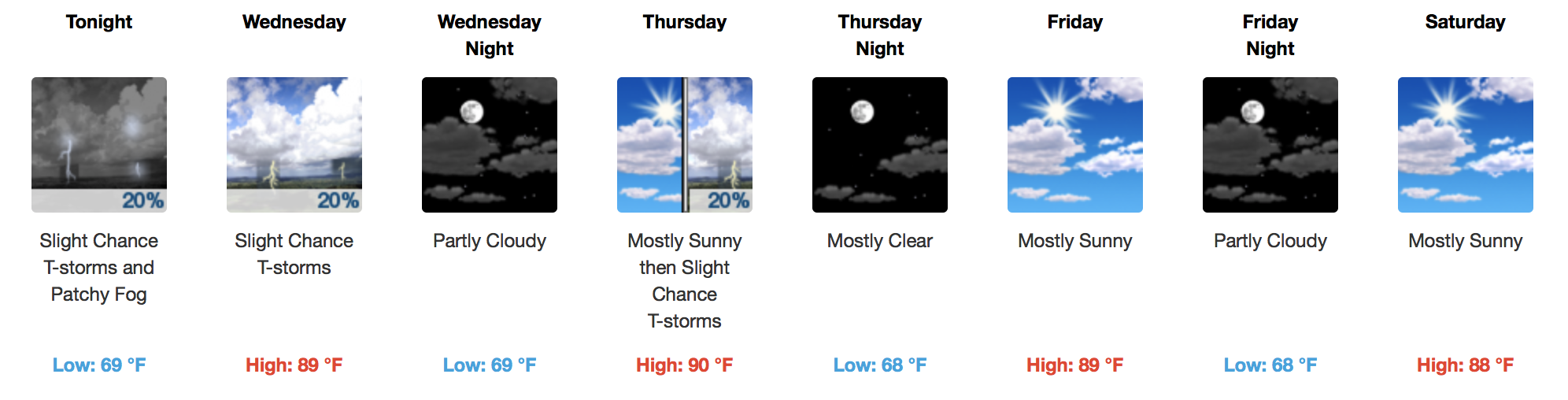
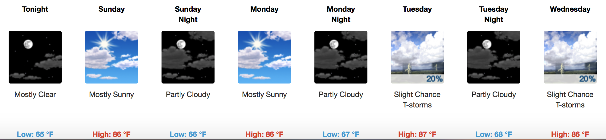
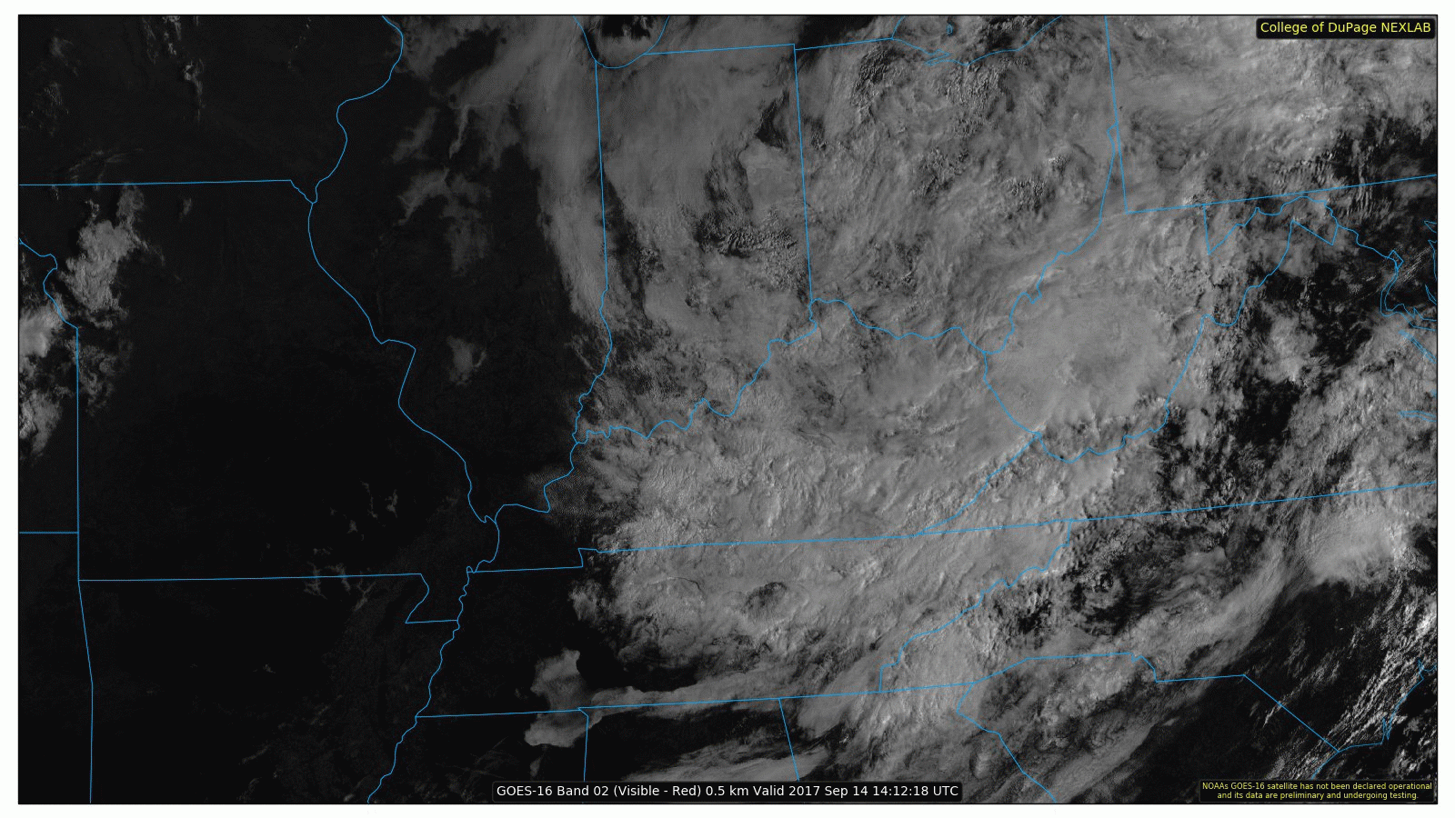
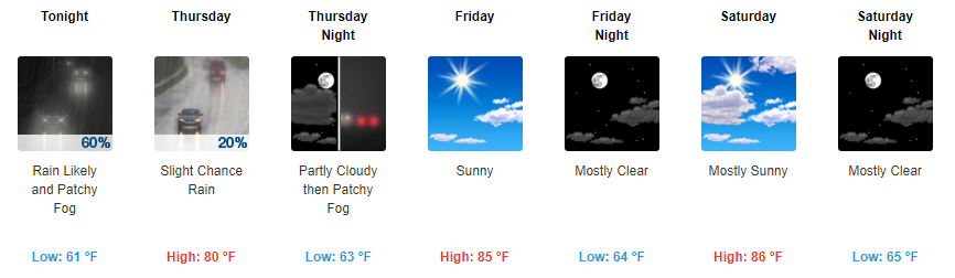
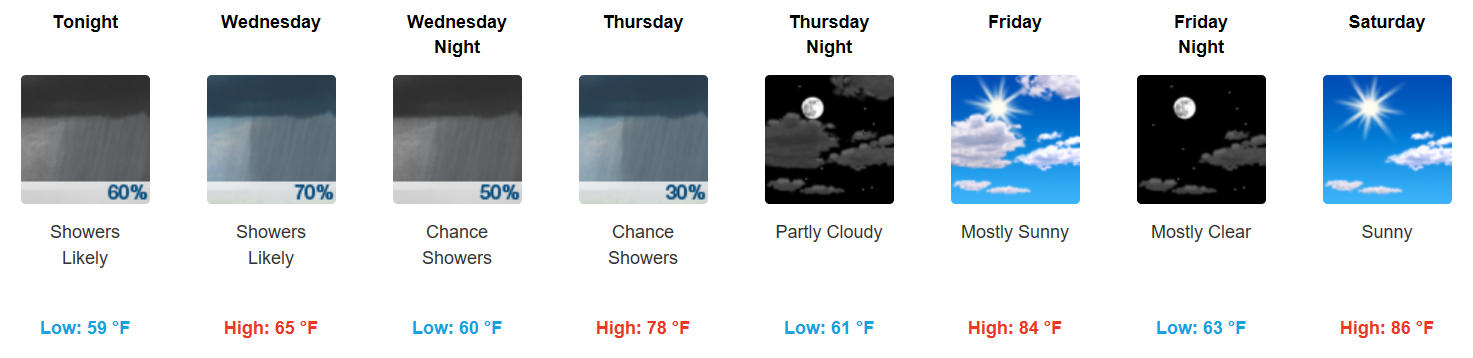
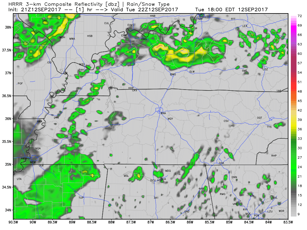
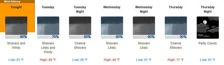
Dry Into Tonight
Another bonus for today is that we should stay rain-free. If you have evening plans tonight, temps will drop through the 70s and into the upper 60s overnight.
https://giphy.com/gifs/youngertv-tv-land-tvland-3oKIP6cQ7KAkr8scPS

Another bonus for today is that we should stay rain-free. If you have evening plans tonight, temps will drop through the 70s and into the upper 60s overnight.
https://giphy.com/gifs/youngertv-tv-land-tvland-3oKIP6cQ7KAkr8scPS


A frontal boundary is hanging out with us this week which means we will continue to forecast daily rain chances. As today goes on, this front is expected to slowly sag further south, which means areas in Northern Middle Tennessee will see less rain chances this week than those elsewhere. Somewhere in the middle are Davidson and Williamson Counties.
Expect a cloudy week, keeping temps below 90°. Humidity remains set to “Summer.”
As I write this, storms are breaking out all over Middle Tennessee.
Look for two rounds of storms.
Round 1
Storms developing on top of us, or south of us, beginning now until Round 2 arrives. These storms should work their way north. They are not widespread and you may not see anything at all.
Yesterday’s weather was a fall preview, it wasn’t the full length movie. Although cloud cover will keep temps in the 80°s this week, humidity is on the rise. Expect dew points in the upper 60°s this week. That’ll be sticky and gross.

Things really can’t get any better than they have been today for August. Temps will stay relatively cool even into the evening hours tonight.
A quick fun fact for today:
This morning we tied the record low for August 5, 58° (1974).

Low humidity (dew points in the 50s), temperatures in the low to mid 80s, and sunshine will make for a fantastic start to the weekend! I can attest to the power of this cold front…the air behind it feels and smells like fall.

Friday
Storms are expected to be more widespread on Friday as a cold front approaches. This front will be moving through during afternoon peak-heating hours, which means a few thunderstorms could become strong to severe. Damaging winds and hail will be the most notable threats. The Storm Prediction Center has us under a 1/5 risk, or “Marginal” risk.

Tomorrow appears to be a whole lot like today and yesterday with decent cloud coverage through a good bit of the day. Highs will be just below the 90° mark with dew point temps coasting around the mid 60s.

A slight chance of a storm exists today from Davidson/Williamson Counties westward. There’s just enough moisture, apparent on this morning’s upper-air observations, to squeeze out a storm or two. Not everyone gets so lucky, but some burnt area lawns could definitely use it.
A pleasant evening is in store for all of Middle Tennessee with temps falling into the upper 60s overnight.
Tomorrow dew points will begin to creep back into the mid-60s range.
It won’t feel horrible out, but it also won’t feel as nice as it has been.
You must be logged in to post a comment.