
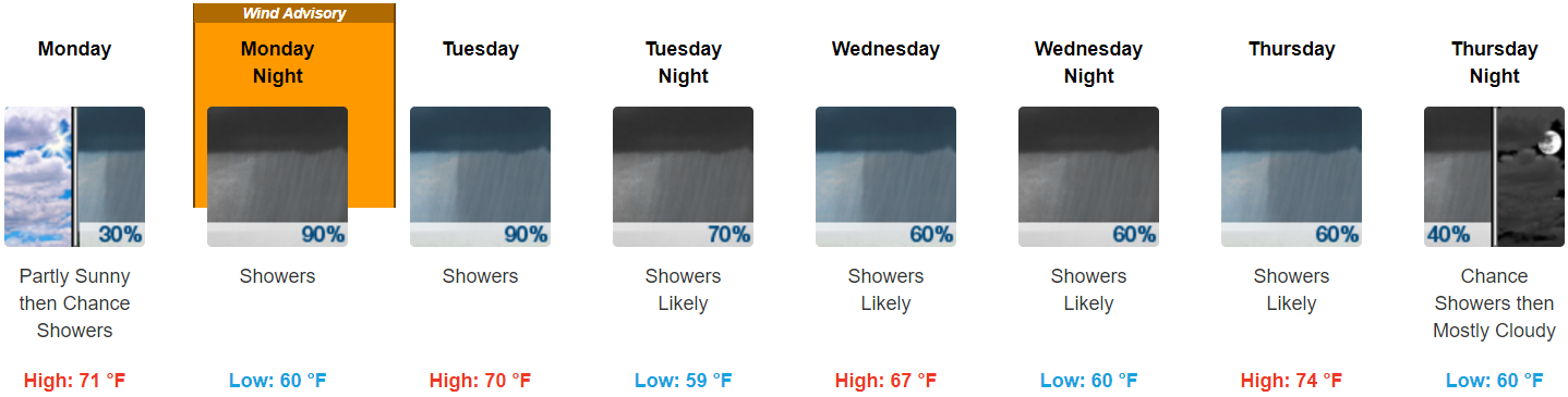
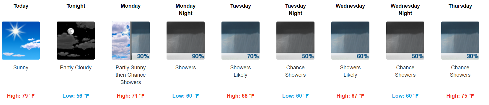
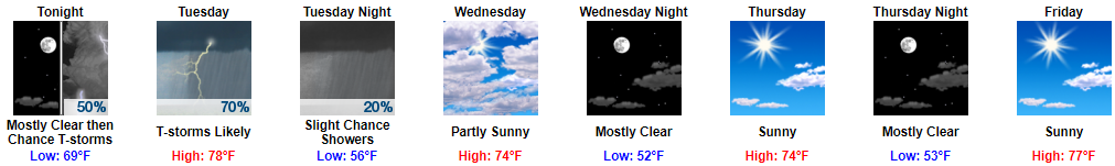
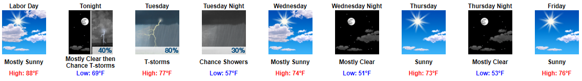
Summary
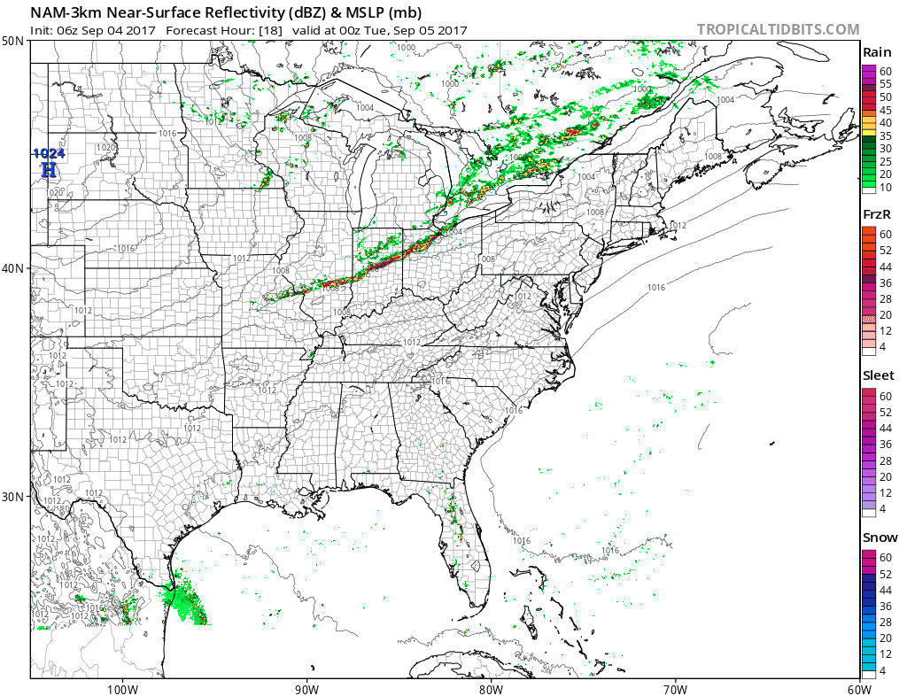
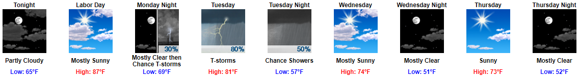
- 1.5″ to 2″ Monday afternoon through Thursday afternoon is most likely; most of it falling Monday night into Tuesday morning. Flash flooding cannot be ruled out, but it is not expected.
- A Wind Advisory goes into effect Monday at 7 PM until Tuesday at 7 AM for winds 15 to 25 mph with gusts to 45 mph. Expect a few trees down, isolated power outages possible, and hazardous driving conditions.
- Severe thunderstorms and tornadoes are not currently a concern.
- This does not look like a repeat of Harvey, but stay connected to reliable weather information as this storm approaches.
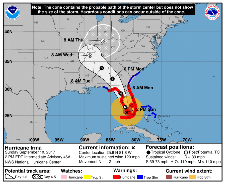
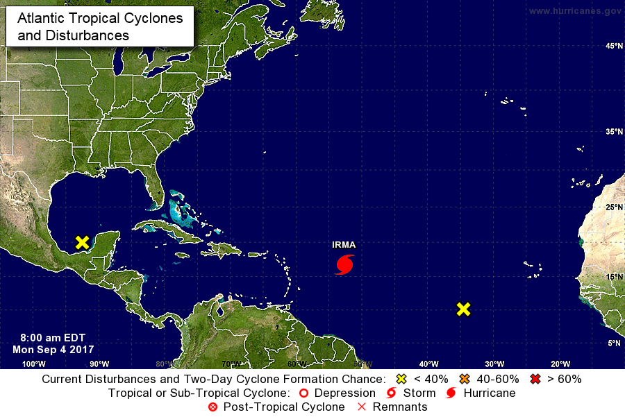
Irma’s Rain
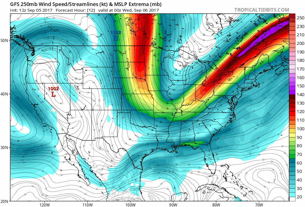
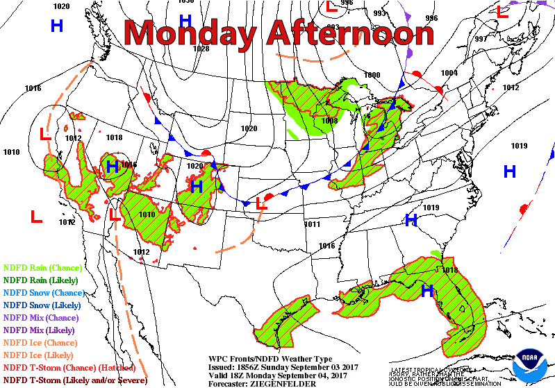
Late Monday night, Irma’s center will pass to our south. See the red “L” below.
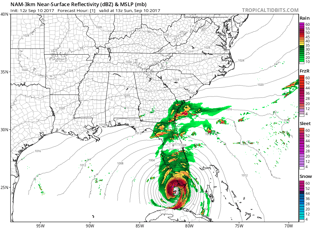
Irma is a large storm. Before Irma’s center crosses I-65 in Alabama, rain will approach from our southeast.


You must be logged in to post a comment.