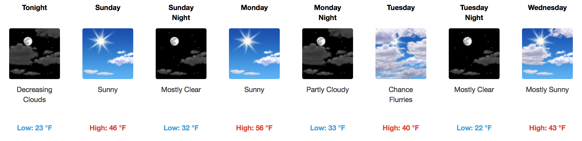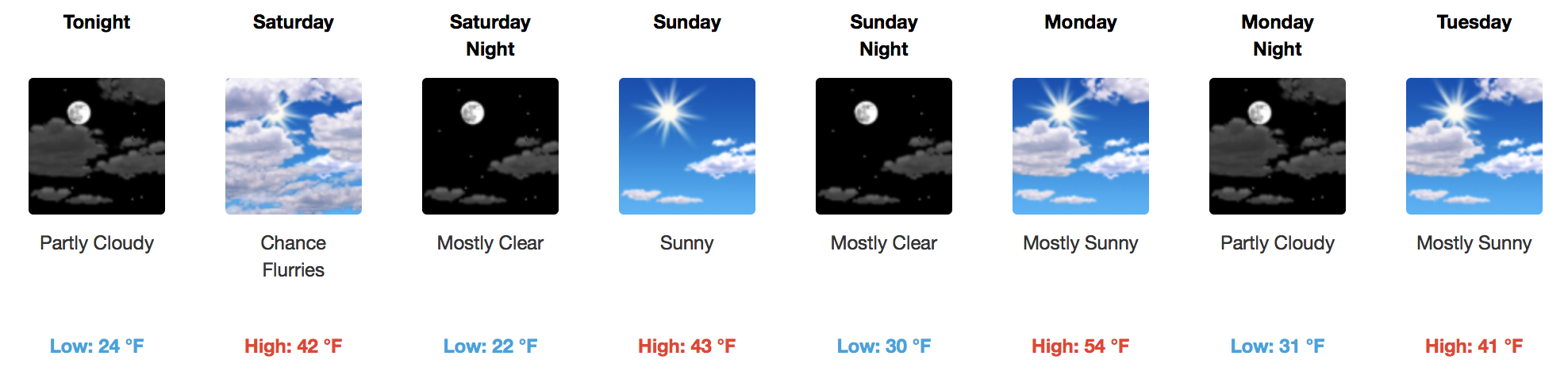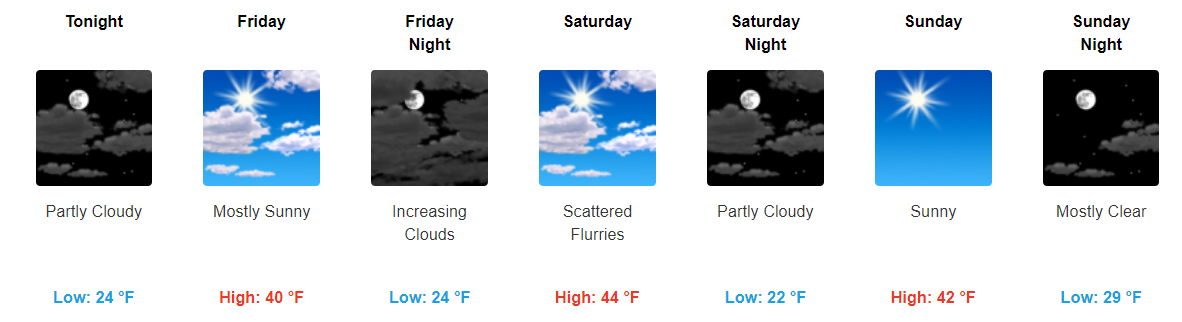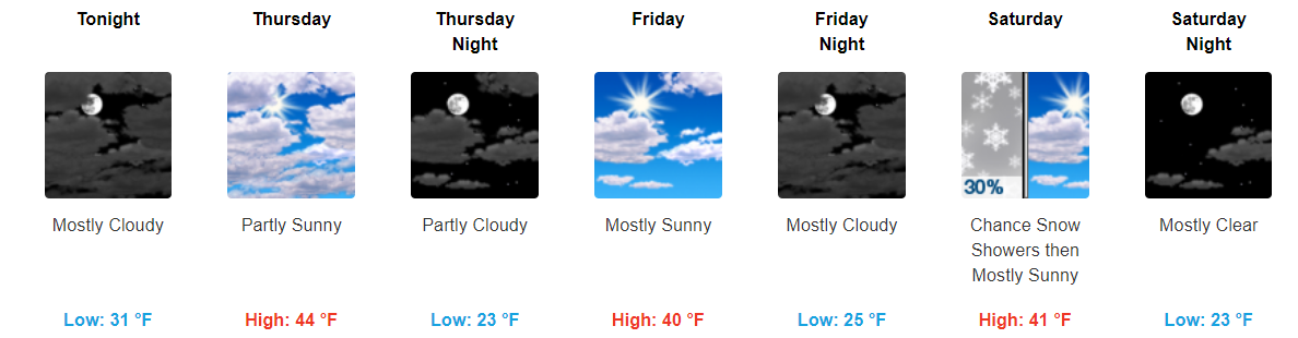
Hurricane Nate made landfall on the northern Gulf Coast.
Nate’s now a tropical storm, speeding northeast into Middle and Eastern Tennessee. The center of Nate should pass east of us.


Rain
Off and on all day.
Hurricane Nate made landfall on the northern Gulf Coast.
Nate’s now a tropical storm, speeding northeast into Middle and Eastern Tennessee. The center of Nate should pass east of us.


Off and on all day.

Some fast moving showers have popped up over Middle Tennessee this morning, in addition to extra cloud cover. A gradual increase in rain coverage is expected today as moisture pumping in from the Gulf of Mexico and Hurricane Nate aid in shower development. Additionally, a frontal boundary will spark off a few storms after dark tonight.

Let me start by saying that there are still a lot of uncertainties surrounding Nate’s track and how the remnants will eventually impact Middle Tennessee. Ultimately, we will see showers, and sometimes showers will be heavier than others.

Sunny skies and mid-upper 80s are two phrases you’ll only find in the late spring and early fall, but to have 5-6 days of it in a row has been quite the gift. Unfortunately, the sunshine and “relaxed” weather pattern will come to a screeching halt this weekend, thanks to an active Gulf of Mexico. Southerly flow is expected to return in full force tomorrow, ushering in added moisture and warmth…consequentially leading to increased cloud cover and a small chance for an afternoon thunderstorm.

High pressure remains well in control of our area and looks to stay that way through at least Friday. This will keep our temps above-average in the mid 80s with overnight temps falling into the upper 50s.

GOES 16 Visible Loop


GOES 16 is busy this morning across the Mid-Mississippi Valley, as showers and a few storms are ongoing. An increase in moisture is evident over those areas, but high pressure holds strong for us here in Nashville.

Temperatures Today/Tomorrow
[av_textblock av_uid=’av-tp8utb’]
[cjtoolbox name=’Treg DONT DELETE’]
[/av_textblock]
Starting tomorrow, our highs will jump into the low to mid 80s. Overnight temps this week will dip into the upper 50s to low 60s, so you may need a jacket in the evening and for the early AM commute.
Testing streaming with some new equipment. Here’s Will (and Sam) on tonight’s sunset:
October means “you’ll say ‘brrrr’ eight times.”

You’ll probably want a jacket in the morning.

Temperatures Today/Tomorrow
[av_textblock av_uid=’av-woy64i’]
[cjtoolbox name=’Treg DONT DELETE’]
[/av_textblock]
Those little music notes will get close to the 80ºF mark today and Sunday, but nothing higher than that! A few fair weather cirrus clouds will traverse the Tennessee Valley, as seen on visible GOES 16 imagery this morning:

High pressure will remain in control over the foreseeable future with no rain chances in sight. While temps won’t be completely fall-like, they will feel a bit nicer with highs in the low 80s and overnight temps in the 50s. Tomorrow will by far be the coolest day with highs in the upper 70s.
You must be logged in to post a comment.