
Warmer Day On the Way
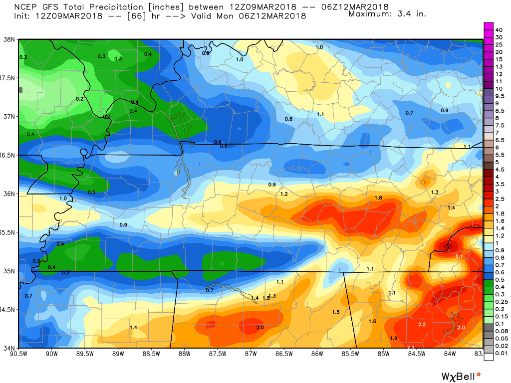
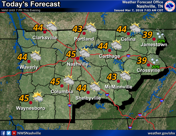
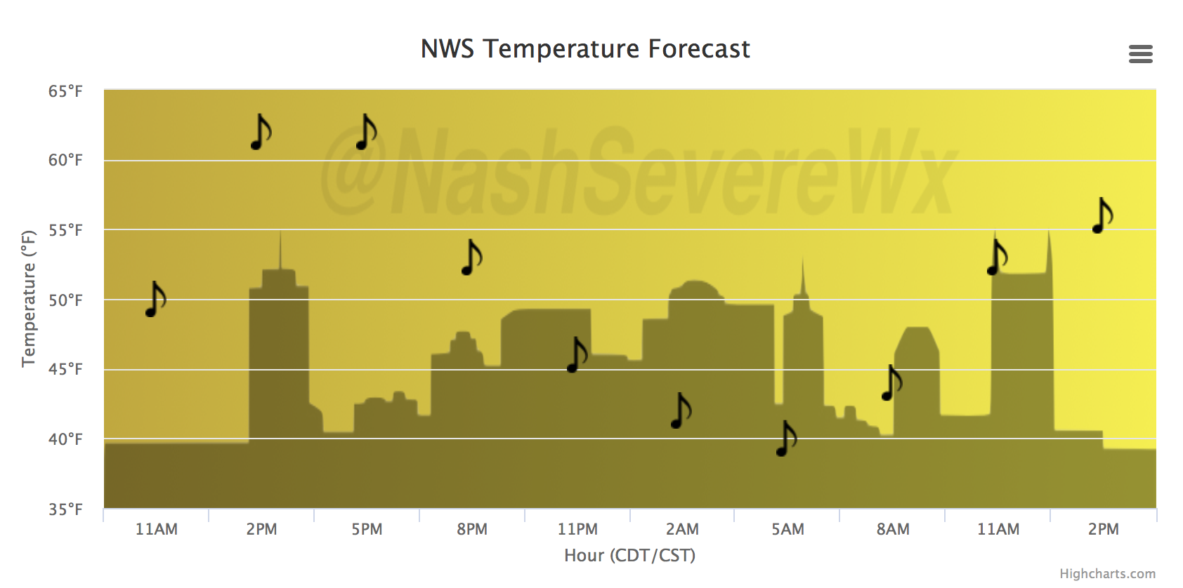
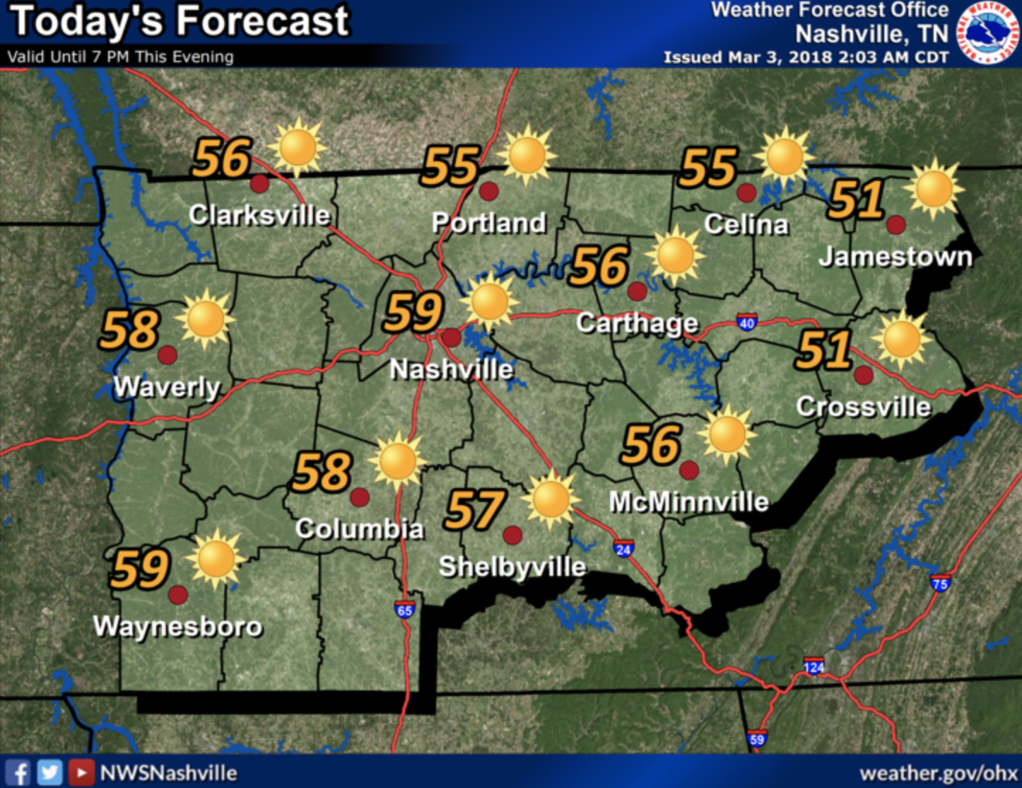
A southerly breeze will bump temperatures into the middle 50s today, and while some clouds will be passing through, there will be enough sunshine to get us there. It’s Friday! And for some of the kiddos/teachers/college folk out there, Spring Break officially begins today. Road conditions will be most optimal today for heading south. Rain and a few storms will make driving less pleasant on Saturday, detailed below. If you’ll be a beach bum like me, don’t forget the SPF 1,000 sunscreen.


You must be logged in to post a comment.