Hot This Afternoon
At the 4:00 pm observation at BNA this afternoon, the temp was 94° with a dewpoint of 62°. It’s hot! Temps should cool to 72° tonight with rain chances very low, although a few spotty showers aren’t out of the question.

At the 4:00 pm observation at BNA this afternoon, the temp was 94° with a dewpoint of 62°. It’s hot! Temps should cool to 72° tonight with rain chances very low, although a few spotty showers aren’t out of the question.
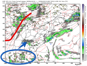
Temps and humidity will rise this afternoon. High today 91º, with dew points remaining in the mid to upper 60°s. That’s not oppressive humidity. Pretty much normal for early August.
This weekend will be hot, humid, and mostly dry.
High temps will stick close to 87° today, dewpoints are holding steady in the upper range of uncomfortable.
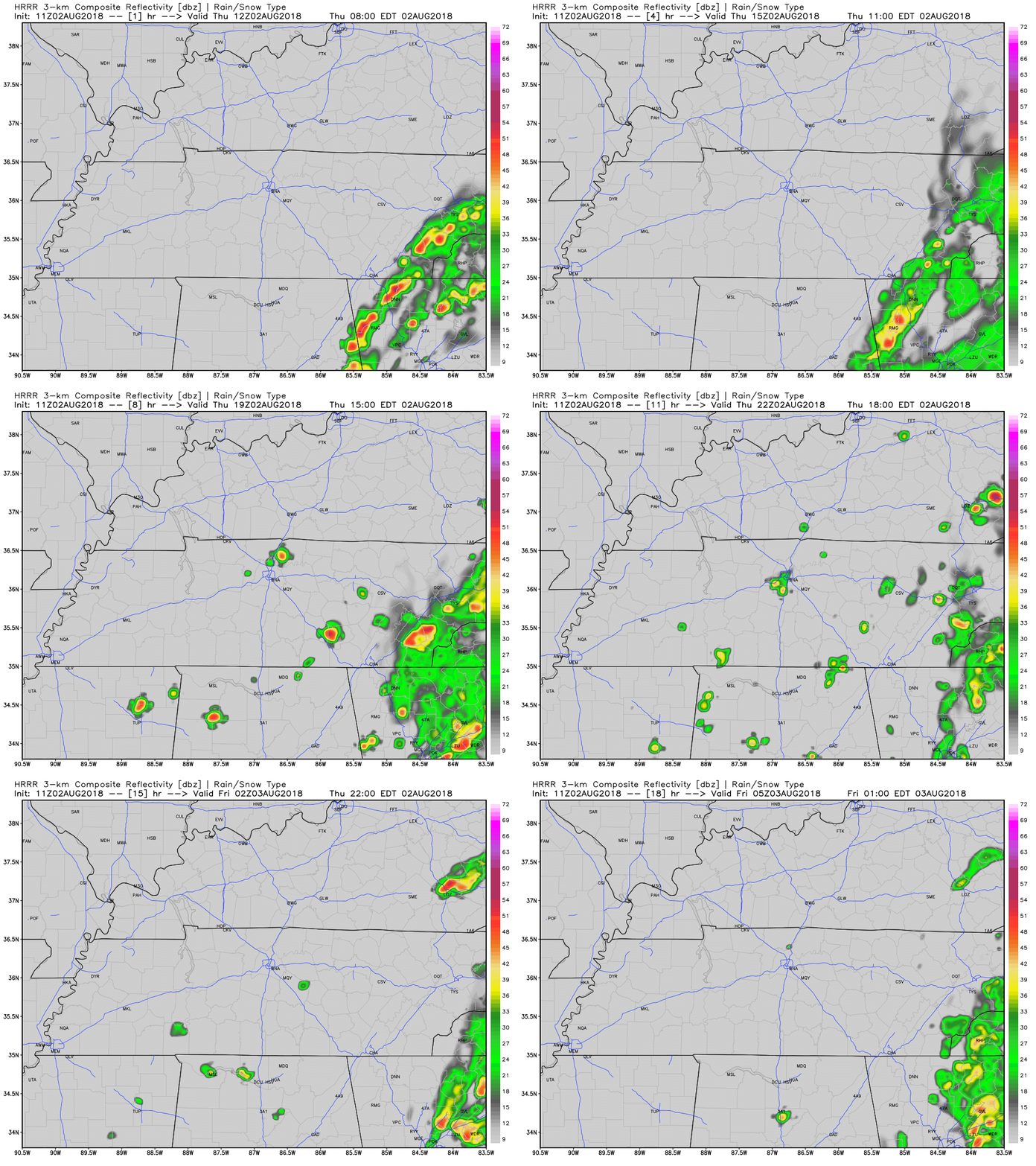
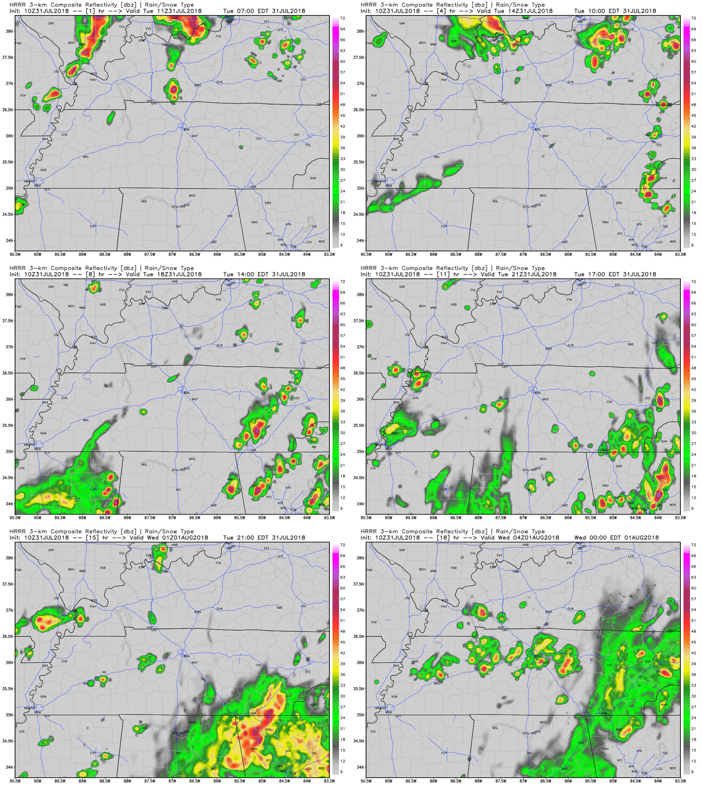
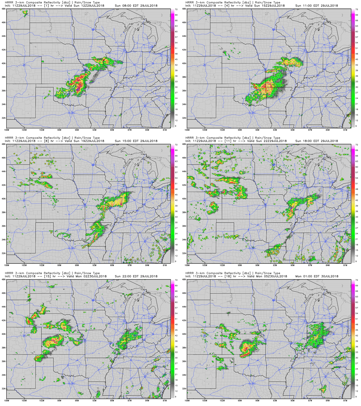
We’ll experience a typical hot, humid, summertime storm pattern today. The HRRR (below) has a few storms going up over Davidson and Williamson counties in the early afternoon.
If you were mostly east of I-65, you got some OK rain overnight. Cocorahs observations:
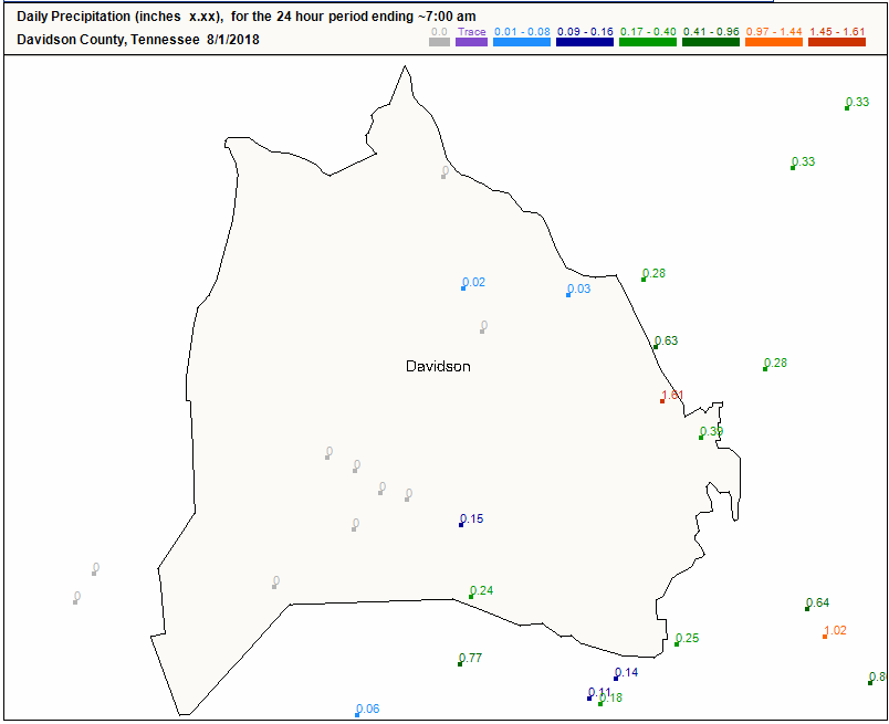
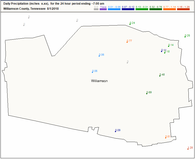
Today we’re stuck on the line between wet and dry.
Rain is happening to our east, divided by a surface front over Middle Tennessee. Sinking air (shown by yellow arrows below) has set up west, behind the front, harshing our rain vibe.
Skies will be cloudy for much of the day. Good news: clouds will keep our high temp from soaring. High temps in the mid 80°s and dewpoints in the upper 60°s.
GOES-16 Low-Level Water Vapor Imagery shows low pressure slowly swirling over the Midwest (near St. Louis). It’s pulling moisture straight up into Tennessee, keeping our storm chances high.
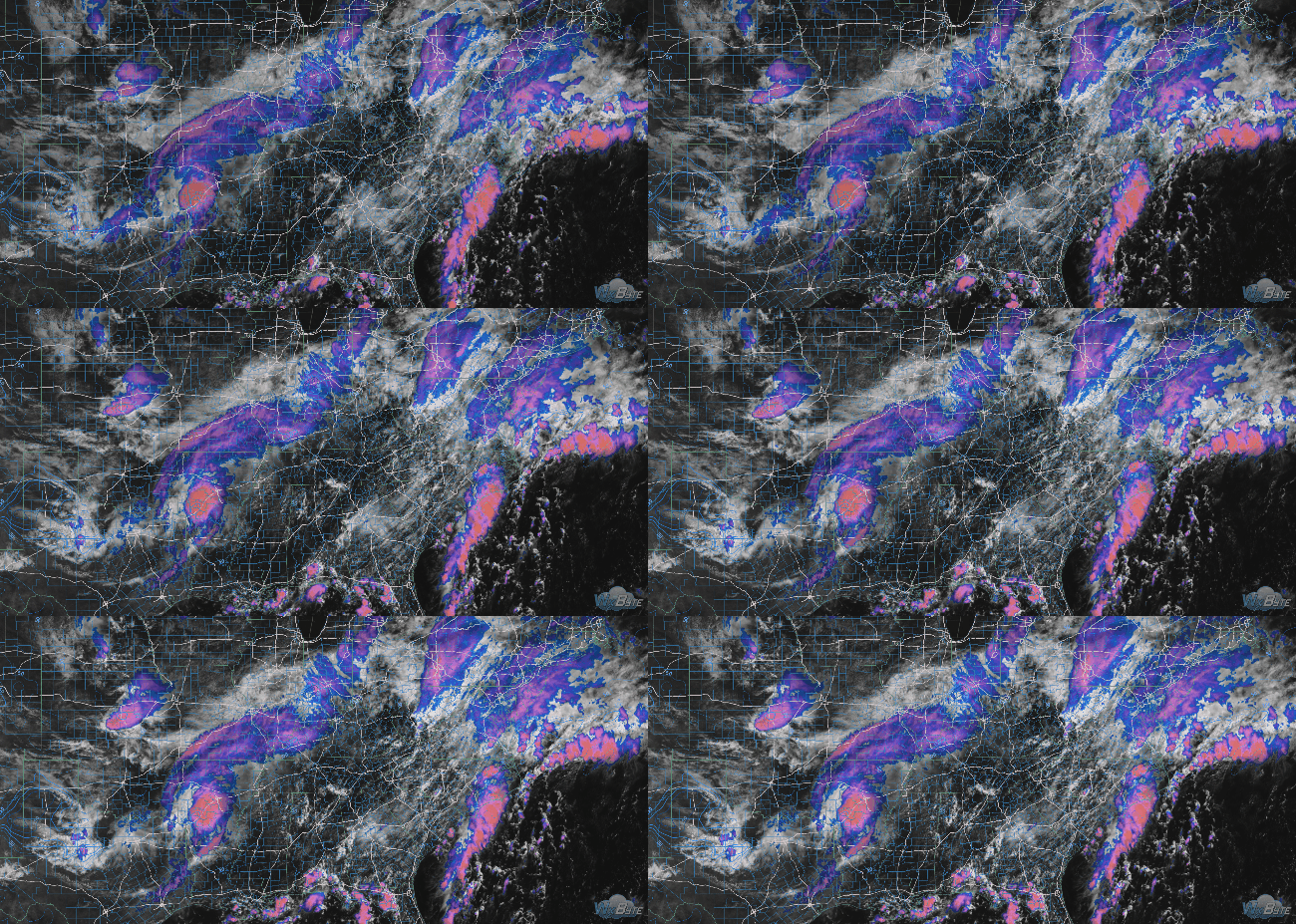
At noon, satellite showed a weak weather system brewing to our west.
It’s moving this way.
Rain is likely later today and tonight. Showers will be hit or miss. Expect unequal distributions of rain in both our counties, and in Middle Tennessee as a whole.
Sunday will be fantastic. Low 60° dewpoints mean another day of low-for-summer humidity. The temperature will cooperate (High 90°).
Rain Monday and Tuesday is coming from the Plains.
Timing
That’s ^^^^ the HRRR model running through midnight tonight. Today’s storms in Oklahoma and Nebraska will shift east and weaken, but a few showers may survive the journey so don’t be surprised if you wake up to wet pavement.

Dry air has taken over Middle Tennessee, bringing with it welcomed relief! High temps will make a run at 90° today, but dewpoints continue to drop. By this evening, dewpoints will sit just below 60°.
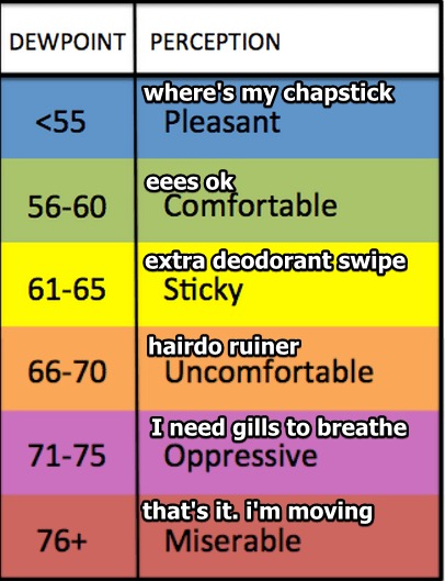
The cold front that came through last night dropped the temperatures slightly and the dew points noticeably. Temperatures will be a bit lower today than yesterday. Looking at a high in the upper 80º range with dew points in the mid to low 60s.
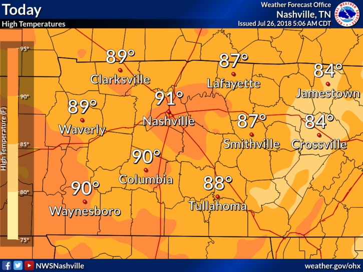
High temps will reach the low 90s for Nashville – that’s some of the warmest temps we’ve seen in a few days. We could be feeling a bit sticky, dewpoints are reading in the mid/upper 60s.
You must be logged in to post a comment.