
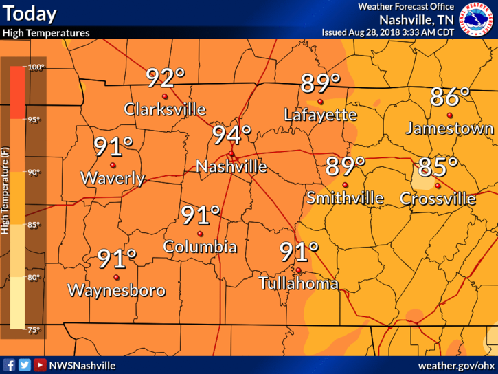
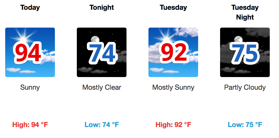
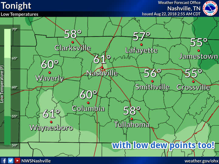
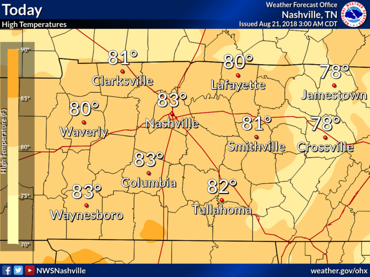
High temps will climb into the low/mid 90°s today. Dewpoints continue to stay within the low 70°s making temps feel closer to 100°.
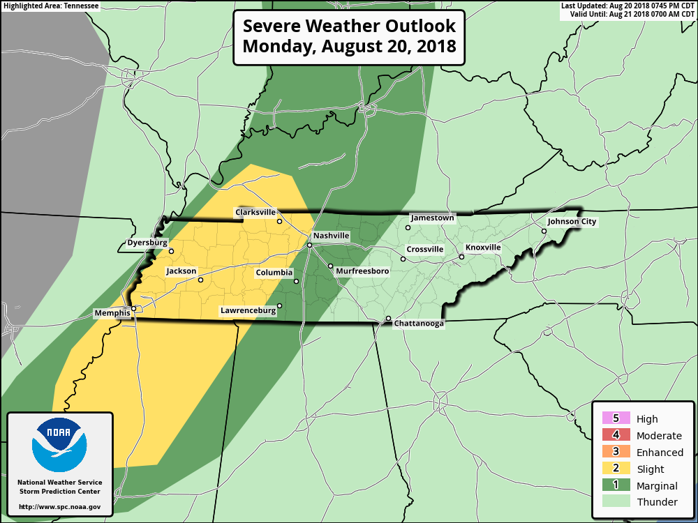
We could see a popcorn shower/storm or two over Nashville today. The HRRR model shows storms going up during the hottest time of the day. You could see a quick downpour and hear a few rumbles of thunder, but that’s pretty unlikely. Showers should be scattered far and wide.


You must be logged in to post a comment.