
Brief Relief!
I think it is safe to say that yesterday was noisy, especially late last night when those NE-moving cells intensified over our heads.
A cool down begins today, happening slowly but surely.
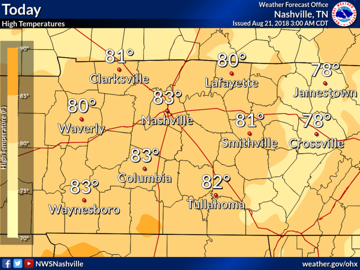
High temperatures will be in the low to mid-80s today as the cold front we talked about yesterday approaches and finally passes by this evening. The average high is 88º for this time of year.
A slight chance of rain is possible this afternoon before the front passes, though not likely. Keep your plans.
The Cool Down Continues
NWS Nashville put it best this morning:
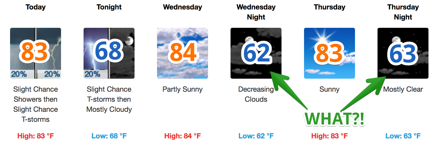
Dare I say we feel a little autumn over the next couple of days? Highs will be in the low to middle 80s (though clouds will stick with us through Wednesday) and there are some morning lows in the upper 50s Thursday and Friday morning, too.

Most importantly, north winds will replace the wet, humid air with a cool, dry airmass. It will feel comfortable outside Wednesday, especially Thursday, and most of Friday.
Don’t Grab Your Pumpkin Spice Latte Yet…
A strong upper-level ridge will control the weather pattern starting Saturday. Afternoon showers and thunderstorms will return to the forecast, humidity will increase and afternoon highs will climb into the low (and maybe even middle) 90s. This should continue through the beginning of the next work/school week.
Updates and more info can always be found @NashSevereWx on Twitter.

Categories: Forecast Blogs (Legacy)
You must be logged in to post a comment.