Wind chills will remain below or near freezing today despite our high of 41°. Winds will gradually relax through the day.
Below are forecast wind chills every three hours beginning at 9 AM today continuing through noon Wednesday:

Wind chills will remain below or near freezing today despite our high of 41°. Winds will gradually relax through the day.
Below are forecast wind chills every three hours beginning at 9 AM today continuing through noon Wednesday:
17-20 MPH sustained this afternoon. From 9 PM to midnight, winds will gust up to 32 MPH. You may hear things creak.
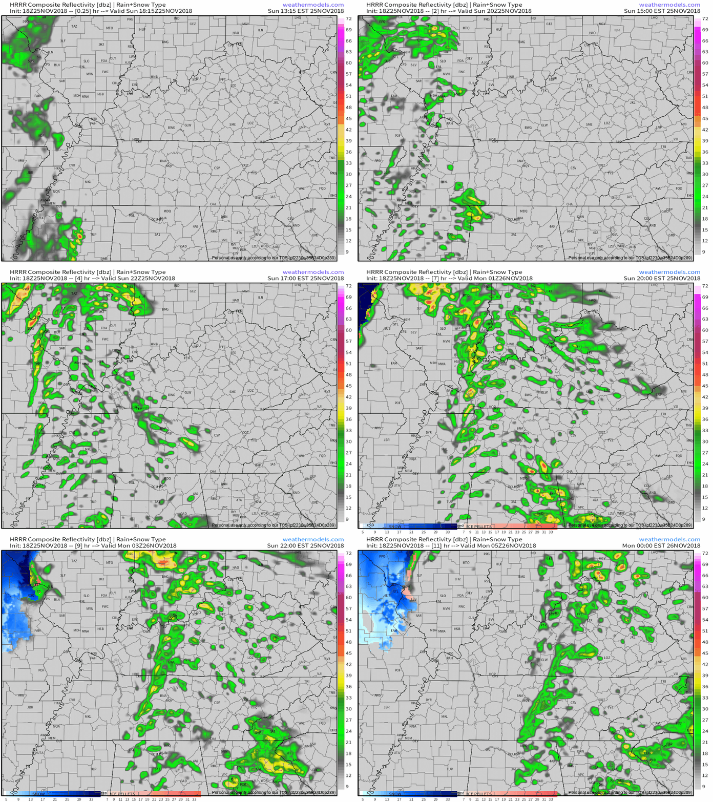
Very light, scattered showers possible beginning at 4 PM. Off and on, meh. Should end around 11 PM. HRRR model future radar:
The kids say “rn,” efficiently meaning “right now.” Hey, it’s your tomorrow. It means everything.
48° and foggy rn. pic.twitter.com/nswJ3CPraI
— NashSevereWx (@NashSevereWx) November 25, 2018
The last band of rain has moved to our east, bringing today’s rain chances to a close. Sun is returning as we go into the afternoon.
Winds will calm down this afternoon/evening as dry air is ushered into Nashville. High temps should reach the low/mid 60s, slowly cooling into the mid 50s by bedtime.

Few Thanksgivings in recent memory have been as nice weather-wise as yesterday. With a high of 61°, it was perfect for David’s Turkey Bowl, which he described yesterday.
So, every year I aim to leave 30% of the plate visible once I load it up with food. Each year I fail miserably. The problem is this: Once 70% of the plate is full, there’s still 30% of the buffet remaining left to visit. It’s simple math. But, that was yesterday. This is today.

Turkey Bowls will be windy tomorrow.
Turkey Bowl is where you play touch football with family and/or friends, dads and moms included, until:
Not expecting to get below freezing Friday morning, so hopefully shoppers encounter no freezing fog. High 60°.

A nice warm-up is underway today with sunny skies and a high temp forecast at 52°. Tonight, we fall to 33°.
High pressure is our main weather driver this holiday week. Drier conditions with warming temperatures will follow suit through tomorrow.
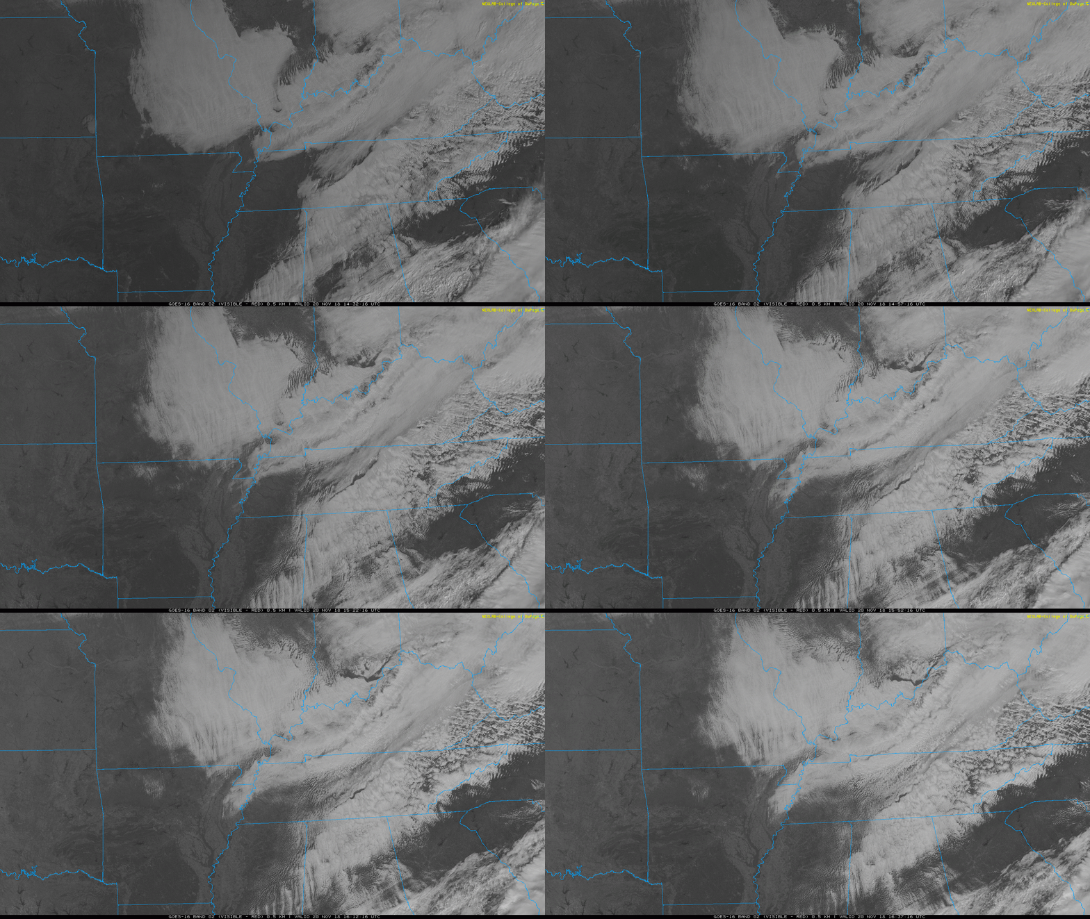
It’s overcast, so says the orbiting satellite GOES 16 and any two eyeballs pointed up. Clouds are dissipating over central Missouri, signaling cold, dry air creeping south and closer to us.
We should see a break in the cloud cover late this afternoon as dry air arrives.
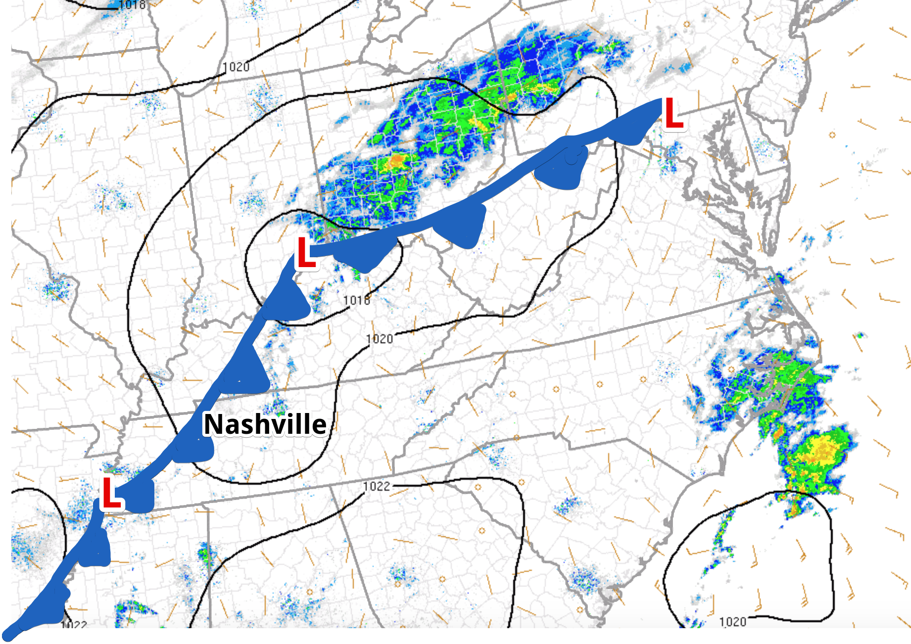
After a stellar weekend, a weak cold front (Editor’s Note: expertly drawn by Alex) is beginning to drop into Nashville, bring some isolated showers with it for the next several hours. These light showers will progress eastward as the day rolls on; not much in the way of rain is expected. No big deal if you forgot an umbrella or you left it you don’t know where.
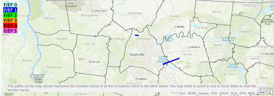
One year ago today, at 4:31 PM, a 200 yard wide EF-0 tornado touched down just north of I-24 in Joelton. It ran parallel to the interstate for 2.34 miles with no injuries. Twenty-two minutes later another tornado touched down at the Villages of Long Hunter subdivision in Antioch, crossed Percy Priest Lake and churned 10.93 miles into an EF-1. No injuries, but there was property damage.
You must be logged in to post a comment.