
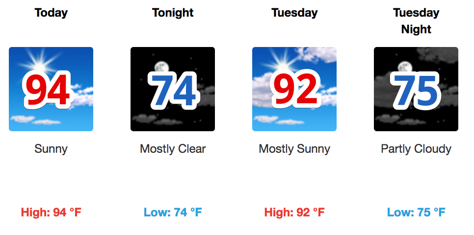
Temperatures will increase today, tomorrow, and Wednesday, stopped only by the arrival of clouds and rain beginning sometime Wednesday. Expect high temperatures to be in the low to mid-90s with morning lows in the mid-70s.
Dew points may briefly cross into the oppressive range this week, but most of the time we’ll be in “uncomfortable” territory.

A storm or two is only remotely possible today and Tuesday because high pressure says so.
Rain Chances Return Wednesday Night & Continue Thru the Weekend
Low pressure will build in, introducing a chance of rain more likely during the second half of the day Wednesday. Rain chances will then continue into Thursday, Friday, and the weekend.
Right now we think the most likely time for rain and storms is Thursday night. This could change though with any delay in the pattern set up.
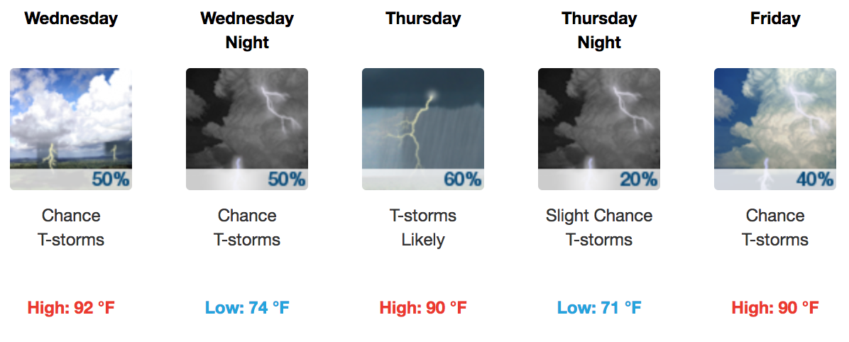
The models are still a bit up in the air in regards to the timing. The bottom line is we are going to be seeing rain off and on from Wednesday through at least next weekend. Here’s @NWSNashville:
[The] surface boundary will at least leave a swath of moisture across the mid state and weak troughing aloft will provide some needed lift to produce at least scattered convection through the end of the 7-day forecast period…and possibly beyond.
Stay connected for radar updates and new forecast information on Twitter @NashSevereWx (not on Twitter? Go here).

Categories: Forecast Blogs (Legacy)
You must be logged in to post a comment.