Severe weather is on Spring Break. Medium and long range models show no severe weather through at least the rest of March into early April. These models aren’t always right but this is what we want them to say.
Get Outside (this afternoon)
TODAY:
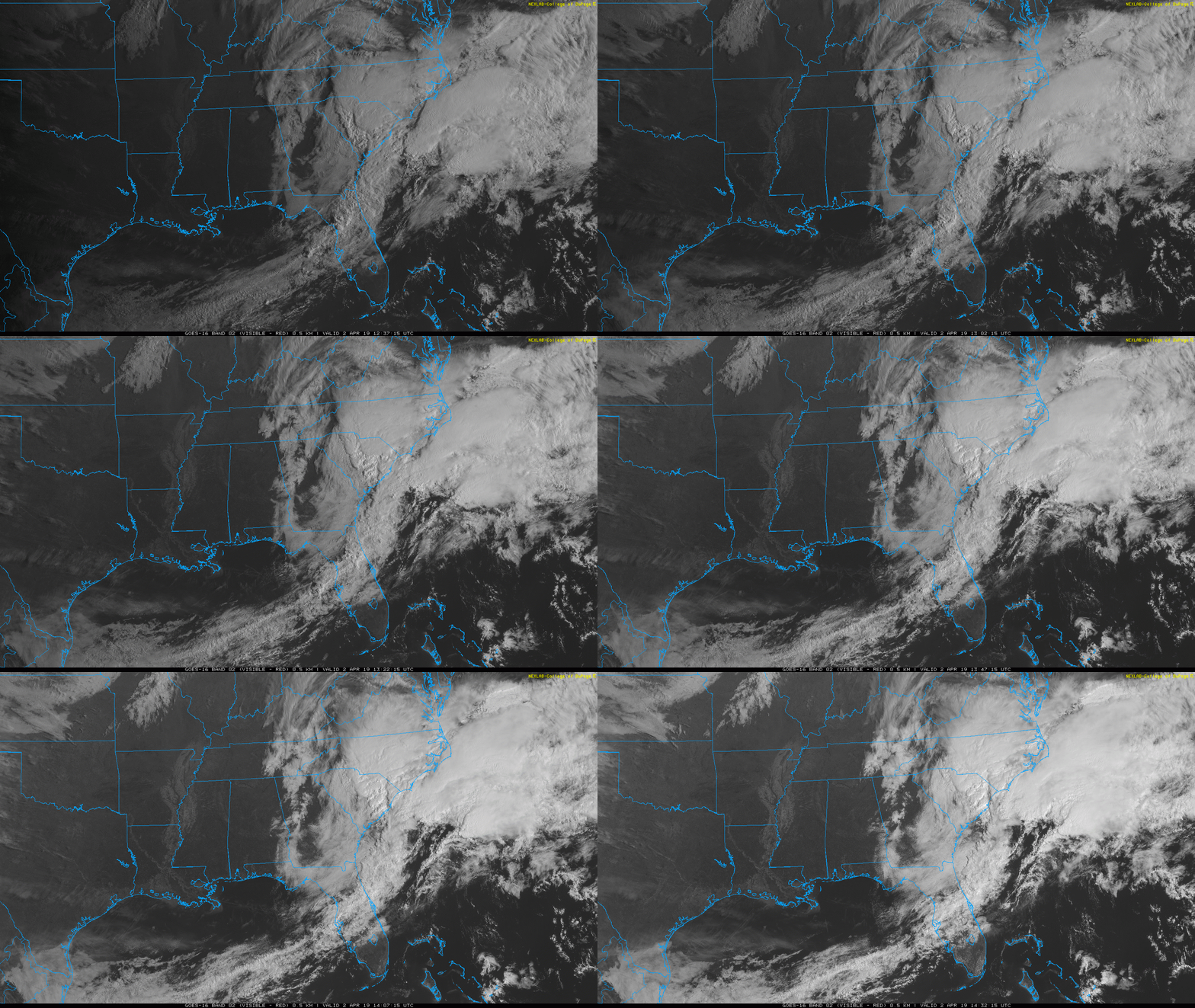
As my friend and favorite pub owner Jeremy Palmer would say, “it’s a BEWT”. Nothing but Sun and a high of 57º. Below the HRRR simulates what the IR Satellite will look like through tomorrow morning.
Chilly Mornings, Sunny Afternoons, Rain Chances Evaporate
Today:
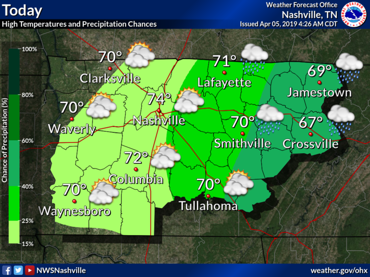
Happy Friday!! After storms threatened us yesterday, the weather story for this week is a return of the sun. Clouds will move across our area today keeping the sun by and large hidden. The temp this afternoon with get up to around 55º and wind will keep gusting to around 20mph. High pressure will be working its way in from the west and that will make the next 4-5 days nearly cloud free.
Severe Threat Has Ended; Lots of Sun for the Weekend
Today’s Severe Threat Is Over
As we’ve been saying for several days, severe storms require certain ingredients. Most of them were in place, but we were lacking enough cold air aloft to get good updrafts going.
Weather balloon data is back! Shows lapse rates too low for severe weather here. Temps aren’t cold enough aloft to cause clouds to rise/lift fast enough to get robust vertical motion needed to create a storm capable of producing a rapidly rotating updraft (aka tornado).
Tornado Watch, Wind Advisory In Effect Until 7:00 pm
Tornado Watch in Effect Until 7:00 pm

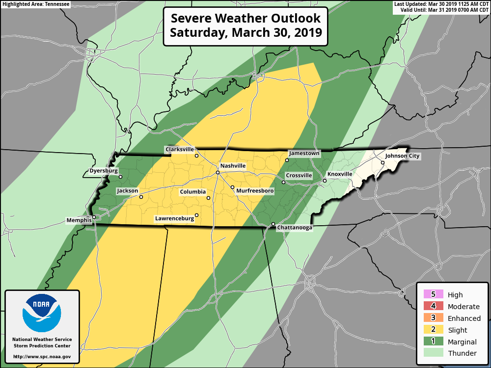
Severe Weather Possibilities Today
We are expecting showers and thunderstorms today as a strong storm system moves through the Upper Plains and Great Lakes region. The system will drag a cold front across our area today bringing storms, some of which could be severe.
Windy, Severe Weather Possible Today; Cooler Air Returning This Weekend
Possible Severe Weather Today
Today will be another warm day with morning lows around 61°, but highs warming to around 73°. Southerly winds could gust even higher than today as a strong system approaches from the west. As far as storms go, let’s start general and work toward specifics.
Storms, Strong & Maybe Even Severe, Thursday
Dry today. Tonight more clouds arrive and we resume talking rain.
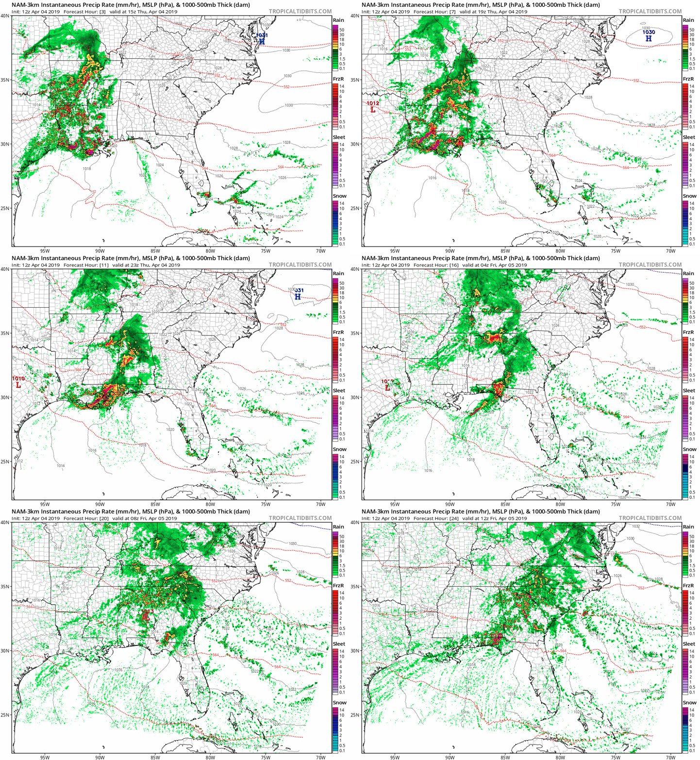
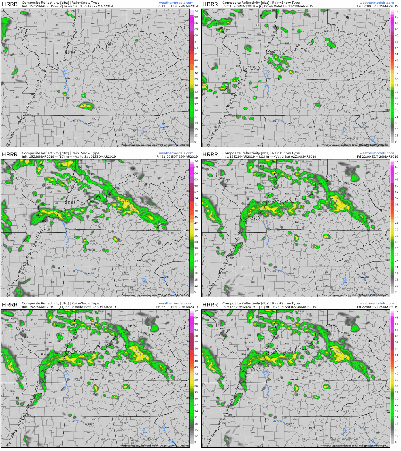
The NAM3 model thinks light rain is possible at times tonight and again before sunrise Wednesday:

HRRR model thinks no rain tonight, but maybe a light shower before sunrise Wednesday morning:
This Morning’s Forecast Fail; Windy Wednesday; Rainy (Stormy?) Thursday; Cooler/Drier Weekend
Last night’s forecast was “no rain until Thursday!”
Uhhhh. Then this morning happened.

Light rain this morning surprised me. Rain was supposed to pass completely south of us. Most of it did. But we still got some this morning. At 5:56 AM NWS-Nashville noted approaching rain in West Tennessee was not reaching the ground thanks to a low level Dry Air Monster.
Nice Week Ahead, Except Thursday
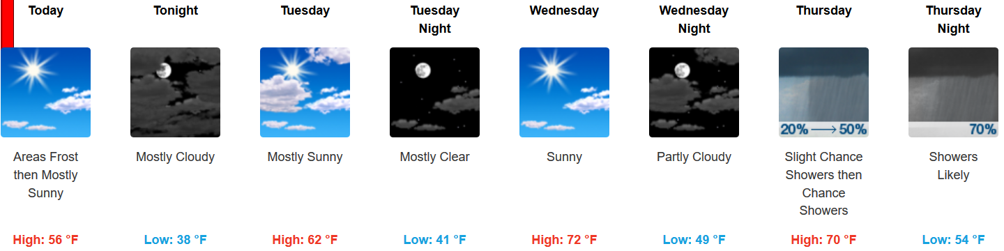
Dry days ahead!
Pretty warm, too.

Rain, Storms Thursday
Rain and storms may start late Wednesday night/wee hours Thursday morning.
South winds will be strong. The Euro model thinks winds will gust over 40 MPH. Storm strength will depend on instability and dewpoint levels. No two storm events are the same, but this looks pretty similar to what we saw yesterday/Saturday — plenty of wind energy, questionable instability. As usual, considerable uncertainty, especially this far away.
Drying Out. Next Rain Event Late Wednesday (but really, Thursday).
Last night’s storm reports weren’t from storms but from the Wind Advisory. “Non thunderstorm-winds,” they call it.

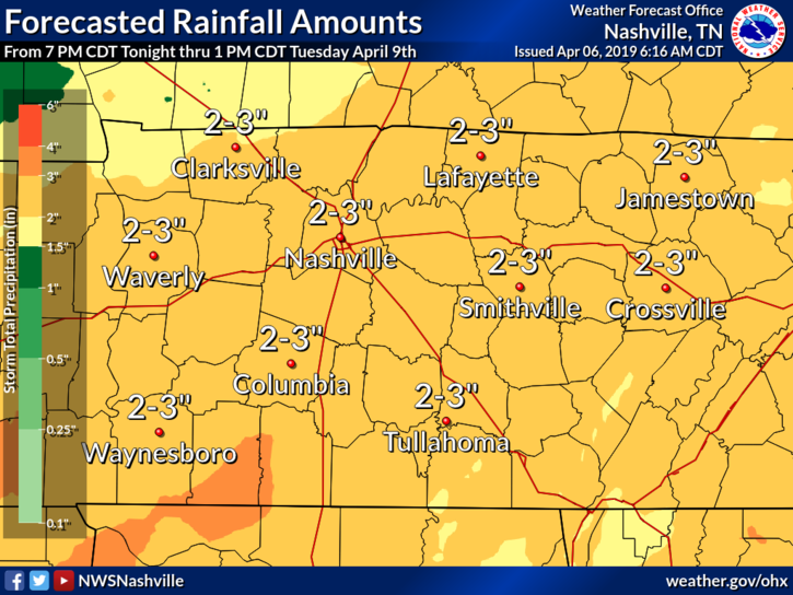
Rain reached 2″+ in spots yesterday. Creeks and streams rose quickly and fell not as quickly. A few rivers reached pre-flood “action stage.” For more on that, this.
You must be logged in to post a comment.