
EDITORS NOTE: This is Marti’s last blog for us as an intern. She has really grown as a writer and we are very proud of her work. Best of luck, Marti!
If you enjoy warm and sunny, then soak up the sunshine while we’ve got it! Starting tonight we’ll be rain-soaked until Tuesday.
Remnant high pressure is controlling our weather today, bringing us plenty of sunshine! We’ll warm into the upper 70°s by this afternoon.
Rain moves in late Saturday (Tonight), Continuing Until Tuesday
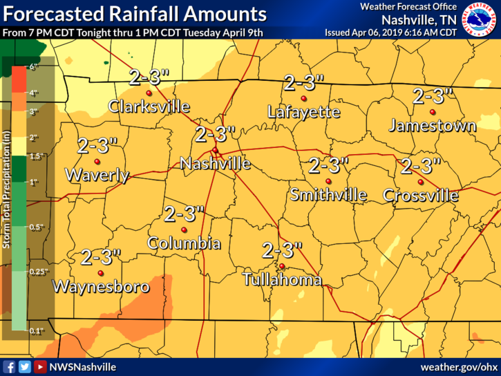
We’re entering a busy weather pattern for the next few days, meaning there will be plenty of rainfall for the coming days. Sunday through Tuesday, we’re expecting 2-3″ of rainfall here in Nashville. As of now, there is no mention of flooding concerns. This is likely because the rain will fall over several days. More on this, below!
Saturday Night Rain Chances
Sunny, partly cloudy skies will give way to thicker clouds after sundown. This is ahead of our first line of rain.
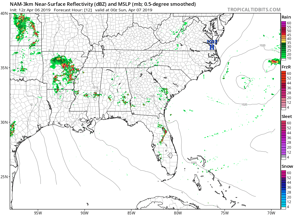
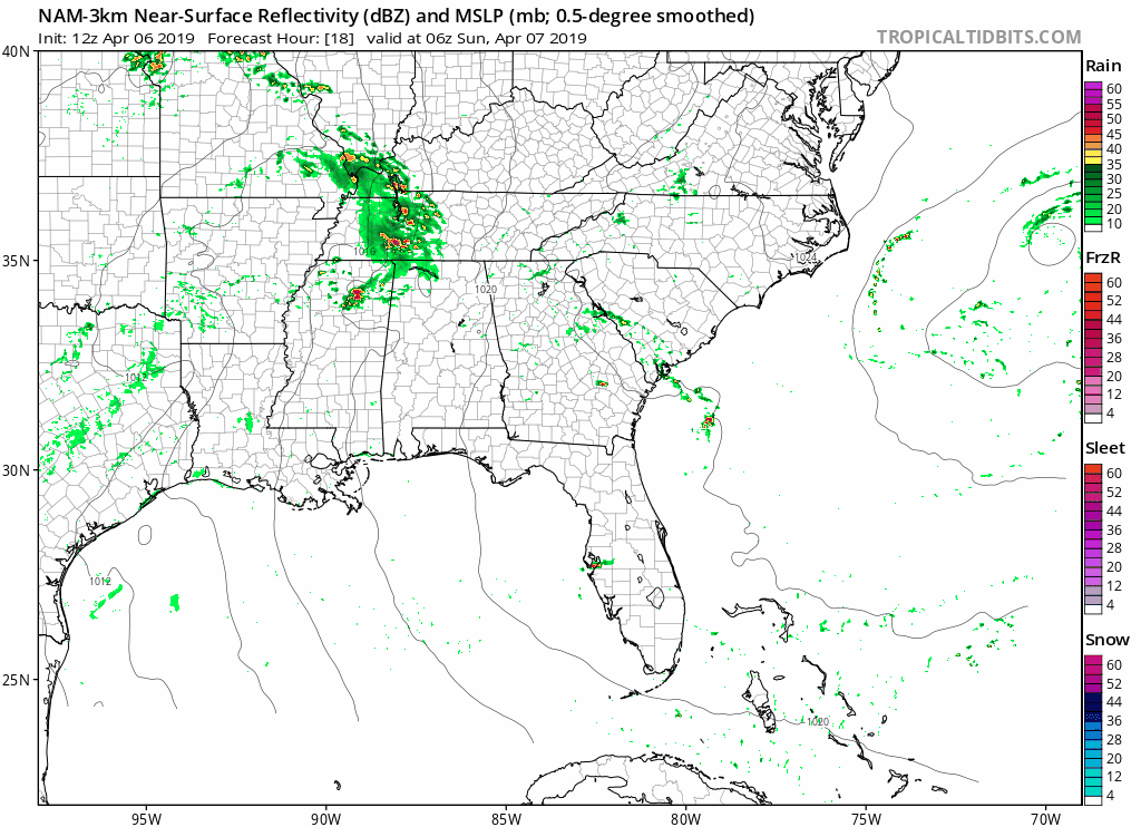
NAM 3km thinks we’ll be quiet tonight, with first sprinkles of rain beginning around midnight.
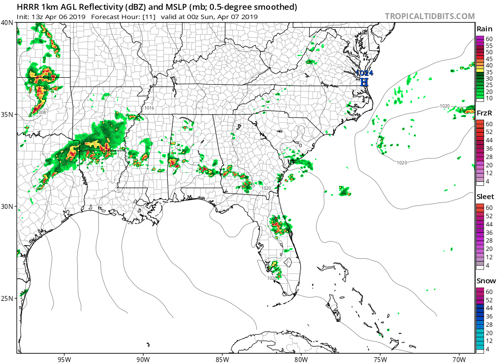
HRRR aggrees; clear, quiet conditions with rain approaching Nashville beginning about midnight.
So, if you plan to go out and enjoy the sun today, go for it! Temps will fall to the low 70°s by sundown and will remain mild through the evening.
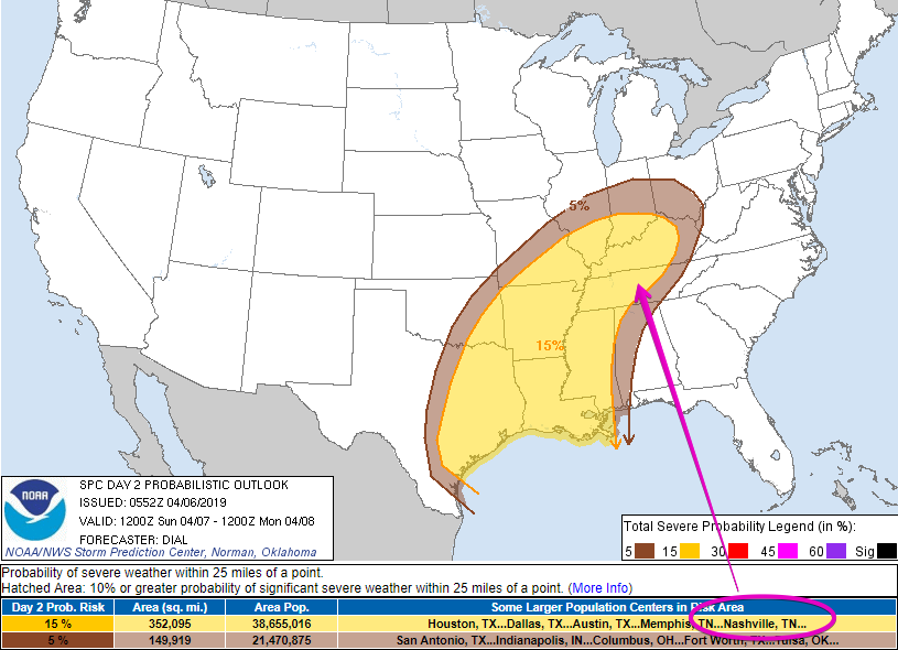
Sunday Storms Possible
Storms are possible all across the southeast tomorrow, including us! Storm Prediction Center has placed Nashville within the Slight Risk (2 out of 5) of severe storms for Sunday.
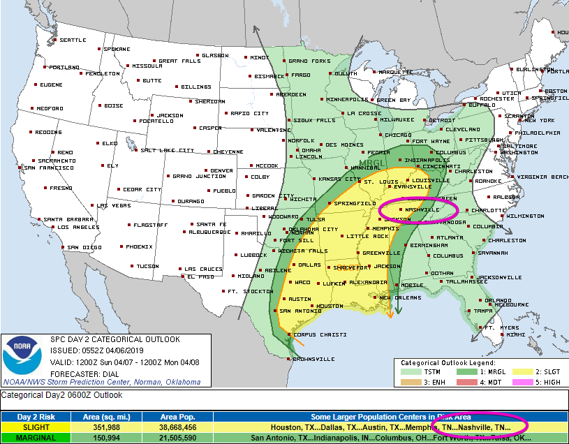
This means there is a 15% chance of a severe storm within 25 miles of you.
Picking up the NAM 3km where we left it earlier, we can see what it thinks will happen Sunday. Overnight rain looks to clear out quickly, giving us a rain break by sunrise. Expect a daytime high in the low 80°s.
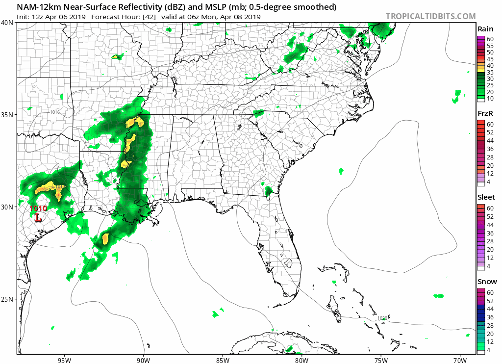
Then, as rain and storms begin to form over Arkansas and move east, they quickly get pushed north. With a lack of rain during the daytime heating hours, we’ll start building energy in Middle Tennessee. If any storms do pass through, our atmosphere will be unstable and storms could easily become severe.
Now, this is only what the NAM thinks the radar could look like. It is model guidance, not gospel. The line of storms could shift east instead of north, so keep your umbrella and radar app handy all day.
Rain Continues Monday
Last day of widespread rain is Monday!
Looks like Monday will have on-and-off rain all day long. A few thunderstorms could be in the mix, but they shouldn’t reach severe potential.
Finally a Break on Tuesday
A few early morning sprinkles are possible, then clouds should break up. I know I’m already looking forward to sunlight after all the rain we’ll have!

Well, everyone, this is Marti Calhoun signing out. It’s been a great privilege and blessing to work side-by-side with this incredible group of guys! This past year has taught me so much about forecasting and weather communication, and for this I’m very thankful. Thanks for the memories and the fun!

Categories: Forecast Blogs (Legacy)
You must be logged in to post a comment.