A Wind Advisory has been issued for both Davidson and Williamson counties from 6 AM today to 6 AM Friday.

With this we can expect sustained south winds of 15 to 30 mph with gusts upwards of 45 mph. Hold on to your hats!
A Wind Advisory has been issued for both Davidson and Williamson counties from 6 AM today to 6 AM Friday.

With this we can expect sustained south winds of 15 to 30 mph with gusts upwards of 45 mph. Hold on to your hats!

Enjoy this calm weather while we have it. Despite clouds hanging around, we’ve managed to reach the upper 50s. After the sun sets, mother nature will be setting the stage for our next weather maker. A surface low-pressure system will move across the Great Plains and into the mid-west, pushing a cold front towards the Nashville area.
Executive summary, because you’re busy:

Unseasonably warm temps ahead!
Start Time: Thursday morning, as light rain. Through the day rain will be off and on.
The heaviest rain will come in a line, expected Thursday late afternoon or early Thursday night. Below is simulated radar (NAM3) showing the heaviest rain rolling in around 5-6 PM.
Merry Christmas! Some in Will Co got a White Christmas!

In this edition:
Sleet streaked through Williamson County this morning, but is long gone. Uneventful weather will follow today and tomorrow.
We may even see the sun. Satellite through 11 AM:
A few light, mid-morning Christmas showers are possible.
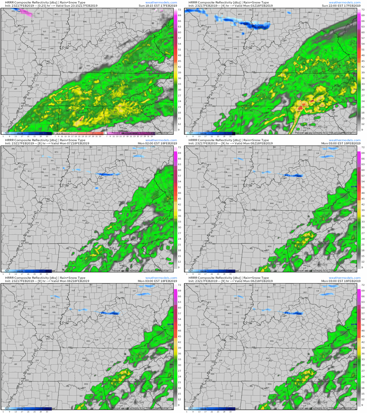
So says the HRRR model:

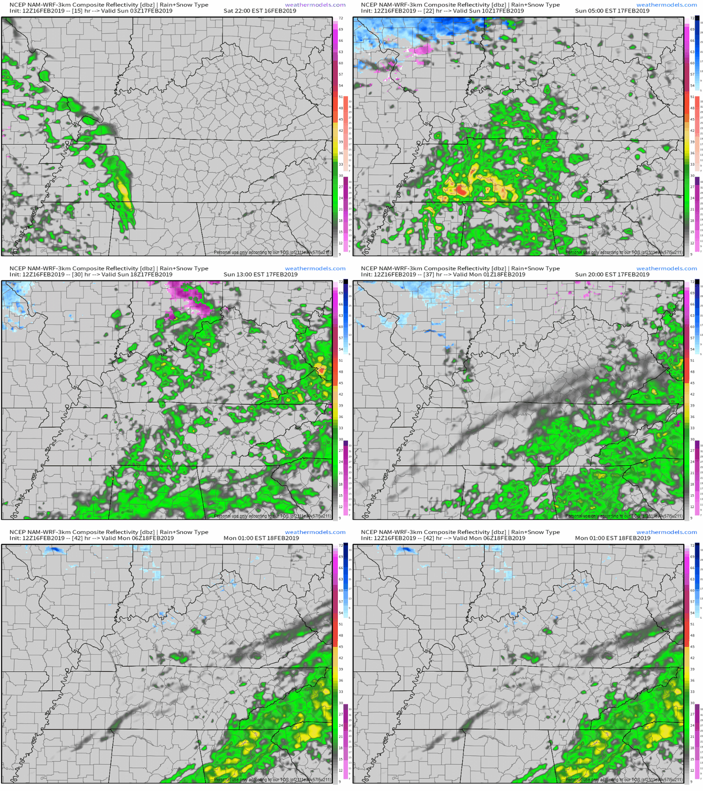
NAM3 model agrees:

These won’t be a problem, just a nuisance. You’ll have plenty of time to be outside tomorrow.
A rain system is approaching from the west. It should fall apart completely when it arrives tomorrow. Just clouds for us, so says the HRRR model:

But the NAM3 model thinks enough rain will survive. If this model is right, Christmas Day will be light, drizzly, and off-and-on.
Tonight, winds turn north. Wind chills will approach freezing.
Temps should drop below freezing shortly after 3 AM and stay below freezing until 8 AM or so. Early morning patchy fog may lay down a thin layer of ice on roads where fog settles. If you’re up early Monday morning and see fog on the road, assume a thin layer of ice has formed. Any such hazard will end about an hour or two after sunrise when temps rise above freezing.
Off and on rain will continue this morning into early afternoon. HRRR model (below) thinks rain will be gone by 3 PM:

Less than 0.20″ expected. High 47°, but tonight’s winds turn colder, and wind chills will approach freezing.
High pressure is here today, leaving us with sunny and mostly-clear skies.
Our high temp will rise into the low 50°s. Tonight’s low will fall into the upper 30°s.
As for getting out and about today: it’s a great day for it! If you’ve got outdoor plans, expect calm winds from the south with a max speed of 8 mph, with no rain for the afternoon kickoff.
The rain is on its way out.
Below is the HRRR’s thinking on today. Notice it has all rain out by 3 PM.

On and off showers will continue through the morning hours and will eventually taper off from west to east as the upper-level low moves north. Additional rain totals could amount up to a quarter inch at most.
You must be logged in to post a comment.