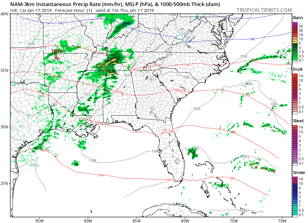
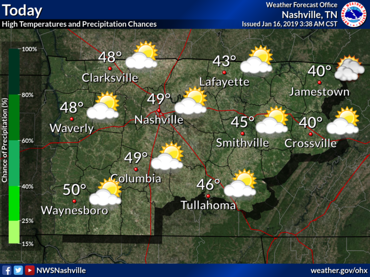
We’ve already had some rain fall this morning, with a few more showers lingering through this afternoon and evening.
High temps today will run a few degrees warmer than yesterday at around 50°.
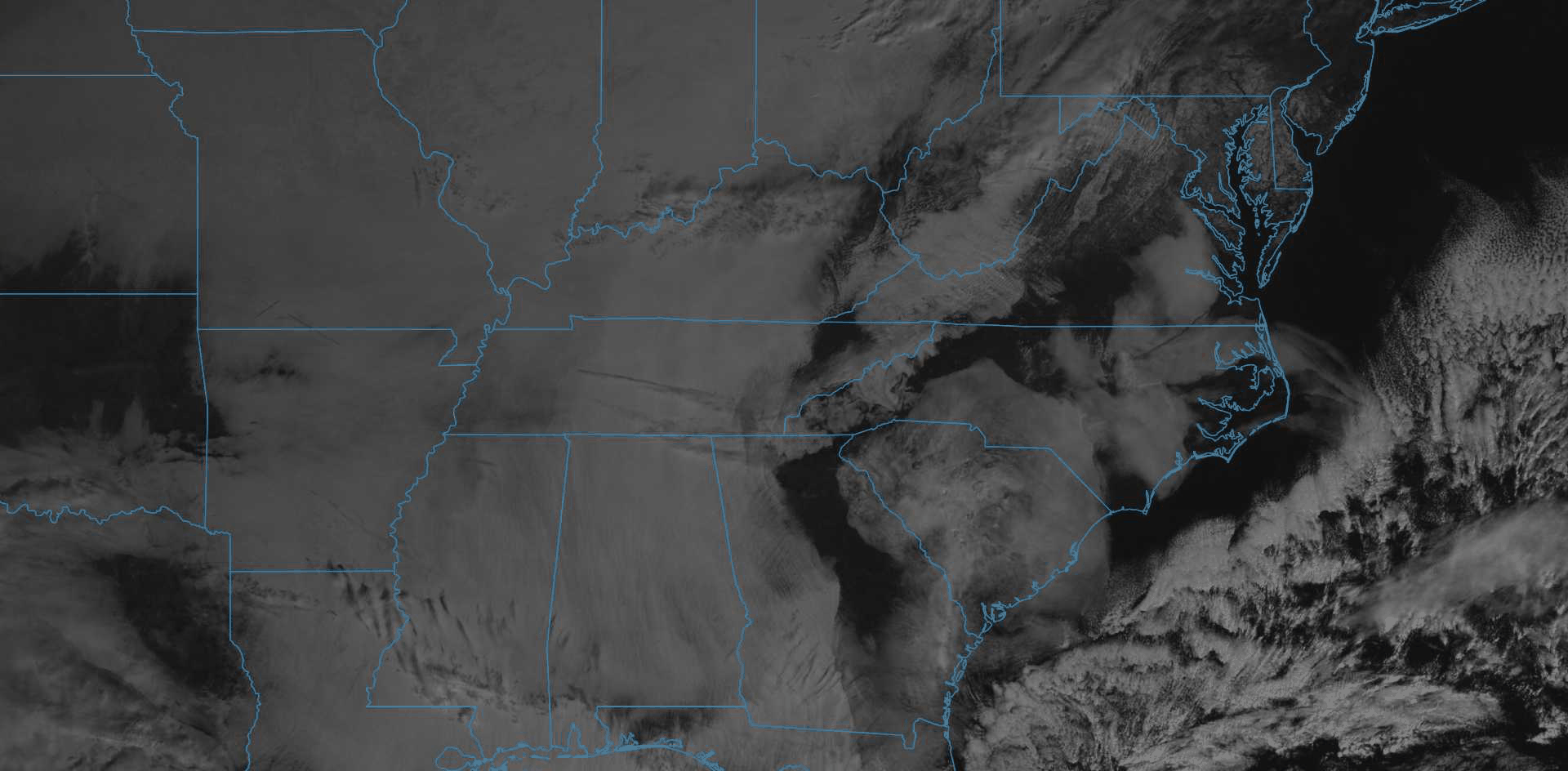
The Nam 3km model illustrates the progress of the showers through the day today. It’s looping through 6:00 am tomorrow morning.
Friday
The warming trend started Wednesday will continue on Friday with high temps in the low 50°s. Clouds will hang around through the day, but we should remain dry.
Friday is the last day we’ll see this week where it’s both warm(ish) and dry. Great day to finish any small outdoor tasks before Old Man Winter arrives late Saturday.
Saturday
First, a quick aside: Now that we’re drawing closer to Saturday, we’re beginning to see where the specific forecast challenges are. Keep in mind, snow/winter forecasting is tricky and could change at the drop of a hat! Stay tuned for more updates as they come!
Late Friday, a swift-moving warm front will push north through Middle Tennessee. This warm front will bring our high temp on Saturday into the low 60°s and plenty of Gulf moisture into the area. The moisture is key to why we expect so much rain.
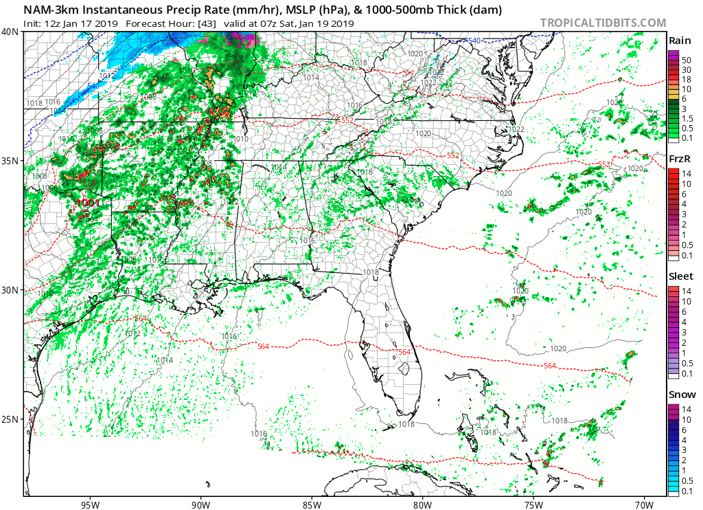
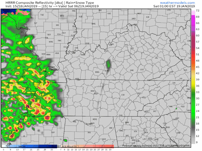
A large, strong cold front will then swing through in the early morning hours of Saturday. The NAM 3km has heavy rain/thunderstorms approaching Nashville just before sunrise. See gif below – the animation begins just after midnight on Friday, ending Saturday about 6 PM.
The NAM model is known for being aggressive when it comes to storms; meaning its bark is worse than its bite more often than not. NWS Nashville is calling for plenty of rain with a few thunderstorms in the mix – not expecting severe storms. The big thing to watch for Saturday morning and afternoon is the heavy rain.
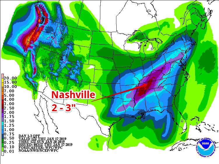
The Weather Prediction Center is still expecting us to see upwards of 2 – 3″ of rain between Saturday and Sunday morning. As of now, there is a concern of flooding along rivers and creeks if this much rain does fall over us but no watches or advisories have been issued yet.
So.. to Snow or not to Snow?
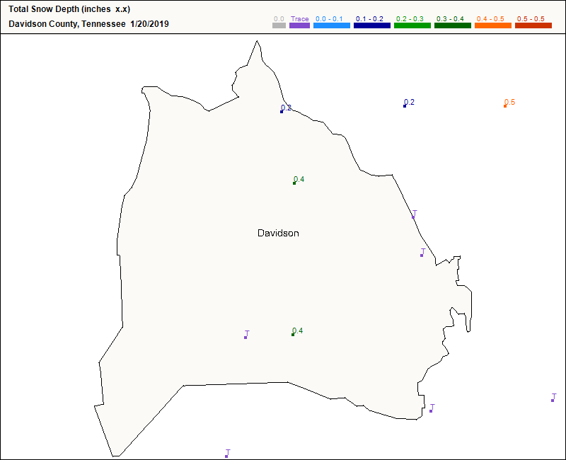
As of now, it’s still hard to say. On Saturday evening, the cold Arctic air will make its arrival, but will there be enough moisture in the air to form snowflakes? The sad answer: not very likely, at least not enough to make a good snowball with.
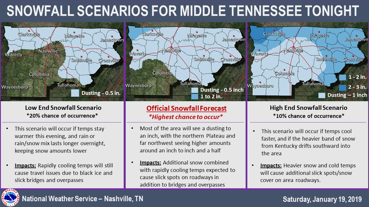
NWS Nashville forecast has this to say about snow:
"My latest forecast snowfall
totals still remain in the dusting to 1 inch range, with lowest
amounts in our southwest, and highest amounts over our northwest
counties where colder air arrives earliest..."
read more


You must be logged in to post a comment.