

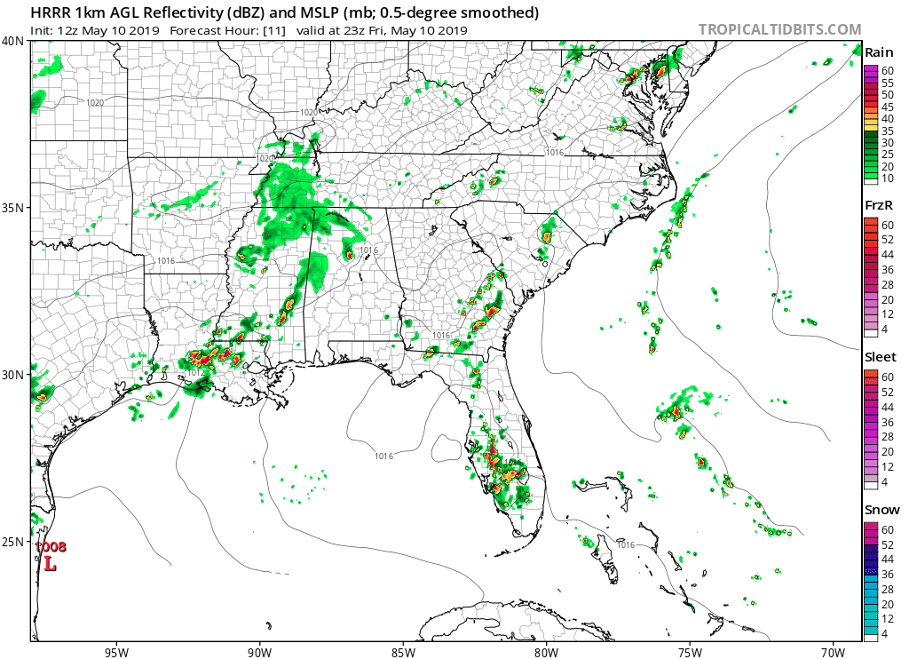
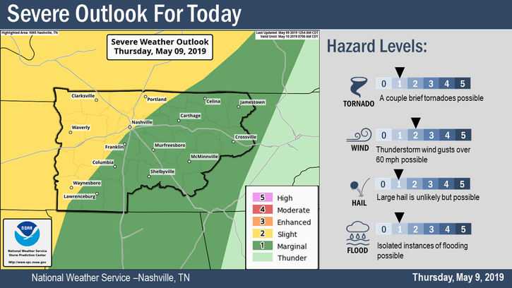
Before the first race…
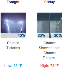
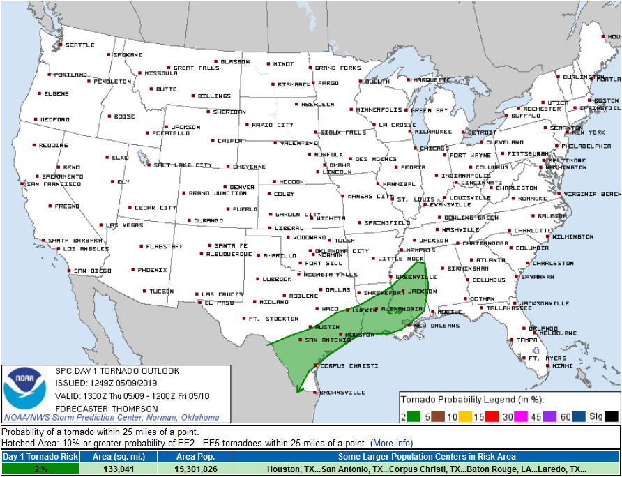
We expect a dry morning. As you’re making the final outfit decisions, know that rain is in the conversation, and the best option is to have a couple options. The rain we had yesterday evening and overnight is gone, but it has left the ground quite soft. After thousands of people and hundreds of vehicles make their way around the infield, it’s going to get muddy. That being said, you won’t need rain jackets as you set up your tailgate spot or unpack linens in your box. We expect a high of 74º at 4pm.
You must be logged in to post a comment.