Category: Featured Blog

Hot and Humid Monday, Dangerous Heat and Strong Storms Tuesday

Monday

As the ridge of high pressure over Texas moves eastward into the lower Mississippi Valley today, temperatures will climb several degrees above normal. Dew points rise into the mid and upper 60s.  It will be a mostly sunny and hot afternoon with high temperatures around 95. Heat index readings will be between 100 and 105 degrees which will make it feel quite hot and oppressive.

Tuesday – Heat Advisory in Effect

Tuesday will be the hottest day with some strong afternoon thunderstorms across Middle Tennessee. High temperatures will be around 97 with dew points in the mid 70s will allow for dangerously hot conditions as heat index readings reach between 105 and 110 degrees.

A Heat Advisory has been issued by NWS for Tuesday as heat index values climb above 105°. Here are their recommendations:

THE COMBINATION OF HOT TEMPERATURES AND HIGH HUMIDITY WILL COMBINE TO CREATE A SITUATION IN WHICH HEAT ILLNESSES ARE POSSIBLE. DRINK PLENTY OF FLUIDS, STAY IN AN AIR-CONDITIONED ROOM, STAY OUT OF THE SUN, AND CHECK UP ON RELATIVES AND NEIGHBORS. TAKE EXTRA PRECAUTIONS, IF YOU WORK OR SPEND TIME OUTSIDE. WHEN POSSIBLE, RESCHEDULE STRENUOUS ACTIVITIES TO EARLY MORNING OR EVENING. KNOW THE SIGNS AND SYMPTOMS OF HEAT EXHAUSTION AND HEAT STROKE. WEAR LIGHT WEIGHT AND LOOSE FITTING CLOTHING WHEN POSSIBLE AND DRINK PLENTY OF WATER. TO REDUCE RISK DURING OUTDOOR WORK, THE OCCUPATIONAL SAFETY AND HEALTH ADMINISTRATION RECOMMENDS SCHEDULING FREQUENT REST BREAKS IN SHADED OR AIR CONDITIONED ENVIRONMENTS. ANYONE OVERCOME BY HEAT SHOULD BE MOVED TO A COOL AND SHADED LOCATION. HEAT STROKE IS AN EMERGENCY, CALL 9 1 1. read more

Afternoon Rain & Storms (& A Tip on Using RadarScope To Detect Massive Water Balloons)

ETAs

No specific reliable ETAs due to model uncertainty and storm setup. But we have an idea: around 1 PM to 5 PM.

  • Rain and storm activity should “increase substantially late this morning, peaking mid to late afternoon.” (NWS-Nashville).
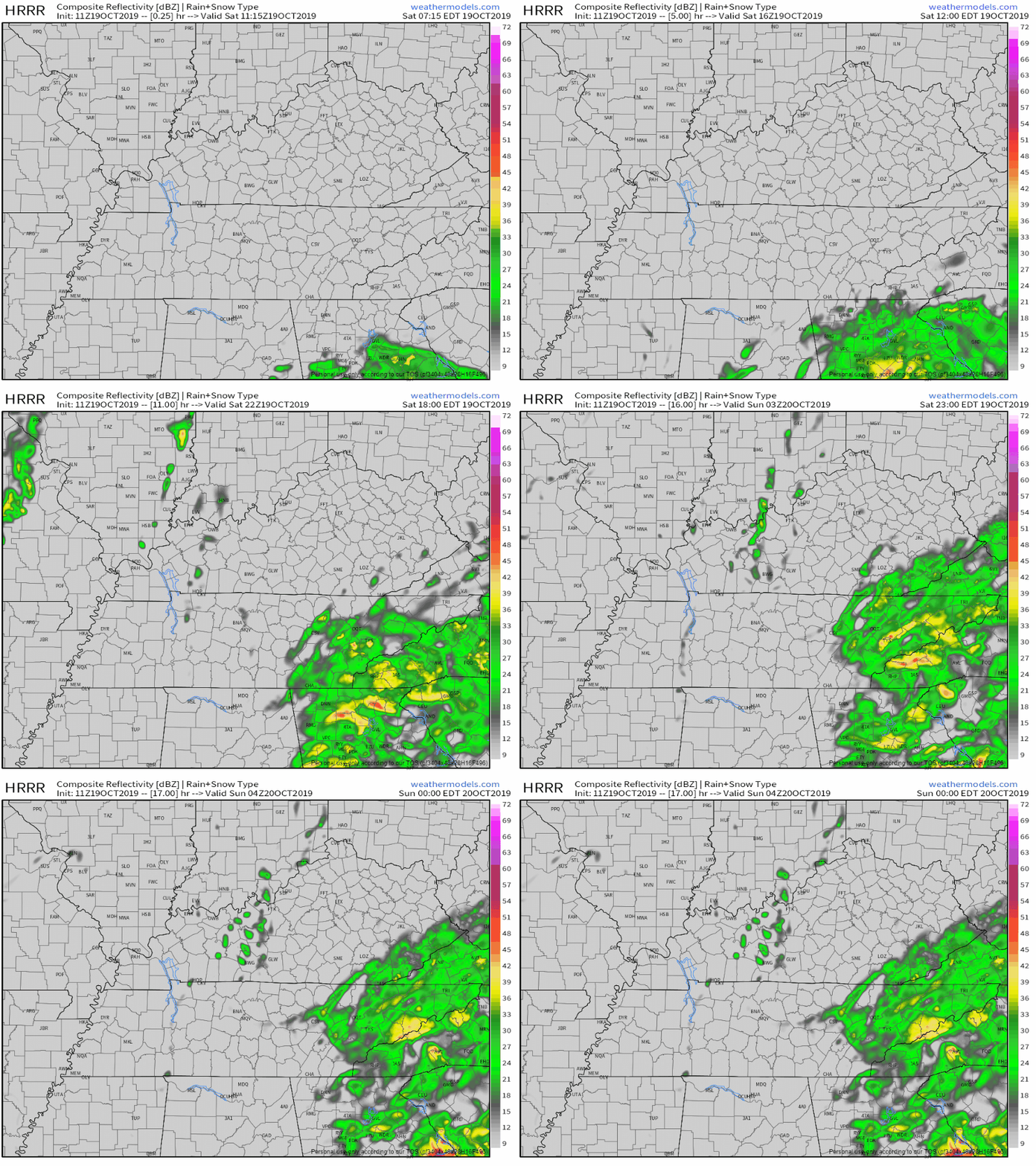
  • The HRRR model expects thunderstorms to develop to our NW just after lunch then swing through Nashville and Williamson County between 1 and 5 PM:

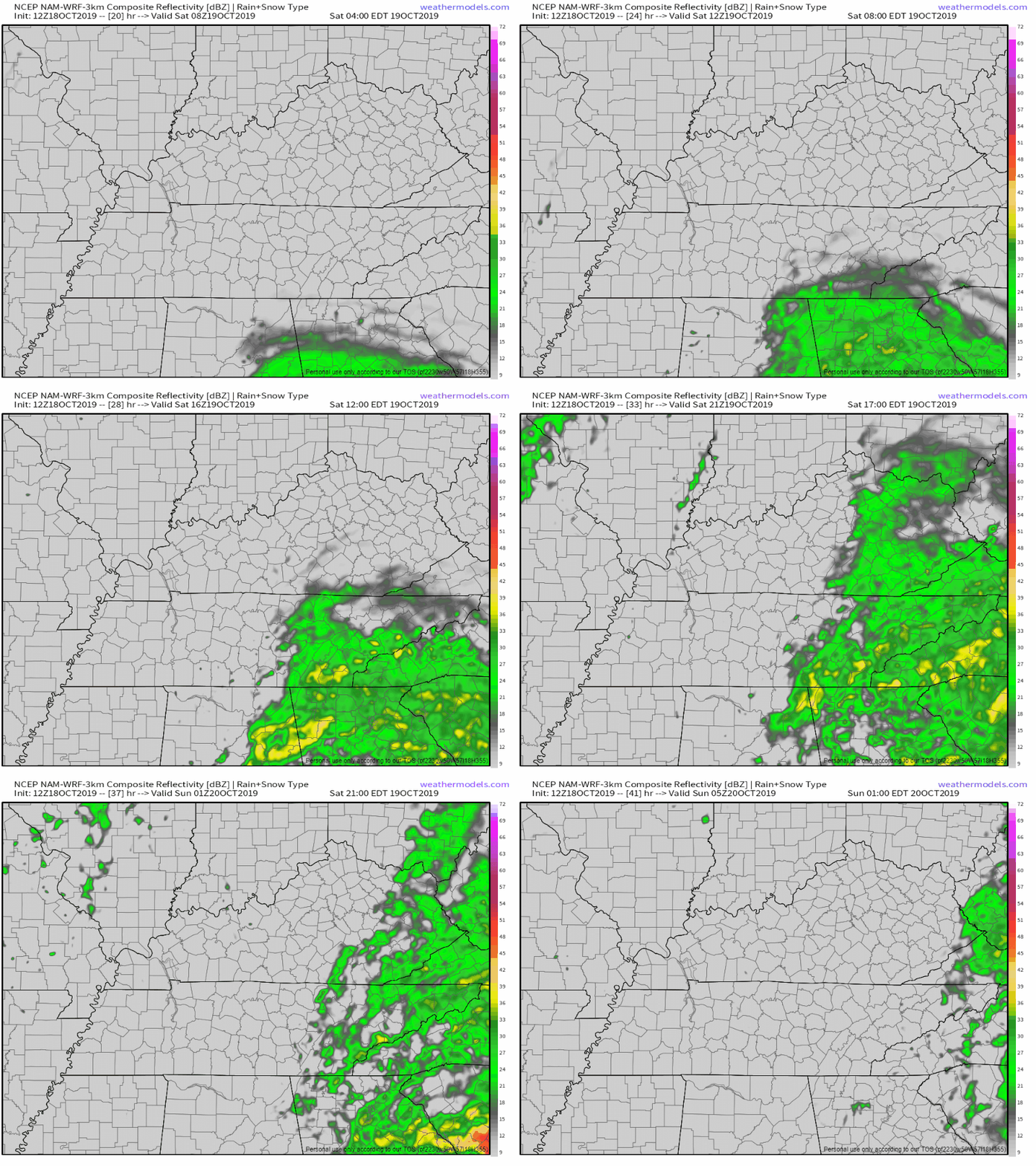
  • The NAM3 model predicts storms will develop later in the afternoon, creating a small amount of forecast uncertainty.
  • New weather balloon data is not yet in. That data provides a temperature at which storms should form. Yesterday that temperature was in the mid-80°s, which we reached mid-afternoon. I bet that happens again today. Today before 8 AM temps were low 70°s and rising. We should hit mid 80°s around lunchtime, so I am leaning toward the 1 PM to 5 PM ETA for all storm activity.
  • NWS-Nashville is confident we will see some rain and storms so factor that into your plans. They think rain is likely around 1 PM and very likely around 4 PM for Nashville and Williamson County.

Flexible plans recommended in case that changes. If you don’t think it may change, welcome to Nashville! You must be new. read more