
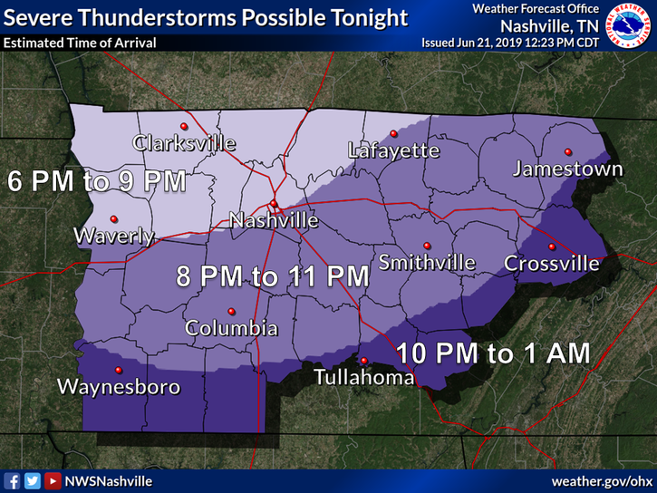
Rest of Today and Tonight
For the rest of our afternoon the skies will remain mostly cloudy, with temps reaching near 73° for our high. The clouds are going to stick around with us as we approach the evening hours, when our next line of showers moves into the area. Rain and a few storms will be arriving sometime between 8pm-9pm and will move through our area overnight. Temperatures will drop into the upper 50s for the overnight low.
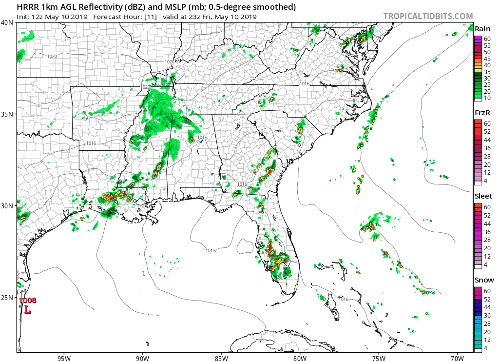
The HRRR model is showing a few of these showers being heavy at times, and moving out of Middle Tennessee overnight.
Saturday
We start off Saturday with early morning showers that move out by 10am, setting the stage for a sloppy steeplechase grounds. Latest runs from the NAM3k show stronger storms then moving through the area in the early afternoon hours starting around 1pm. Wind gusts up to 40 mph are possible. The Storm Prediction Center currently has us under a “general” risk for severe thunderstorms in the afternoon:
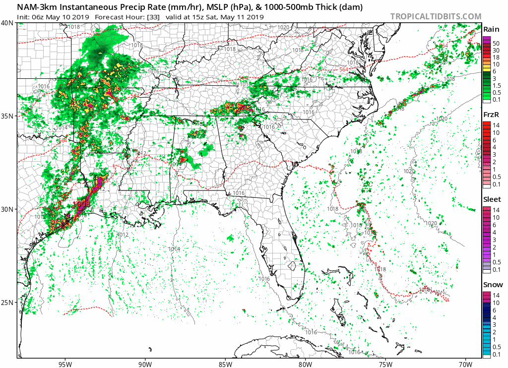
Here’s the NAM3k model showing these stronger storms arriving early afternoon:
EDITORS NOTE: We don’t expect widespread severe weather, but strong/severe storms aren’t out of the question.
Temperatures rise up to 71° for the high, and dropping down to the low 60s for the low. Be sure to use plenty of hairspray if you have plans, because it’ll be another humid one for us, with dewpoints in the mid 60s.
Sunday
The last day of the weekend and…we’re still not completely dry.

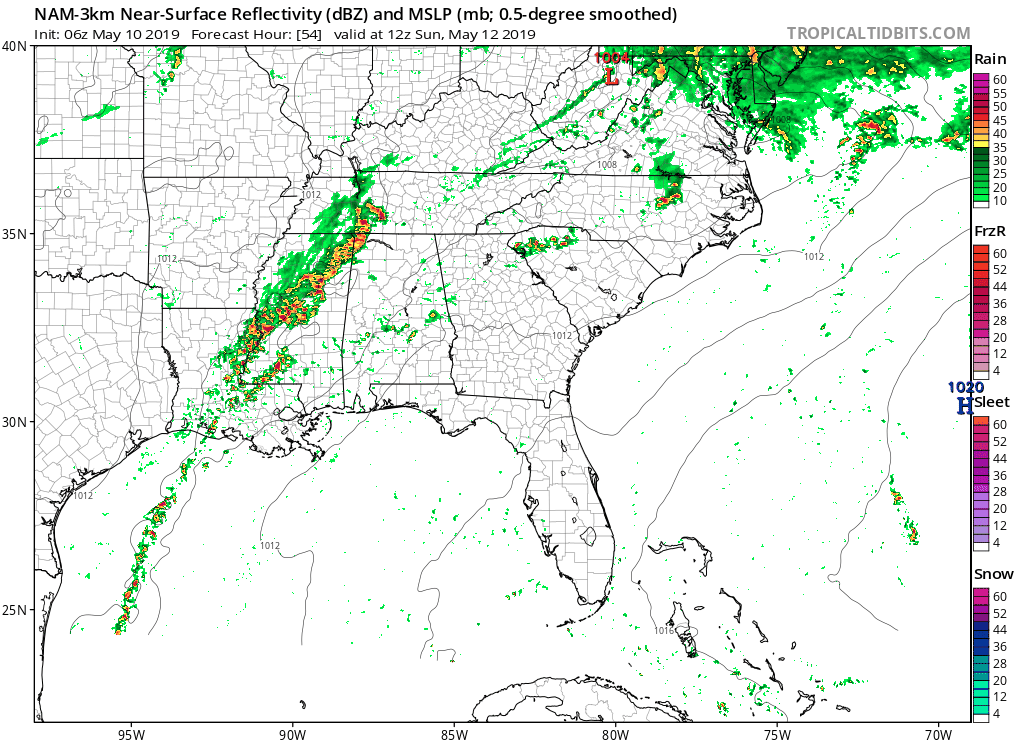
The NAM3k is showing the line of showers moving through and quickly leaving the area by lunchtime, however:
We could see a peek of sun as we approach sunset, temperatures rising up to 70°. We’ll be a little cooler for the low on Sunday, dropping into the mid 50s.
All in all, it’s going to be another wet and soggy weekend. Rain total for our area are predicted to reach up to 1″ to 1.5″of rain through Sunday night, with higher amounts to our South.
Check back for more updates!

Categories: Forecast Blogs (Legacy)
You must be logged in to post a comment.