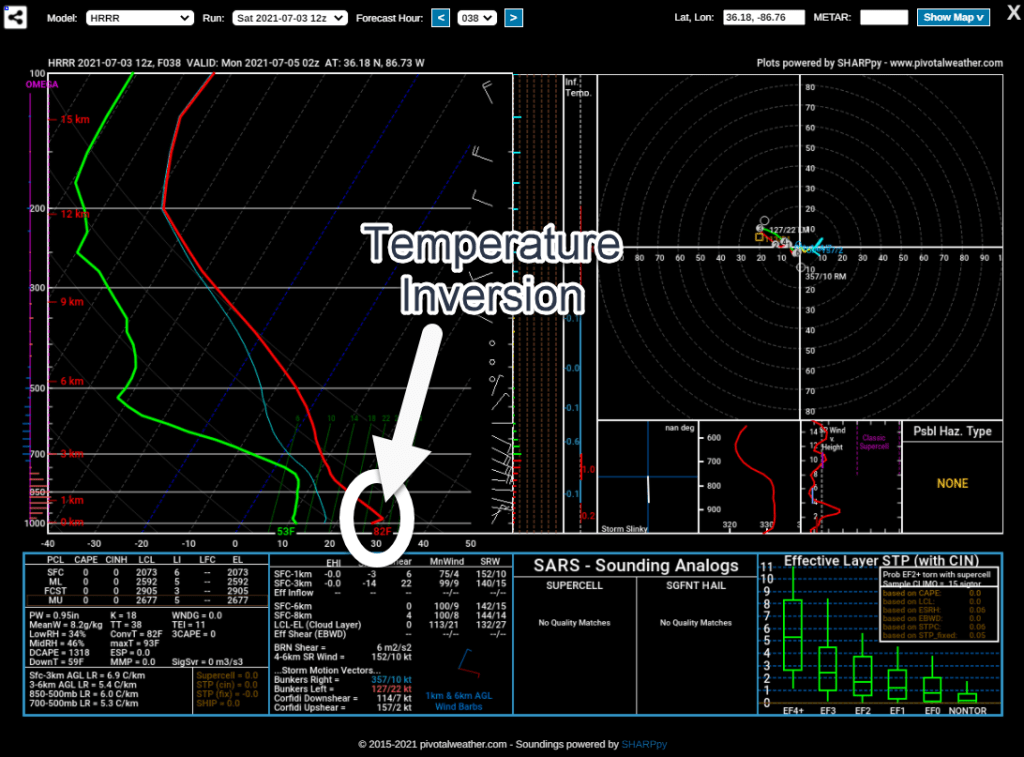
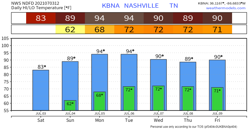
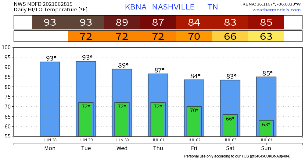
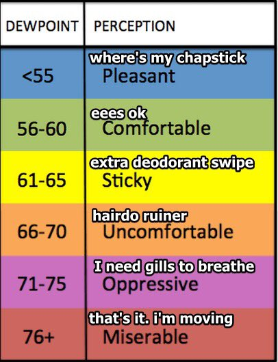
Wait for it. The sun rises on a cold front to our northwest:

Cooler temps are behind the front, rain is along the front. Looks like it’s coming this way. But . . . Doesn’t look like the front get to us. It’ll stall, then fizzle out tonight.
Chances of seeing some showers will continue throughout the afternoon, then should be diminishing by 5 pm.
We should clear out by this evening. Heavier rain will stay to our north.
It’s not looking to be a washout – around a tenth of an inch of rain is possible. There could be some locally higher amounts.
Behold the Urban Heat Island…
We will warm up to 68° today with bright sunshine.
No 30 degree temps tonight. Lows should settle in the upper 40s to around 50. Warmer than this morning was.
Few more clouds than Saturday and touch warmer with a high of 71°. Perfect for a noon kickoff. Expecting a south wind around 10 MPH or so., for all those times Kern will be holding the PATs.
A cold front will go through the area during the the afternoon and early evening hours.
Clouds are beginning to move in this morning.
Highs today will reach around 75° ahead of the front.
We should be dry throughout the afternoon. Our greatest chance of seeing some showers comes after 8 pm and they should be exiting the region by 3 am Friday.
To be social is to be forgiving.
Robert Frost
The cold front that moved through yesterday left us with a beautiful fall day.
Tonight will be cool with a low of 46°.
Similar story Wednesday albeit a bit warmer. Maybe touching 80° by the afternoon.
Cold front ETA Thursday night. Some light rain is possible with this passage.