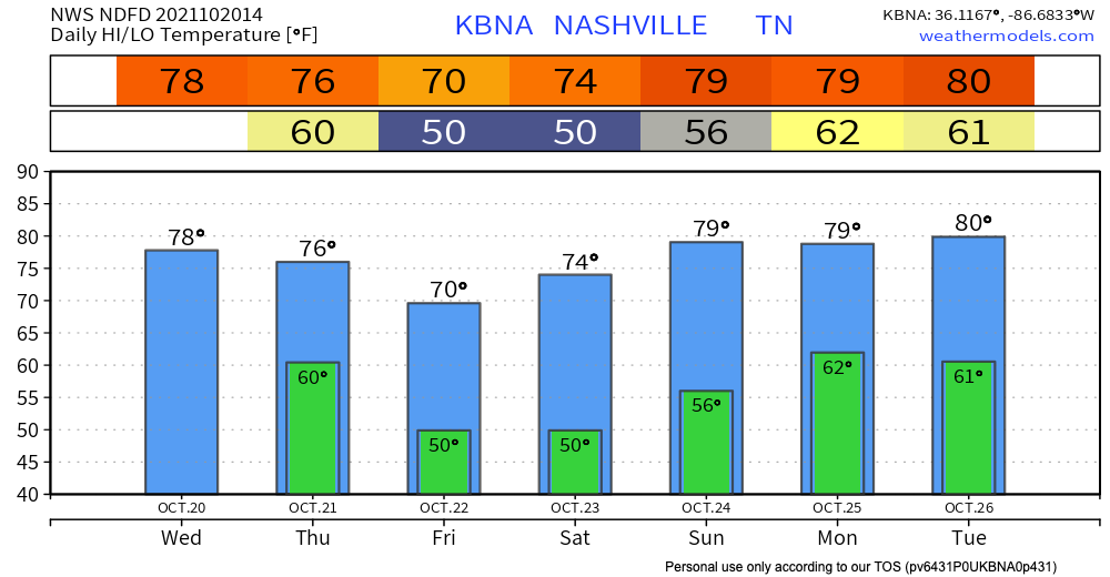
Today is going to feel a lot like the past few days – temps in the upper 70s, sunny with a handful of clouds, and comfy dewpoints in the 40s. Models look clear for today, but starting early tomorrow morning, some rain is possible.

Today is going to feel a lot like the past few days – temps in the upper 70s, sunny with a handful of clouds, and comfy dewpoints in the 40s. Models look clear for today, but starting early tomorrow morning, some rain is possible.
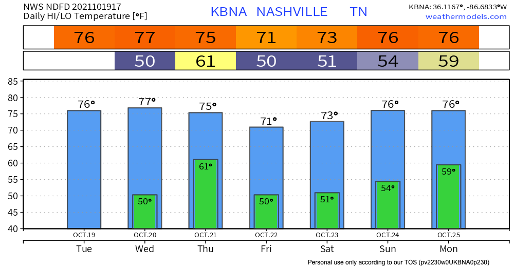
Today is basically a photocopy of yesterday… Clear skies, no rain. Should be another beautiful day, just bump temps up a couple degrees. Highs today will be in the mid 70s.
Tomorrow will bring us the highest temps of the week with highs in the upper 70s to near 80. It’s only fitting that rain follows soon after. Still looking like the incoming cold front will bring us action on Thursday, though minimal. Not looking like anything severe, but T-storms are a possibility. Mostly the annoying, scattered light rain. The Nam 3km model illustrates what it thinks this will look like on radar. Take exact timing with a grain of salt.
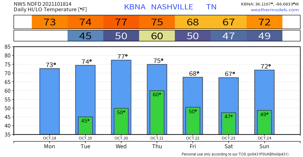
We’re finally down to near-normal temps for this time of year. Highs today hover around in the low 70s. Humidity is an afterthought. Good riddance.
Beautiful night for some Monday Night Football. Temps in the low 60s by kickoff, so set a reminder to grab your favorite hoodie. Doing a touchdown celebration for clear skies and no rain!
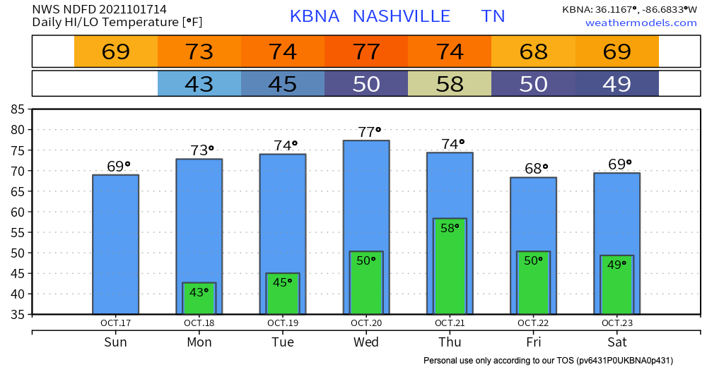
If you’ve been outside today, you know fall is here. Temps this morning were in the low 40’s. Sweater season is now. Temps shouldn’t get higher than 70 today, so feel free to rock your sweaters all day long. No rain in sight, just sun.
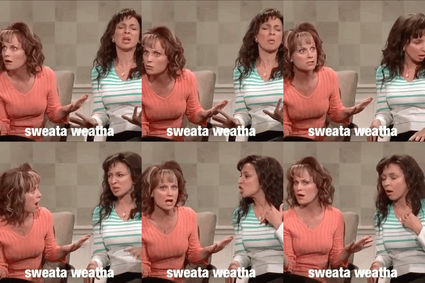
For many of you, this is what you’ve been waiting for. Lowes low enough to make you bundle up. NWS Nashville noted a 15° temp drop. Today, highs that let you wear that sweater. Cue the gif…
For the next several days, we’ll gradually warm, but barely over 75°. Lows in the evenings will round up to about 50°. Locally colder lows are possible.
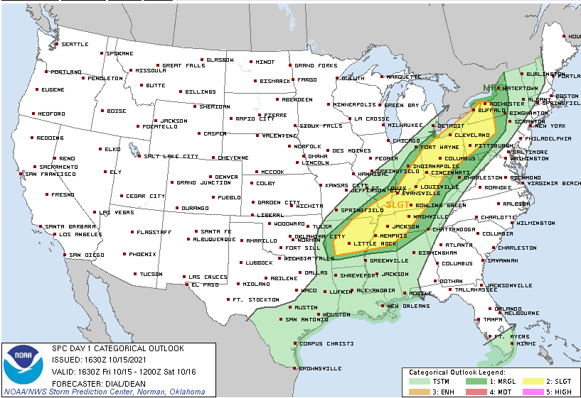
Today we’re looking at the possibility of dangerous storms. Here are the Storm Prediction Center outlooks we are a part of:
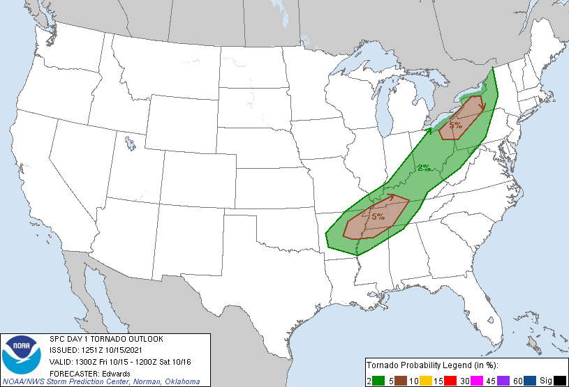
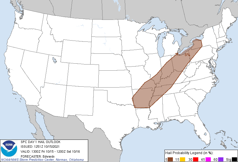
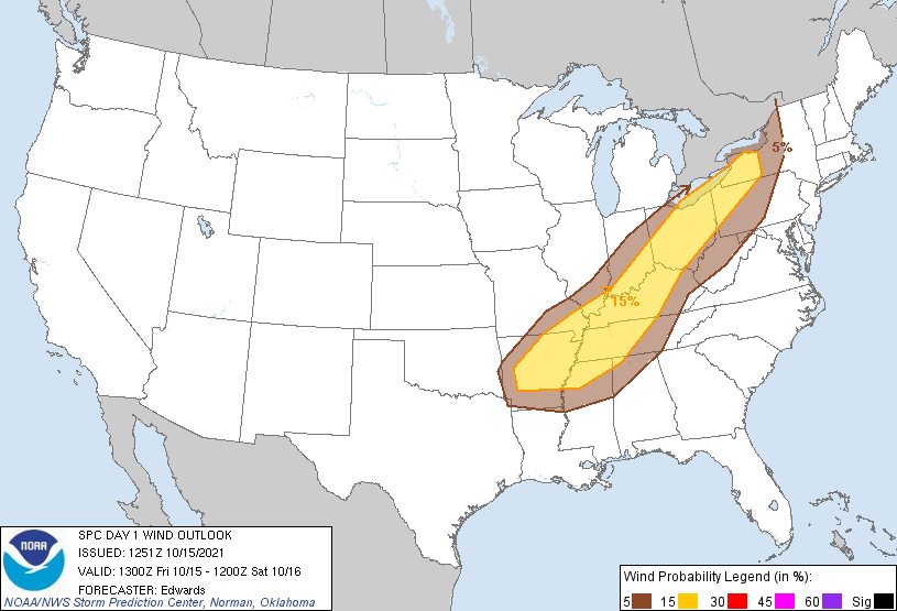
The HRRR model has been back and forth with whether storms will come through mid/late afternoon. The latest runs suggest mid/late afternoon storms are not likely, but we wanted to mention the possibility.
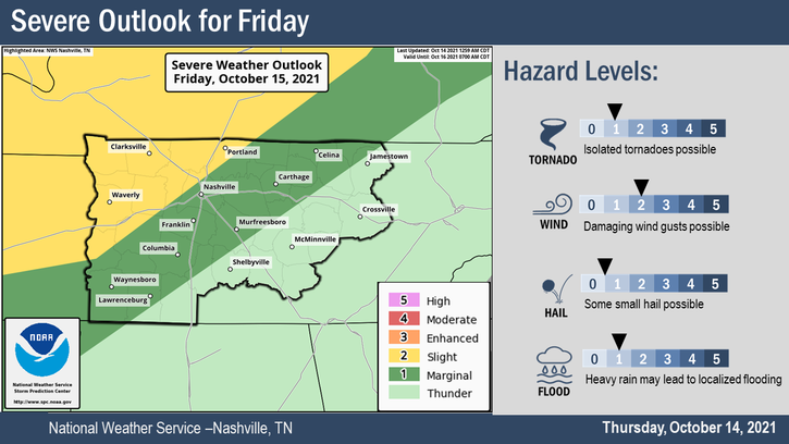
It’s going to rain and probably storm Friday. Storms carry a low-probability chance of turning bad.
The Storm Prediction Center and NWS-Nashville think the biggest threat is damaging straight line winds (58+ MPH). There’s a localized flooding risk especially in urban areas. One inch diameter hail and tornadoes are possible, but both are less likely. See outlook below. (Editor’s Note: you might notice SPC has the hail risk a bit higher than NWS-Nashville. That’s a distinction without a difference, when in doubt, I like the local forecast).
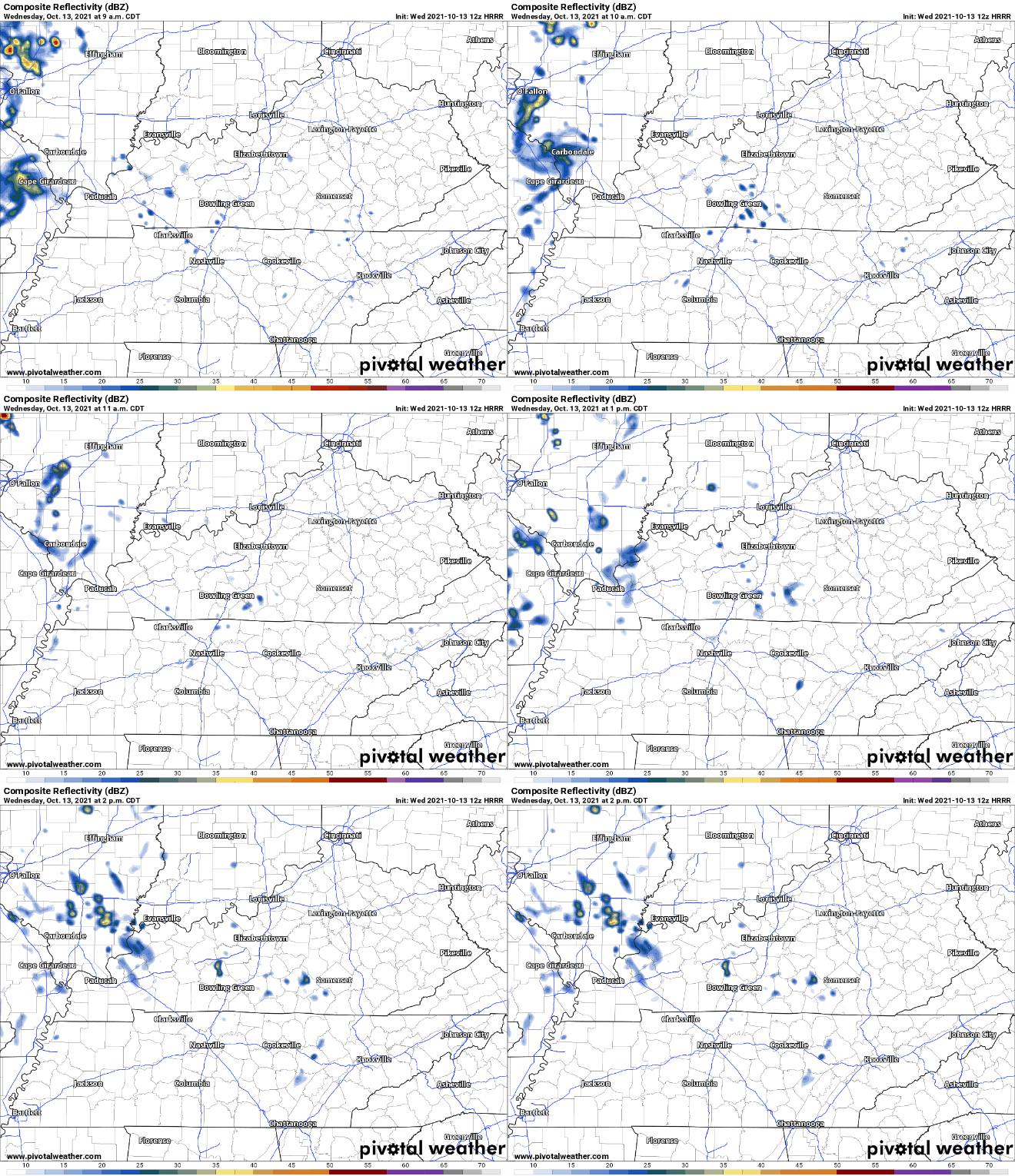
Showers for some of us are possible today. HRRR below has scattered showers from mid morning to early afternoon.
Our next rain-maker will be in the form of a strong Fall cold front. At the moment, the window for rain opens early Friday morning and closes pre-dawn Saturday morning. We believe the heaviest rain will fall Friday afternoon through the night. All of this should add up to between .25″-.50″. Check back on timing if you have outdoor plans Friday night.
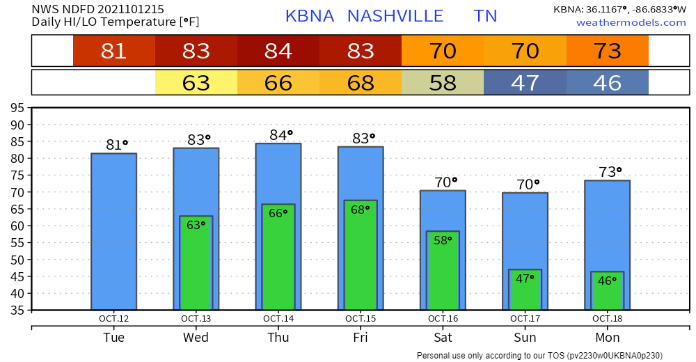
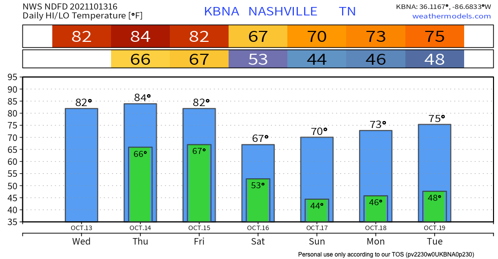
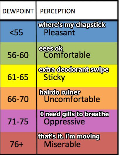
Checks calendar, yes, it’s October despite temps leveling up to low 80’s today. Dewpoints hangout in the low 60’s. See the world’s most useful chart below for interpretation.
Rain shouldn’t be an issue today. HRRR has us dry. Outdoor plans look safe.

Very warm few days ahead for October. Well above average highs in the mid 80s (on the order of ten or so degrees warmer than usual). Muggy dewps stick around for the week.
Hold on to your hats… expecting wind speeds between 10 and 20 mph throughout the day (gusts up to 30 mph possible!). A few clouds in the sky, but otherwise a sunny, warm day. Nothing to ruin any outdoor plans.
You must be logged in to post a comment.