Clouds increasing today ahead of another cold front this evening.
Today’s high temps will easily warm in the mid/upper 40s, overnight low about 34°. Afternoon temps will feel close to freezing with the wind chill.

Clouds increasing today ahead of another cold front this evening.
Today’s high temps will easily warm in the mid/upper 40s, overnight low about 34°. Afternoon temps will feel close to freezing with the wind chill.

A weak overhead shortwave trough has shifted our winds to the north: cold air is pouring in. Cold air and thick clouds will keep us from warming too much this afternoon; high will be upper 30s.
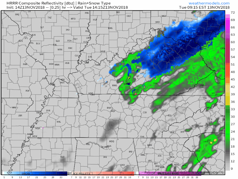
Even a few sleeters and snow showers have raced across NE Middle Tennessee. You may have seen a few wintry pellets on your windshield this morning. This may continue this afternoon with neither worries nor impacts.
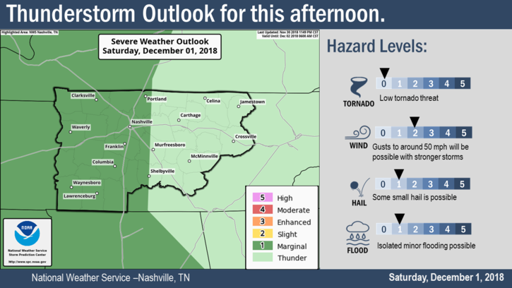
The Storm Prediction Center has us placed within a Marginal Zone (1 out of 5) of severe storm activity for this afternoon.
6:39 PM update: there’s another line of storms to our west.
The latest Mesoscale Discussion mentions these storms:
A shortwave trough over the Great Plains has shifted our winds to the south, bringing gross, moist air to the Midstate. For today, periods of on and off rain. Not expecting anything severe with these.

Cold air is pouring in from the north, making for a breezy day. Wind chills will go no higher than the upper 20s this afternoon, with breezy winds driving the wind chill into the upper teens after sundown.
Normal high temps for the end of November are usually in the mid-50s!. High could crawl close to 35° even though we’ll see more sun through the day.
Some flurries are possible but no impacts are expected. Just be careful if you see a wet road, there may be a thin layer of ice.
Overnight temps will fall even further into the low 20s. This is due in part to clouds breaking up, cold air and calm winds. Here’s what NWS Nashville has to say:
"CAA [cold air advection; fancy term for cold air moving from one place to another] today will also bring drier air with dewpoints in the teens, and with winds calming down a bit tonight, there won't be anything to keep temps up."
The last band of rain has moved to our east, bringing today’s rain chances to a close. Sun is returning as we go into the afternoon.
Winds will calm down this afternoon/evening as dry air is ushered into Nashville. High temps should reach the low/mid 60s, slowly cooling into the mid 50s by bedtime.
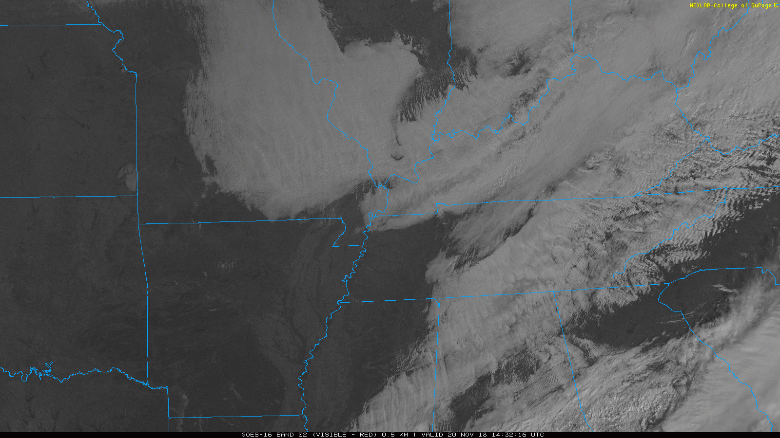
It’s overcast, so says the orbiting satellite GOES 16 and any two eyeballs pointed up. Clouds are dissipating over central Missouri, signaling cold, dry air creeping south and closer to us.
We should see a break in the cloud cover late this afternoon as dry air arrives.
Patchy freezing fog, locally dense, is expected to continue through the mid morning hours today. Some bridges and overpasses may be slick. Black ice may have formed on some area roadways. Take caution as you head out this morning.
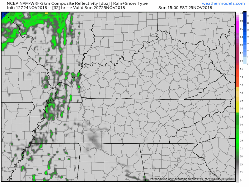
If you were dreaming of a snow-covered wintry day, models just don’t agree. One thing models do agree on is that the cold stuff will likely all fall to the north of us. We could see a rogue flurry throughout the day – nothing that will cause any problems.
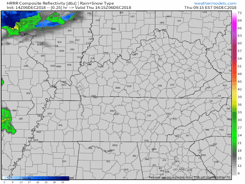
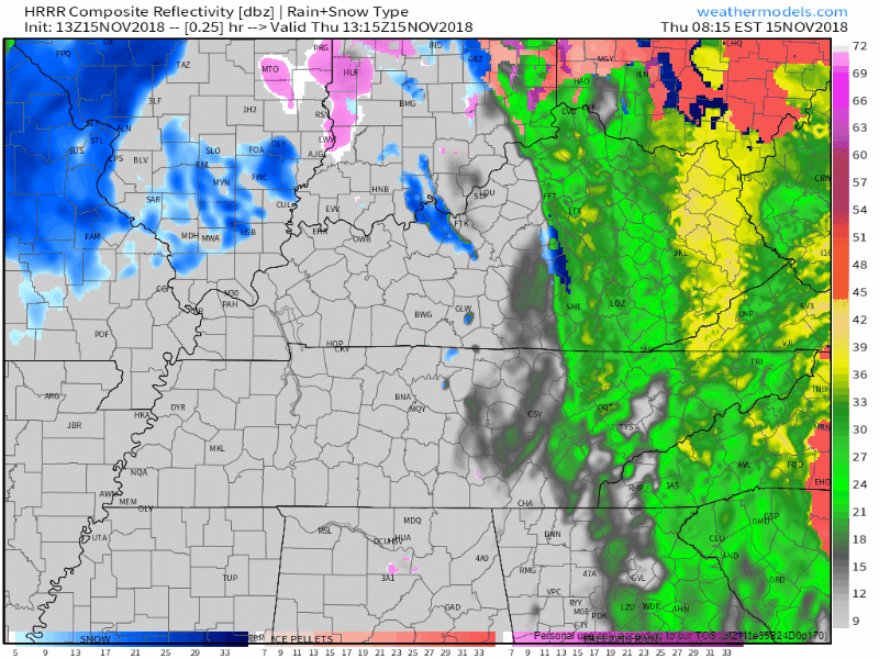
Rain moved out of Middle Tennessee, leaving behind a very cold and dry afternoon.
Here’s the departing precip per the HRRR model:
Temps earlier this morning were creeping toward 40°. They’re now dropping and should settle in the mid/upper 30°s throughout the afternoon. The wind is strong today, blowing around 10 MPH and gusting stronger than that, keeping wind chills at and below freezing today and certainly tonight and overnight. Temps should drop below freezing after midnight, with a pre-dawn low Wednesday of 31°.
You must be logged in to post a comment.