High pressure has moved into the Midstate, mixing out any remaining clouds.
And it is COLD! High temps today will struggle to reach the low 40s, overnight temps will easily drop into the mid/upper 20s.

High pressure has moved into the Midstate, mixing out any remaining clouds.
And it is COLD! High temps today will struggle to reach the low 40s, overnight temps will easily drop into the mid/upper 20s.
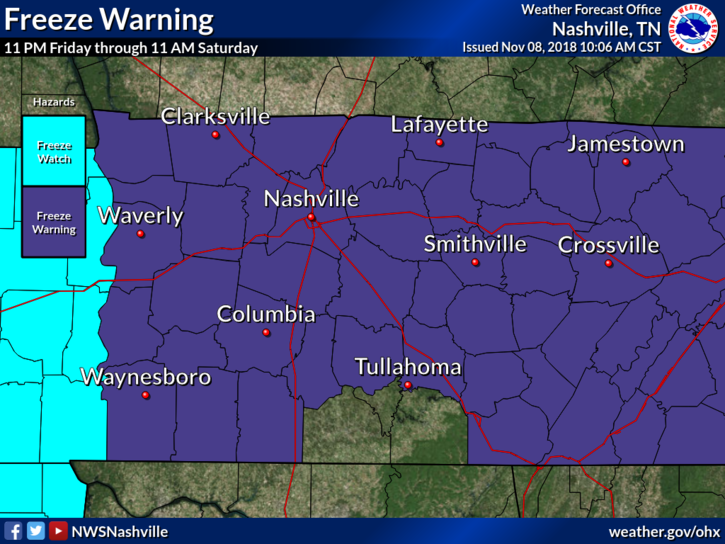
Friday’s overnight temps could fall into the mid/upper 20s, bringing a hard freeze to Nashville.
Afternoon rain chances are low ahead of another cold front slated to push through the midstate this evening.
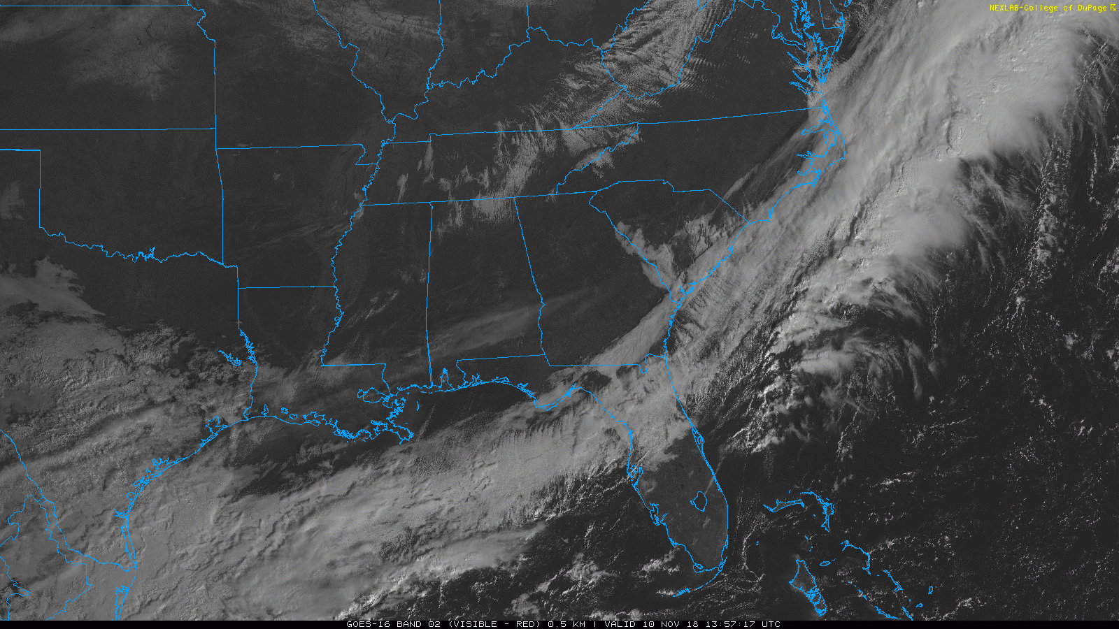
The clouds and storms are gone. As details about the tornado outbreak last night arrive, we’ll post them to Twitter.
Weak surface ridging will build in this afternoon and tonight – therefore, no rain, high temps this afternoon in the upper 60°s. Temps will fall into the upper 40s by sunset.
Winds out of the south are nice and breezy, could see some gusts at 15 to 20 mph. Overnight temps in the low 60s.
No rain.
Models continue the trend of slowing down this cold front’s passage. Trick-or-treat hours now look mostly rainless, though a few quick showers could push through.
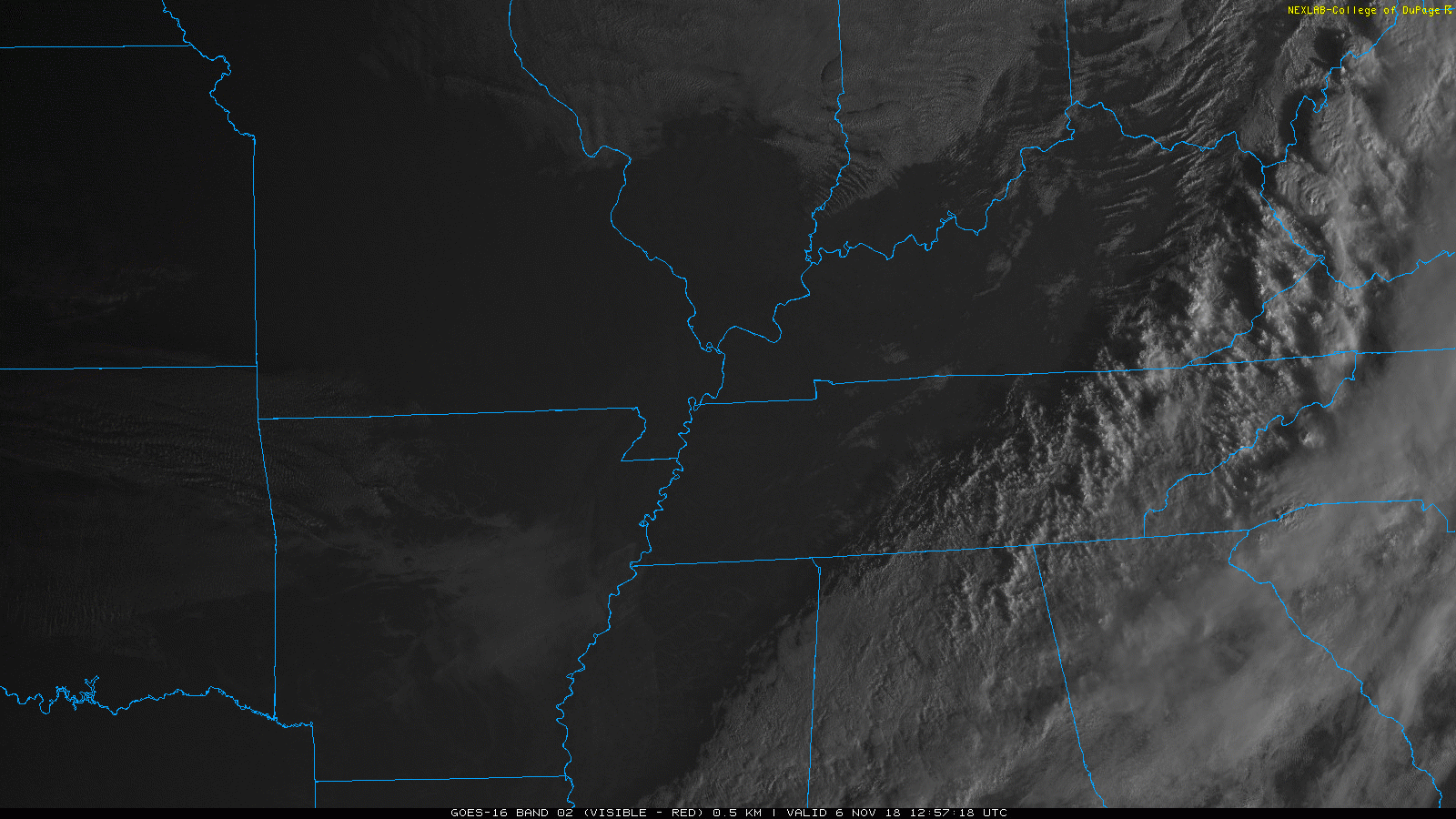
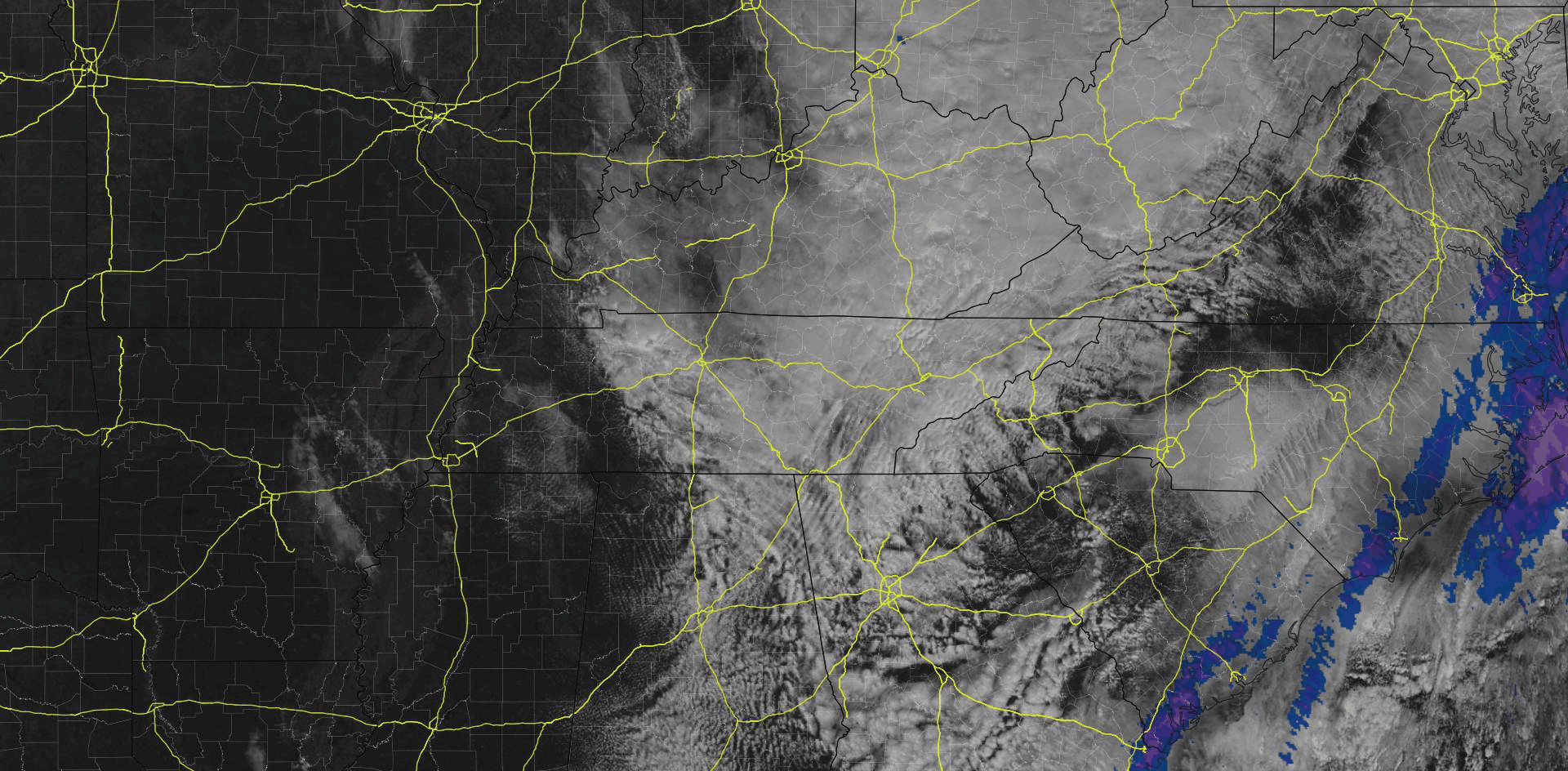
It’ll take most of the day to clear these clouds, seen below shortly after noon.
High temps in the upper 50s.
Afternoon & Evening Plans
If you plan to take part in the holiday festivities this evening, you’re good to go! Temps will drop into the mid/upper 40s, with a calm out of the southwest.
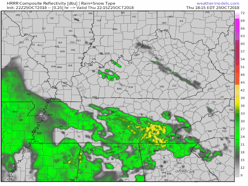
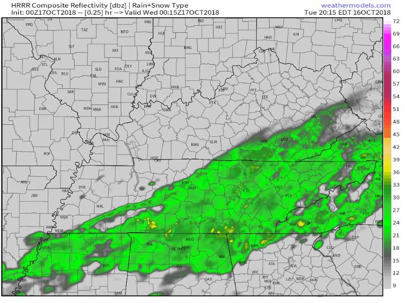
Latest HRRR shows steady rain for Williamson and Davidson counties during the overnight hours. Rain slackens and becomes scattered by your Friday morning commute.
New HRRR rain totals have Nashville receiving 0.4″ overnight.
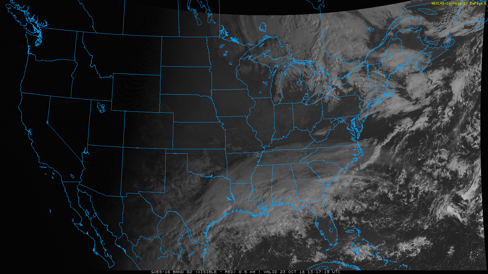
Some high cirrus clouds are sweeping through the Nashville sky this morning, as seen on the GOES 16 visible imagery above. These are reaching out ahead of a dry cold front expected to pass through today.
Frost Advisory for Nashville. 33° to 36°. Sheltered and low-lying areas may see frost producing temperatures for at least a few hours prior to sunrise Sunday. A Frost Advisory means that widespread frost is expected. Sensitive outdoor plants may be killed if left uncovered.
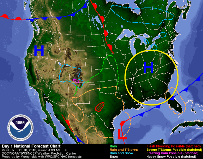
Rain today? High pressure bubble says, “no.”
A ridge of high pressure is now settled right over the Midstate, keeping clouds at bay and squashing any rain chance for our Thursday.
High temps today will remain into the low 60s. Dewpoints in the low 30s! That means the gross-humid weather is out for the day!
Light rain arrived mid-afternoon, on time, mostly south of I-40. From NWS-Nashville:
Expect most of the measurable rain to be south of I-40, with perhaps a hundredth or two falling in the Nashville area . . .
You must be logged in to post a comment.