
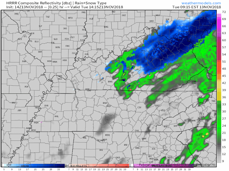
Rain moved out of Middle Tennessee, leaving behind a very cold and dry afternoon.
Here’s the departing precip per the HRRR model:
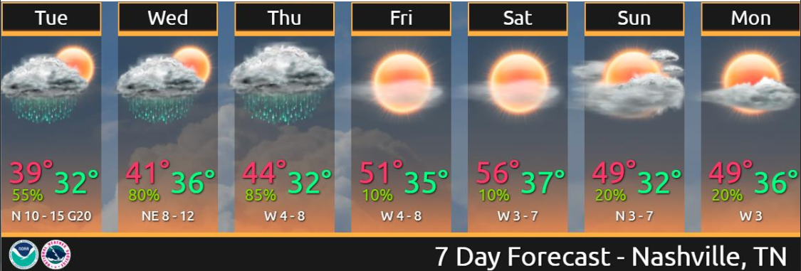
Temps earlier this morning were creeping toward 40°. They’re now dropping and should settle in the mid/upper 30°s throughout the afternoon. The wind is strong today, blowing around 10 MPH and gusting stronger than that, keeping wind chills at and below freezing today and certainly tonight and overnight. Temps should drop below freezing after midnight, with a pre-dawn low Wednesday of 31°.
Wednesday – Thursday’s Rain/Snow Chances
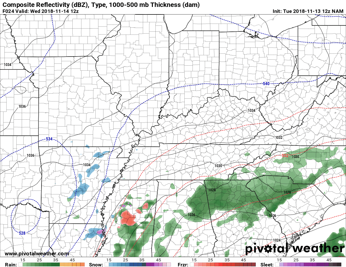
Rain returns Wednesday as an upper low forms over Texas and shifts northeast Wednesday morning. As you can see from the below NAM3 model run, there’s a lot going on with this system as a whole: rain, sleet, and snow. What will we get? Mostly rain! Keep reading.
We could begin to see precip as early as 8 AM on Wednesday morning, but more likely late morning to around lunch time. If it arrives early while sub freezing temps are in place, it could be cold enough for us to see a brief wintry mix of no consequence. Nothing will stick because we won’t be cold enough long enough.
A cold, soaking rain will continue Wednesday afternoon and evening. High temps will move into the low/mid 40°s, keeping it all rain.
Things get interesting again late Wednesday night into the overnight hours Thursday, which is when temps aloft and here at the surface drop.
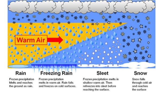
Editor’s Note: A reminder about wintry precip — the temp here on the ground is almost always different from temps overhead. Obviously precip has to fall through various layers of the atmosphere #BecauseGravity, and along its journey down your friendly precip drop encounters varying conditions. Precip often starts as snow or rain pretty high up, and as it falls it changes to sleet and/or snow and/or rain a few times before it goes splat on earth. What it is when it gets to us all depends on whether the temps at various altitudes are above or below freezing, whether the Dry Air Monster is setting up there gobbling the precip, and other things but this paragraph has already gone on too long.
Just because it falls as snow doesn’t mean it’ll stick to anything. Remember, temps overhead and on the ground are often different.
NWS Nashville had this to say about the cold stuff:
Temp profile through duration actually iffy for significant wintry mix but any chance of ice/snow accumulation more than a trace looks remote at this time.
Models try to figure this all out, but the large number of variables makes that very difficult. This is especially true of upper level low pressure systems, one of the most nefarious and confounding weather systems during near-freezing events.
For example, the NAM3 model brings a snow event as close as one county away to our west at 11 PM Wednesday night:
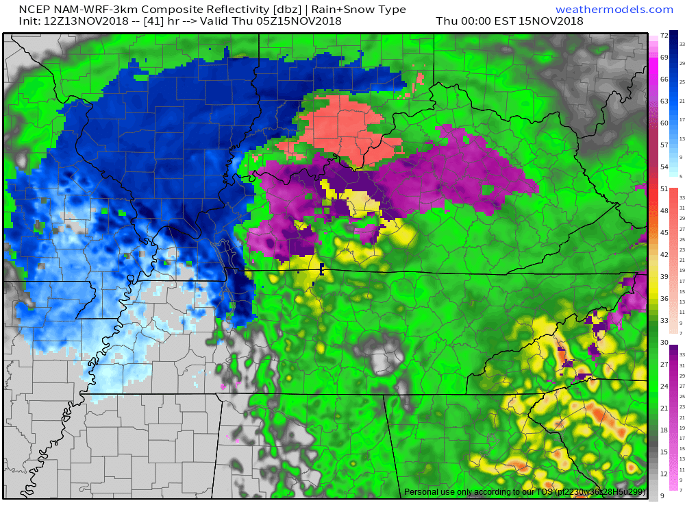
Then, sometime during the Thursday morning rush hour, and off and on through the day, the NAM3 model thinks some snow will fall as the upper level low crosses to our northeast.
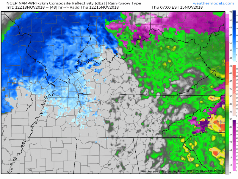
Other models agree we may see a few flakes Thursday, but — and don’t miss this — no model depicts an accumulating snowfall. Maybe only a trace, if that much.

Factors limiting any travel impacts Thursday include:
- ground temps above freezing.
- surface air temperatures expected to be over 40° most of the day Thursday.
- already-wet surfaces.
- not that much precip expected by any model.
Of course all this may change. Stay connected for additional information. Currently no snow is found in the official forecast from NWS-Nashville for Nashville or Williamson County for Thursday.

Categories: Forecast Blogs (Legacy)
You must be logged in to post a comment.