Stay Tuned at: @NashSevereWX


Stay Tuned at: @NashSevereWX
Today, skies over Davidson and Williamson counties will become increasingly cloudy as another cold front approaches.
High pressure moved into our area yesterday, breaking up the clouds, but now that is moving on to the east. The advancing clouds are west of us, as seen via satellite thru 11 AM:
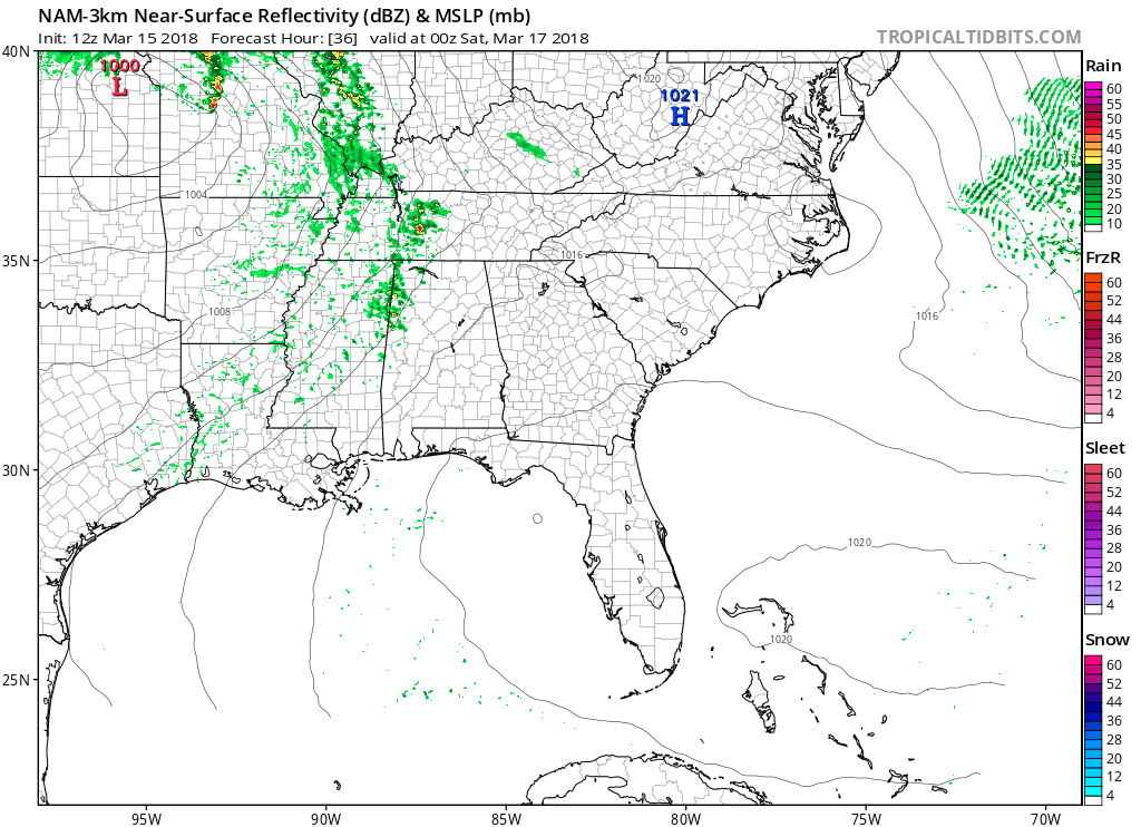
HRRR 3-km shows the expected radar through today and into early Saturday morning. High pressure is building in behind the low pressure system that has been bringing us so much rain. The showers from this morning have moved out, and clouds should break up into the afternoon and evening hours. Winds will continue to die down too.
It’s cloudy!

Overcast skies are currently widespread and will be hanging out all day, so don’t expect for the sun to break through.
Rain showers will be on and off throughout today and tonight.
The freeze warning we’ve been under has expired as of 9 AM this morning.
Your Thursday will start off clear and crisp with temperatures in the mid 40’s. A quick warm up to 55 degrees will have you really feeling like Spring has Sprung!
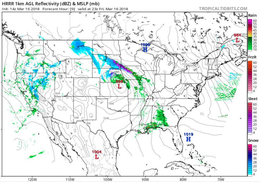
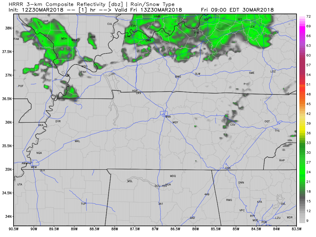
The HRRR model for the mid afternoon today. It is one of the more spatially-accurate models. This shows where the low pressure center is not very organized and most of the rain will miss the Nashville area.

The early afternoon hours are expected to be breezy with winds out of the WSW until the winds shift into the SE on Friday when the rain begins to arrive.
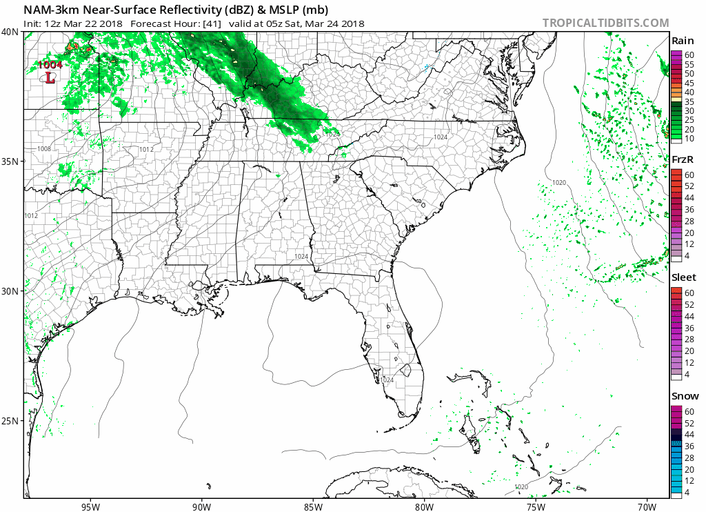
Current rain ETA is around 7 PM Friday night. At least that’s what the NAM3 model thinks:
The cold temperatures will hang around for a day or two more as a high pressure system funnels cold, north air down into the area. Today there will be some clouds, but the sunshine breaking through will allow for very slight warming, as the high won’t reach 50 degrees. Keep a warm sweater nearby because as the sun sets, the temperatures will fall to below freezing!
You must be logged in to post a comment.