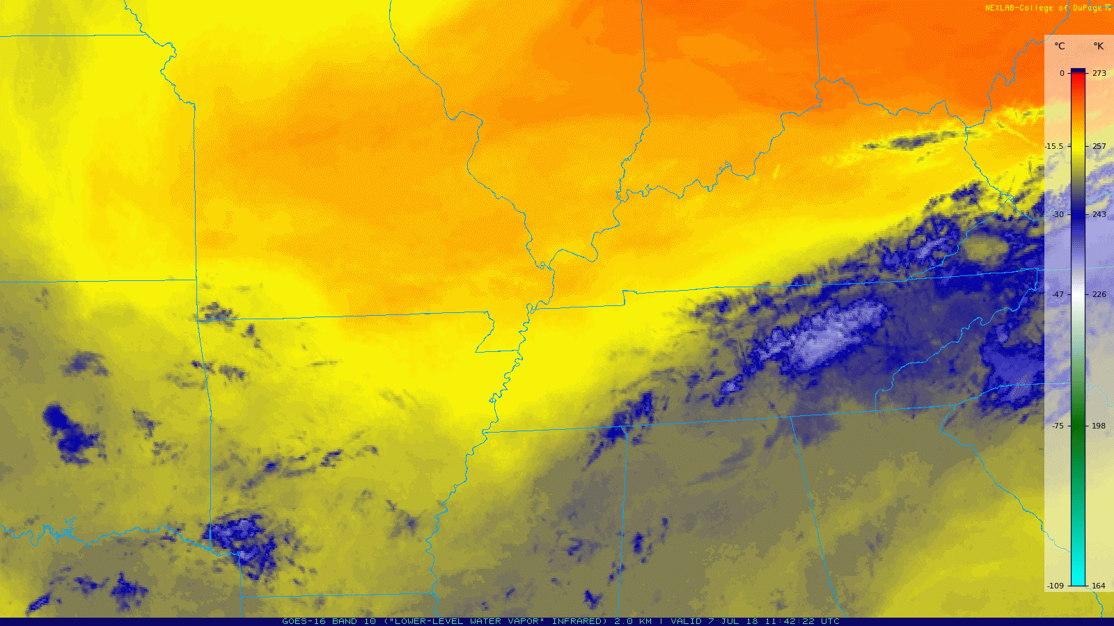
Yesterday’s frontal passage left us right on the fringes between two air masses. GOES-16 Water Vapor imagery (below) does a great job showing this: dry air can be seen as the warm, orange color; moist air is the cooler, blue color.

Yesterday’s frontal passage left us right on the fringes between two air masses. GOES-16 Water Vapor imagery (below) does a great job showing this: dry air can be seen as the warm, orange color; moist air is the cooler, blue color.
NWS Nashville has placed Williamson and Davidson Counties in a Heat Advisory between 11 AM and 8 PM today.
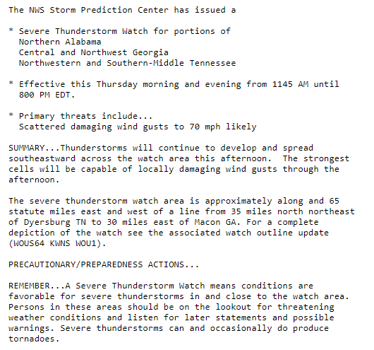
More from NWS Nashville:
The combination of heat and humidity will lead to an increased risk of heat-related stress and illness. The very young, the elderly, those without air conditioning, and those participating in strenuous outdoor activities will be the most susceptible. Also, car interiors can reach lethal temperatures in a matter of minutes.
Cloud cover should increase this afternoon, tossing shade and bringing our high temps down. The high will hover around the low 90s. Dewpoints remain in the low 70s – humidity will be “oppressive.”
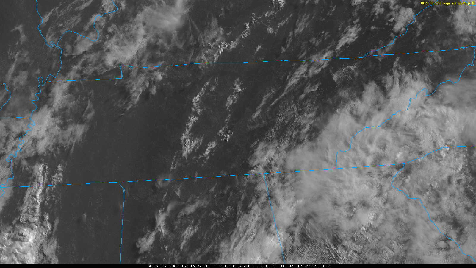
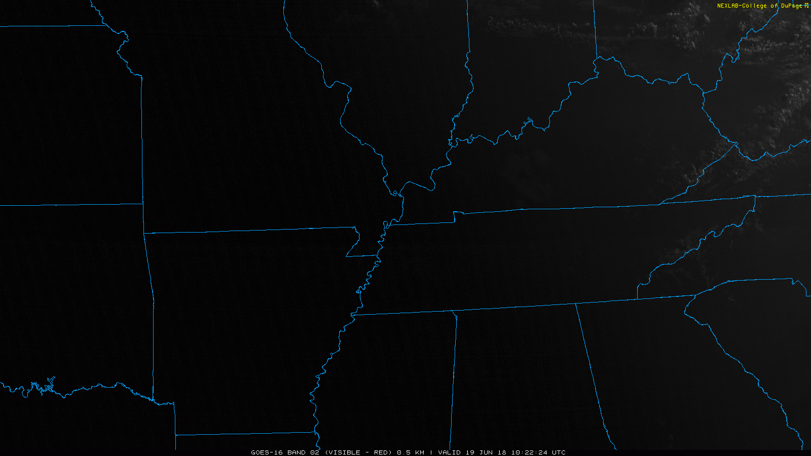
GOES-16 satellite imagery allows us a bird’s-eye view of Middle Tennessee. As of this morning, skies are relatively clear, with a few cumulus clouds. Lack of clouds will allow plenty of sunshine to come through, and temps will begin to climb.
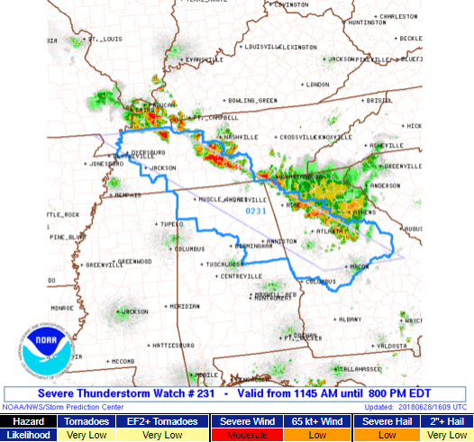
A “watch” means conditions are favorable for severe thunderstorms.
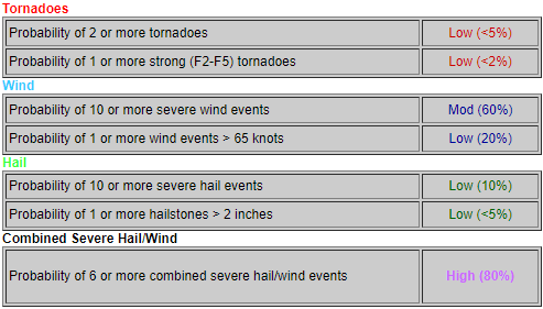
Note the probabilities of various hazards for the entire watch area:
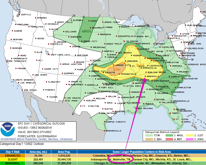
Nashville is not included in this watch. Williamson County is included. It appears the boundary where storms are setting up is going to cut through Williamson Co., which is why they drew the area where they did.
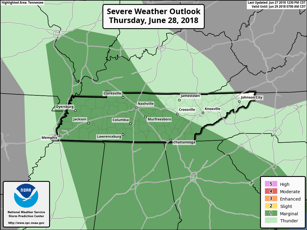
The Storm Prediction Center has placed us within a Marginal risk for Thursday. They think there is a 5% chance of severe storms occurring within 25 miles of you.
Threats are strong winds and heavy rainfall if a storm pops up over you.
*Outdoor plans at First Tennessee Park, Ascend or somewhere else? Keep your radar handy and check in frequently. Could have some storms around. See below.
It’s going to be hot and steamy today. The high will reach into the low 90s with the dewpoints staying in the low 70s.
We have some storms moving into middle Tennessee. These will hang around late tonight into early Sunday morning.
Both our HRRR and NAM 3-km models are in disagreement – lending to uncertainty for tomorrow.
We’re expecting a high of 84° today. You can thank the clouds and rain-cooled air for that. Dewpoints will remain in the upper 60s and low 70s from tropical moisture funneled into Middle Tennessee. Cooler temps, but uncomfortable humidity.
We’ve got sunny skies across Williamson and Davidson Counties to start off our morning. Lack of clouds will let temps soar pretty quickly. Our high today could reach 93, and with dewpoints in the upper 60s, you can expect that real-feel to be a few degrees warmer.
You must be logged in to post a comment.