
We’re expecting a high of 84° today. You can thank the clouds and rain-cooled air for that. Dewpoints will remain in the upper 60s and low 70s from tropical moisture funneled into Middle Tennessee. Cooler temps, but uncomfortable humidity.
The Storm Prediction Center has us placed in a Marginal risk (1 out of 5) for severe weather this afternoon and evening.
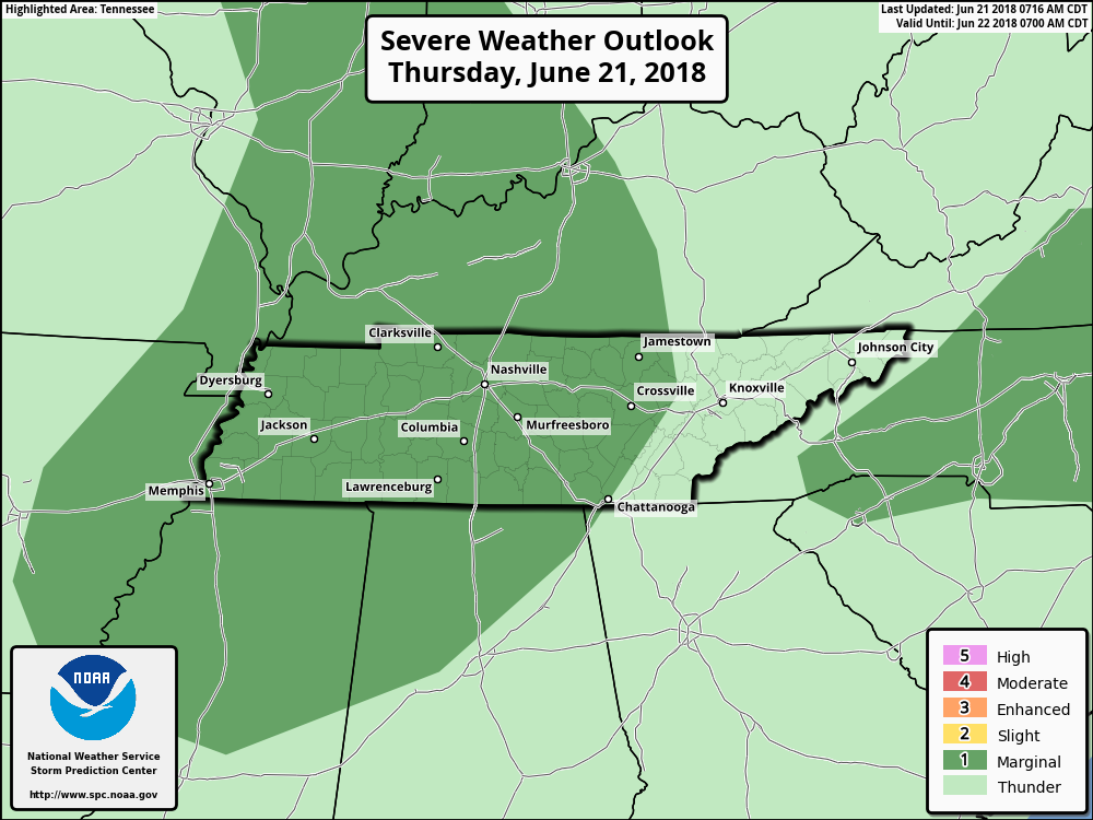
The Marginal risk was issued because SPC thinks there is a 5% probability of damaging straight line winds within 25 miles of you. Lightning is always a factor with thunderstorms.
Flood threat is low as these storms should move through relatively quickly.
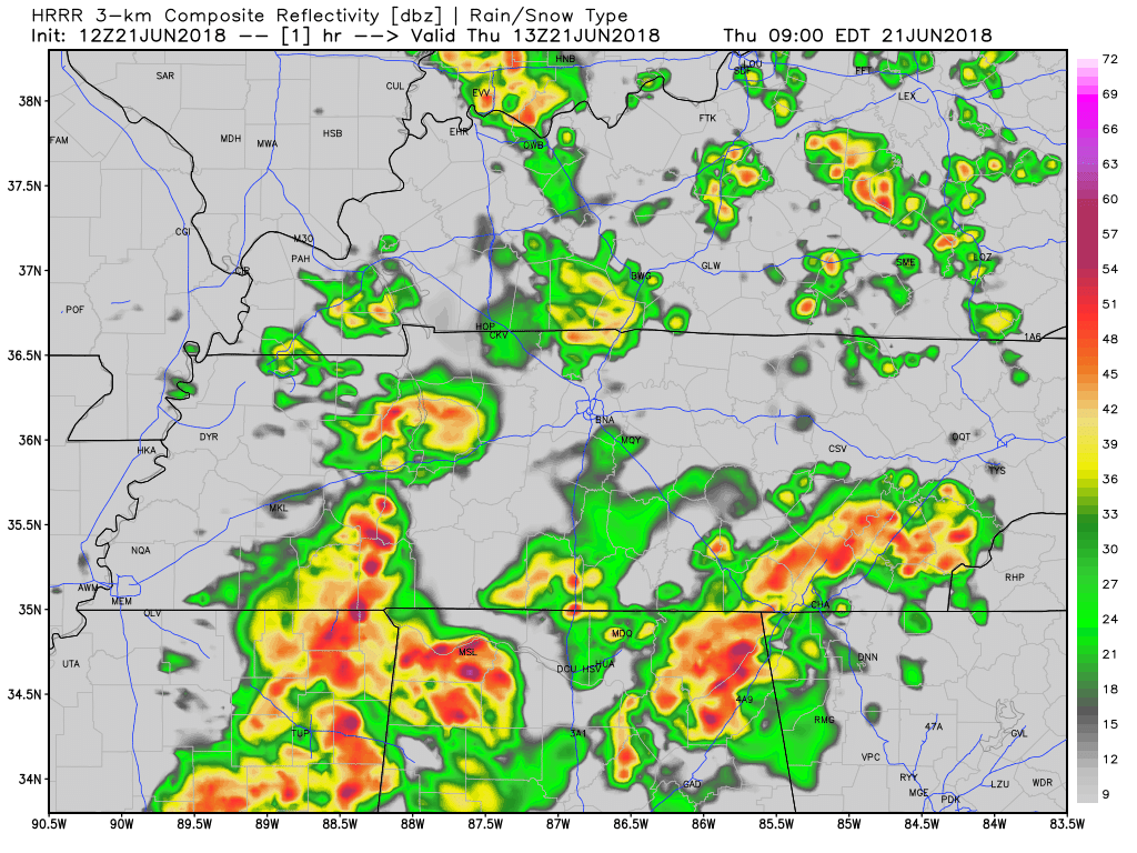
The HRRR model, above, is showing the widespread rain moving out early this afternoon, a lull for a few hours and then more storms sparking to our west into tonight and coming in around 8 PM or so. They may weaken on approach as the sun is going down.
Friday – Severe Weather Possible?
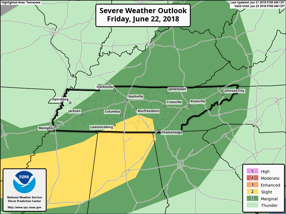
The Storm Prediction Center has us under another Marginal risk for severe weather again on Friday. Rain chances remain high, with wind and hail possible in some storms. Chances for more widespread severe storms remains to our south.
By late Friday night, the radar should be clearing outas the low pressure shifts to our east.
The Weekend
As of right now, Saturday morning and afternoon are looking dry – although it won’t feel that way. High temps will be on the rise again, nearing 90° with dewpoints in the upper 60°s.
A strong shortwave trough is forecasted to develop in the Plains and move toward us Saturday evening, sparking storms to our west that will head our way. We’re a few days out, so timing and severity remains uncertain, but it’ll be something to watch. ETA is superfuzzy, but more like very late night Saturday night into Sunday morning.

Stay clicked here or @NashSevereWx on Twitter for updates to our forecast!

Categories: Forecast Blogs (Legacy)
You must be logged in to post a comment.