
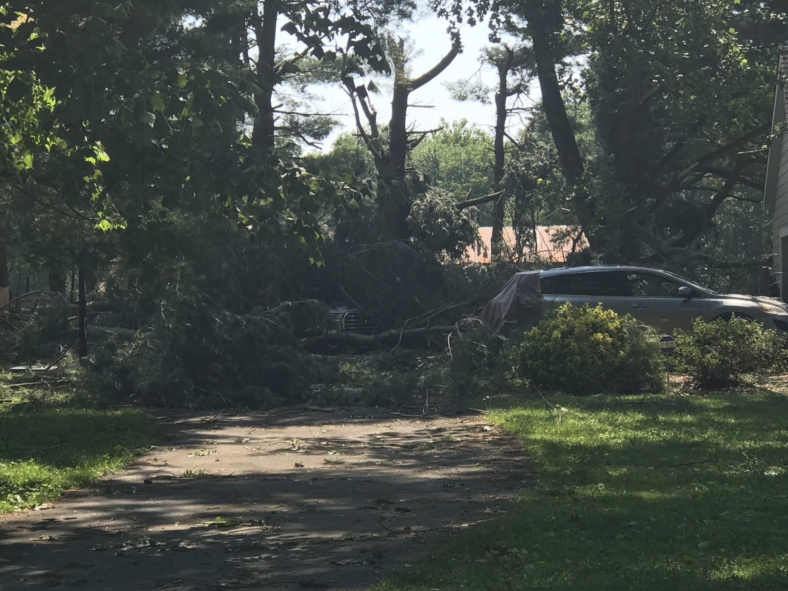
Yesterday’s Microburst
Large hail was the big hazard yesterday, from Nashville to East Nashville, and Franklin to Thompson’s Station.
And I think we had a microburst.
Southwest of Franklin, winds likely 60+ MPH resulted when a tremendous amount of water dropped quickly from the sky. Residents said it wasn’t raining, then suddenly a massive amount of water and wind came all at once. The water flooded a garage as strong winds swept through in a straight line, dropping these very large branches on cars (note this was after the bigger trees limbs had been removed)…

You must be logged in to post a comment.