
Afternoon Rain Chances
Cloud cover should increase this afternoon, tossing shade and bringing our high temps down. The high will hover around the low 90s. Dewpoints remain in the low 70s – humidity will be “oppressive.”
If you’ve got outdoor activities this afternoon and tonight: Afternoon showers are a possibility, a strong summer storm could hang around after sunset.
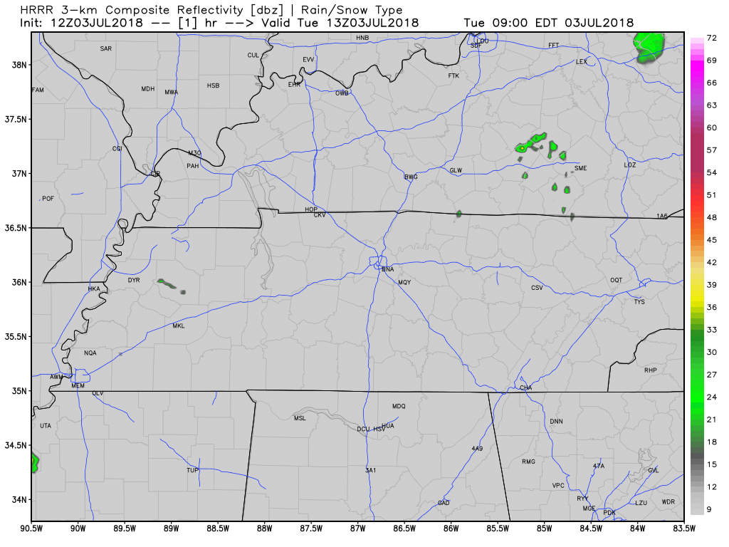
The HRRR model thinks rain will build in from the south in the mid to late afternoon. As storms begin to go up, a couple of strong storms could be in the mix.
Storms should move from south to north due to south winds.
The Fourth

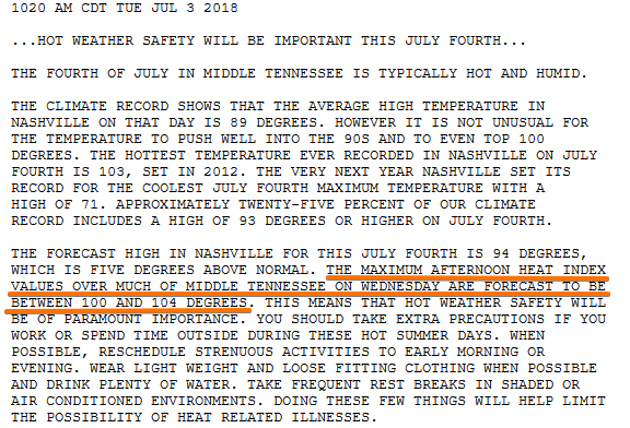
The average Fourth high is 89; we’re expected hit 94 with still-oppressive humidity. This will be a hotter — and more humid — Fourth than usual.
A dome of high pressure will build to our north on Wednesday, suppressing cloud formation. Daytime heating will bring temps into the mid 90s. Heat index values could reach into the 100s.
[Editor’s Note: In fact, NWS-Nashville issued a Special Weather Statement highlighting the heat, along with common sense heat safety tips that should be obvious to everyone except those visiting from Iceland (welcome, Icelandic tourists!):
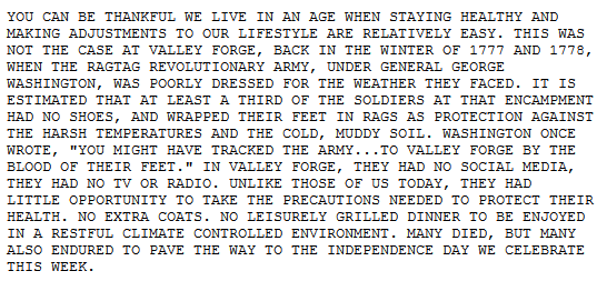
The Special Weather Statement included a history lesson from @NWSNashville. Spend your Fourth taking heat precautions while wearing shoes and eating your leisurely grilled dinner.
An unstable air mass will still be over our area, so a few storms/showers can’t be ruled out for late afternoon.
If you’re heading out to celebrate the holiday, keep a radar close by. Not really worried about fireworks rainouts but then again, the heat island over downtown may do its thing and pop a storm that could mess us up.
It’ll be another day spent on satellite and radar @NashSevereWx.
Moisture Increasing to End the Week
Rain chances increase Thursday and continue into Friday. An upper level low will track west out of the Atlantic, while a cold front drops in from the north. These two together will funnel moist air into the southeast, increasing the likelihood of storms going up over us.

Stay clicked here as we continue to update our forecast!

Categories: Forecast Blogs (Legacy)
You must be logged in to post a comment.