No Rain, but Hot Hot Hot
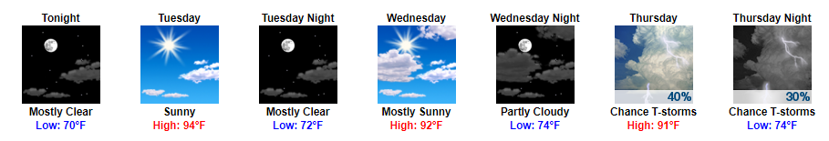
Tomorrow once again appears to be one of the hottest days we’ve seen so far this summer. Dew point temps will begin to creep back into the uncomfortable upper 60s. Our high will be around 94 tomorrow.

Tomorrow once again appears to be one of the hottest days we’ve seen so far this summer. Dew point temps will begin to creep back into the uncomfortable upper 60s. Our high will be around 94 tomorrow.

Today’s dewpoint stayed in the low 60°s.
It was almost, can I say, comfortable? The warm, kind embrace of a summer day.
Tomorrow….
Wait, what’s that mean for this week? How’s it looking?

Today will be the nicest day of the week. Low 60°s dewpoints = low humidity, but it’ll still feel like summer with a high near 90°.
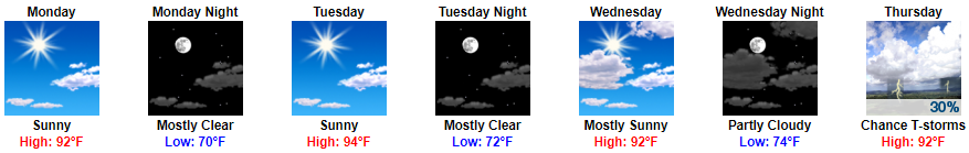
Humidity will increase every day. Today will be on the low end of Sticky, but Monday-Wednesday it’ll be Uncomfortable:

Rejoice! Rain is not in the forecast from now until Wednesday. This means that your weekend lake/BBQ/golf plans are finally a “go”, compared to the past couple of weeks.
What will be keeping us dry for the next few days? High pressure (otherwise known as the big, blue “H”)!
Happy Friday! While it will still be very hot outside, we are not anticipating any rain throughout the daytime and into the early evening hours.
https://giphy.com/gifs/excited-the-office-yes-t3Mzdx0SA3Eis
Latest HRRR Model
Showers and storms are again expected to “pulse up” this afternoon and evening across Middle Tennessee. Some could be on the stronger side with a few severe storms capable of damaging straight-line winds.
A few scattered showers continue to move across the area. If you have early evening plans, bring the umbrella just in case.
Into the remainder of the evening, all eyes are on a few lines of showers currently located in western Tennessee. If these showers hold together, which some models think they will, we could see another round of showers and thunderstorms later tonight.
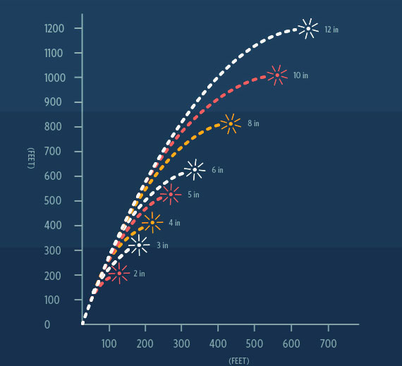
Most fireworks only fly about 1,200 feet up.
Models think “LCL levels” will be low tonight, meaning clouds should be closer to the ground. Some models predict cloud levels as low as only a thousand feet.
We’ve already seen a couple of severe thunderstorms this afternoon. As always, if you have any damage from today’s storms tweet using #tspotter to report it to our local National Weather Service Office.
A typical summertime day is expected with highs in the upper 80s and dew point temps in the low 70s. It’ll be nice and sunny to start, with diurnal heat showers possible later today.
Into this afternoon, we introduce those shower and thunderstorm chances. Latest run of the HRRR, shown below, displays what it thinks will happen today.
You must be logged in to post a comment.