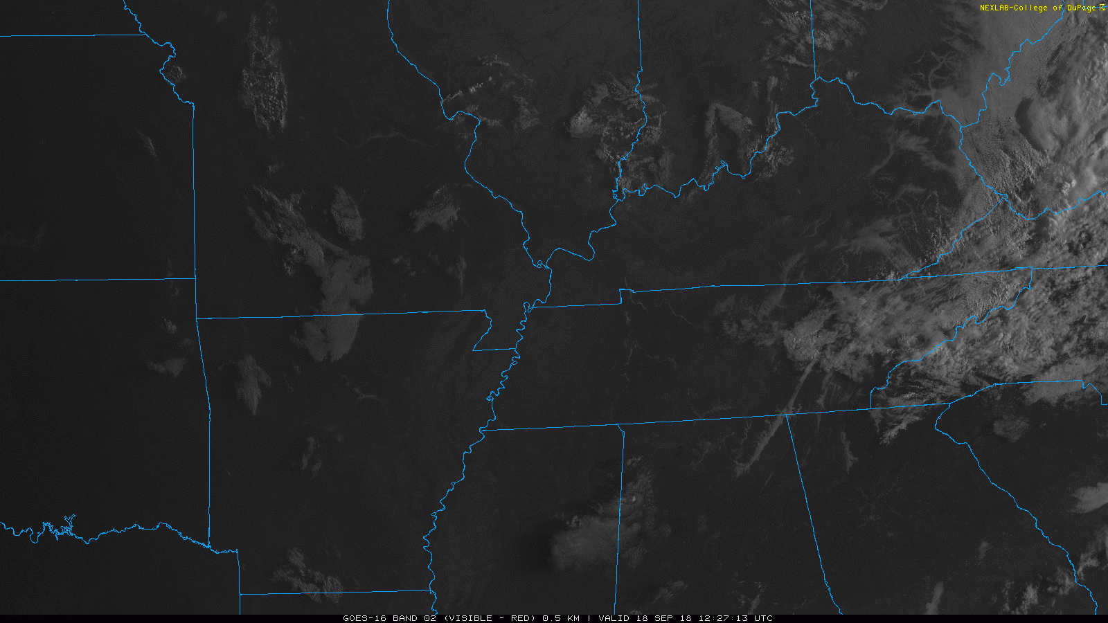
We’ve got quite the clear morning over Nashville. A few pockets of fog are mixing out with the rising sun just to our north.
Expect mostly clear skies today. A few puffy clouds could work their way into our skies.

We’ve got quite the clear morning over Nashville. A few pockets of fog are mixing out with the rising sun just to our north.
Expect mostly clear skies today. A few puffy clouds could work their way into our skies.
Here we are on Monday, September 17, still talking about a storm that formed on August 30. Just wow.
Florence will continue to be the major factor in our weather pattern. Its counter-clockwise flow and constant cloud cover are cooling our high temperatures by upwards of 10 degrees today. Looking at highs only the low 80s rather than the low 90s.
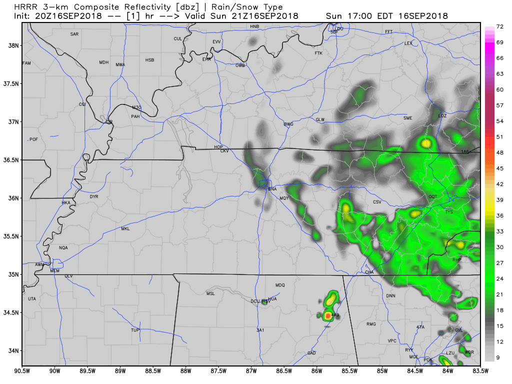
Clouds from Florence’s western edge produced afternoon light rain for a few of us.
A few more light showers are possible tonight and overnight as Florence lifts toward our northeast.
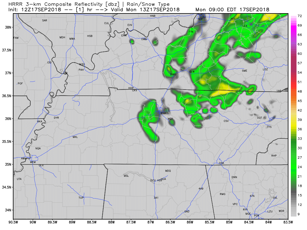
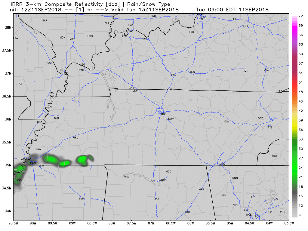
Here’s the HRRR model:
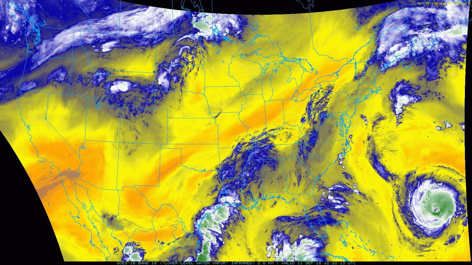
At sunrise, Tropical Depression Florence was centered in South Carolina with maximum sustained winds of 35 MPH. Its western edge extends into Nashville and Williamson County.
Today Florence should weaken more and hopefully Finally Move. It’s forecast to move north of Atlanta then north over East Tennessee today. We’ll be on its weaker west side, bringing us more clouds, winds, and possibly rain. The official forecast track:
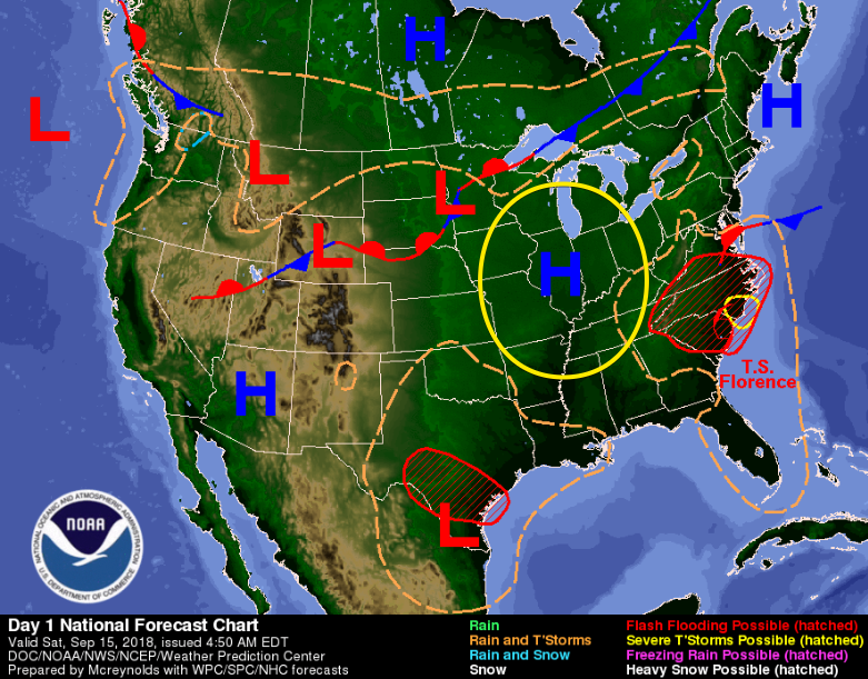
Caught between Tropical Storm Florence to the east and a high pressure bubble to our north, it’s going to be hot and dry for us here today. Rain chances are slim this afternoon, but a quick thunderstorm could go up on radar.
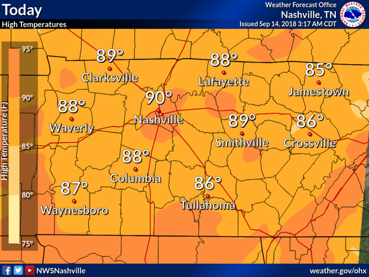
Hot. Hot. Hot. That is the story of the day. High temperatures will slowly approach 90º with dew points in the 70ºs. Heat values will soar as high as 97º in some spots, so keep that bottle of water close by.

Dewpoints have returned to oppressive, and it definitely feels like it. I wish I could say there’s relief on the way, but fall-like temps have come and gone.
High temps today will be around 90, but with the dewpoint sitting around 70, the heat index will be in the upper 90s.
High temperatures are going to jump back into the 80s today. Those 70s as highs are over… for now.
Editors Note: Gross
Humidity will remain on the noticeable side, especially in the afternoon hours. Dew points will remain below 70, however.
Widespread cloud cover continues to push temps high down into the upper 70s.
Dewpoints have fallen back into the low/mid 60s. It’s not going to be overly pleasant outside today, but a break in the heat is always welcome!
Rain chances today? The HRRR is keeping us dry throughout the day. Should be a pleasant, quiet evening.
Look for high temps to jump back into the mid 80s. A funnel of southwest winds is bringing moisture back to Tennessee, as part of a very large upper trough-ridge. You can see it (below) spanning from the desert southwest, up through the Ohio Valley.
This moisture will bring dewpoints up, increasing the humidity.
A few afternoon storms could go up overhead, but we should remain mostly dry.
Thursday will be markedly warmer, but similar conditions with low(ish) humidity.
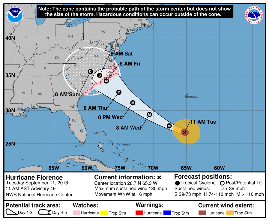
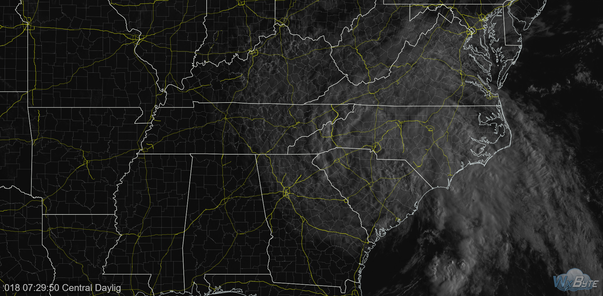
Hurricane Florence strengthened to Major Hurricane status early yesterday. Overnight, the storm weakened a bit, but as of this morning, it’s a Category 4 hurricane – max sustained wind of 130 mph.
Projected landfall remains a bit fuzzy as models continue to nail down when they think it’ll arrive – could be late Thursday to early Friday.
The GFS and Euro have aligned a tad overnight. Each are seeing the storm slow down upon arrival to the US. A slow storm means increased rainfall over a smaller area. The flooding threat continues to rise, along with hurricane and tropical storm-force winds. Nonetheless, the Carolinas and Virginia are in for a very hard impact from an incredibly dangerous hurricane.
Will we see impacts here?
Yes. What exactly will they be? We cannot say for certain.
I’ll leave this bit from our NWS Nashville office regarding some expected impacts in Middle Tennessee:
"So, what does this simply mean for the mid state region? There could be the potential for some breeze winds with gusts across the Cumberland Plateau Region, especially the Upper Cumberland Region Sun afternoon thru Mon evening."

Afternoon high temperatures in the 70s for the next two days?
We are in a brief break from summer, needless to say. In fact, tomorrow morning’s lows will be in the low 60s.
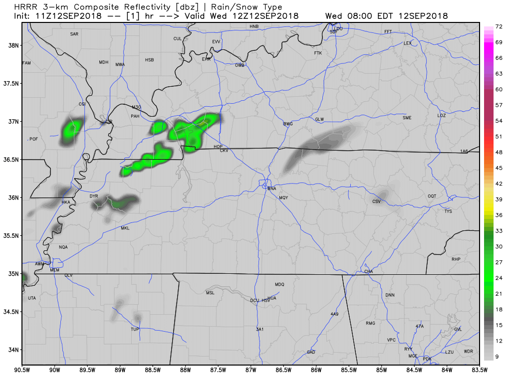
Here’s the HRRR model for today:
You must be logged in to post a comment.