Tranquil Now
No weather concerns today and Tuesday. Yesterday’s front made today’s weather tranquil, with high-pressure dominating the pattern. Clear skies today and tomorrow with temps approaching 70º today and 80º tomorrow.

No weather concerns today and Tuesday. Yesterday’s front made today’s weather tranquil, with high-pressure dominating the pattern. Clear skies today and tomorrow with temps approaching 70º today and 80º tomorrow.
Monday and Tuesday will be great. Low 40°s early, warming to 66° Monday and 75° Tuesday. No rain either day. Tuesday night will be breezy and mild, a fact you may find important by the time you get to the bottom of this page.

Sunday looks picture perfect. Get outside! Temps will fall back to the 60’s tomorrow, but before they do, they’ll get to 75º+ today. One other note about today: the wind. We could see winds gust up to 30 mph, but no damage is expected.
It’ll take most of the day to clear these clouds, seen below shortly after noon.
High temps in the upper 50s.
Afternoon & Evening Plans
If you plan to take part in the holiday festivities this evening, you’re good to go! Temps will drop into the mid/upper 40s, with a calm out of the southwest.
Low clouds and light pockets of rain are going to be the story of the day.
The low-pressure system that brought us the rain yesterday (or lack thereof), is moving up the eastern seaboard and bring the rain with it. In the words of NWS-Nashville, it will be “gloomy and drippy” today, highs in the 50s.
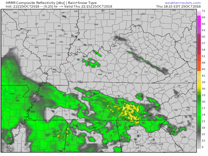
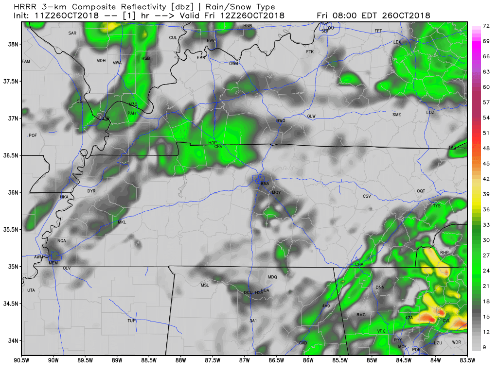
Latest HRRR shows steady rain for Williamson and Davidson counties during the overnight hours. Rain slackens and becomes scattered by your Friday morning commute.
New HRRR rain totals have Nashville receiving 0.4″ overnight.
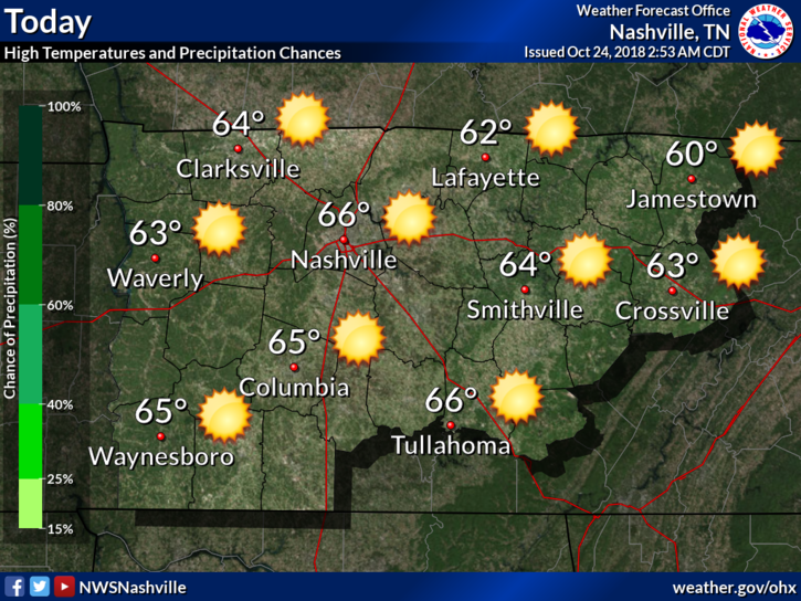
Today will be our last quiet day weather-wise before clouds and rain move in for an extended stay. Highs today should be mainly in the middle to upper 60s.
We are still watching what is now the remnants of Hurricane Willa over Mexico. What’s left of that system will redevelop into a surface low-pressure system that will track eastward along the Gulf coast Thursday and Thursday night.
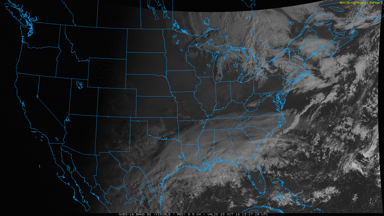
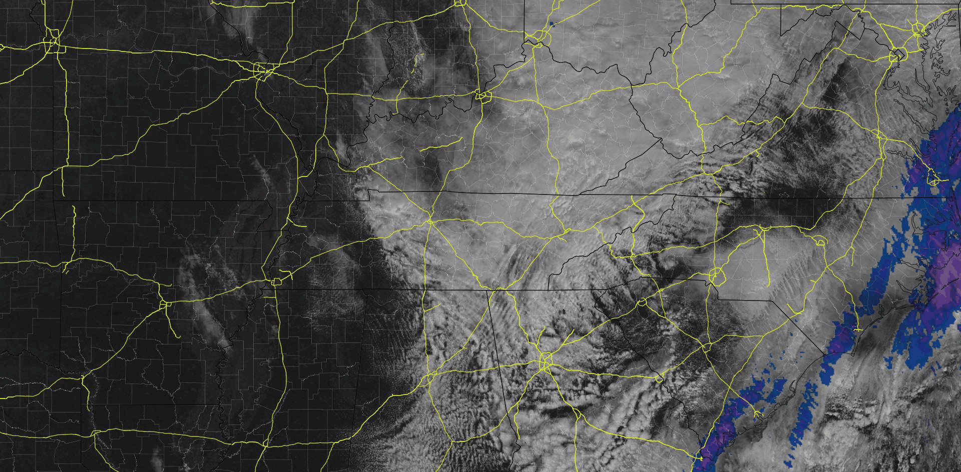
Some high cirrus clouds are sweeping through the Nashville sky this morning, as seen on the GOES 16 visible imagery above. These are reaching out ahead of a dry cold front expected to pass through today.
Tonight will be several degrees warmer with lows dipping to around 40 degrees. By Tuesday morning a weak dry front will dip into the mid state, but will really only bring a change in wind direction. Temperatures are expected to rise into the mid to upper 60s by the afternoon hours making for a pleasant fall day. Wednesday will see similar conditions as light northerly winds and mostly sunny skies continue.

Well, we were just about freezing this morning! Literally!
We got down to 34º at Nashville International Airport. Just 2º shy of reaching the freezing mark. Many local areas did hit freezing, as recorded by personal weather stations.
You must be logged in to post a comment.