It’s chilly out this morning. Wind chills are near 29°.
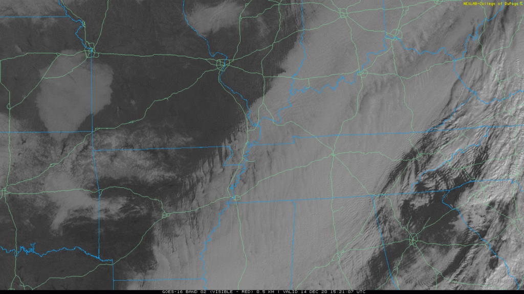
Some clouds are still lingering this morning, as shown in the satellite imagery below. They will clear out through the late morning and afternoon hours, giving way to sunny skies.

It’s chilly out this morning. Wind chills are near 29°.
Some clouds are still lingering this morning, as shown in the satellite imagery below. They will clear out through the late morning and afternoon hours, giving way to sunny skies.
It’s Hump Day!
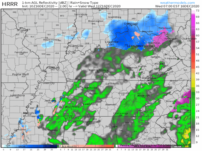
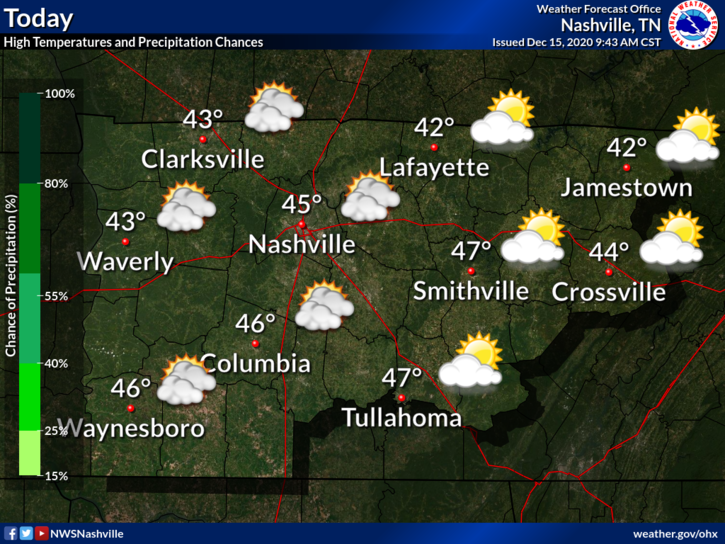
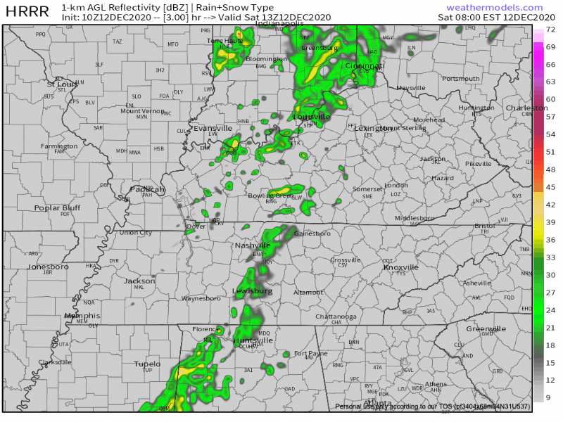
Light rain continues across the region this morning with temperatures in the low 40’s.
This system should be moving out around lunchtime/noon.
Those temperatures aren’t going to warm up very much as the day goes on with only a high of 44.
Bundle up! A cold day awaits. Luckily, we will be sunny today, so that will help our high temperatures reach a ~balmy~ 45º.
Clouds are clearing a bit this morning, but they will build back up this afternoon ahead of our next precipitation event.
It’s cloudy.
Sunshine is advancing behind a clearing line crossing the Ohio River around 10:30 AM. It may get here before dark.
Highs today will remain in the mid-40s but with that wind coming out of the northeast, real-feel temperatures will feel more like the 30s.

This morning, the fog lifted over Middle Tennessee, as seen below on satellite.
Sunshine today, but clouds will increase this afternoon. Colder than yesterday. High temps near 52°.
The HRRR model thinks a hard, cold rain (wind chills in the 30°s) will start around 8 PM. Rain won’t end until just before sunrise Monday morning.

Our morning light rain will have ended before lunch.

Sunday morning and early afternoon will be clear and dry. High only 54° with a cold north breeze. Clouds will arrive around late afternoon.
It’s going to start raining Sunday night. Rain will end early Monday morning. Euro model:

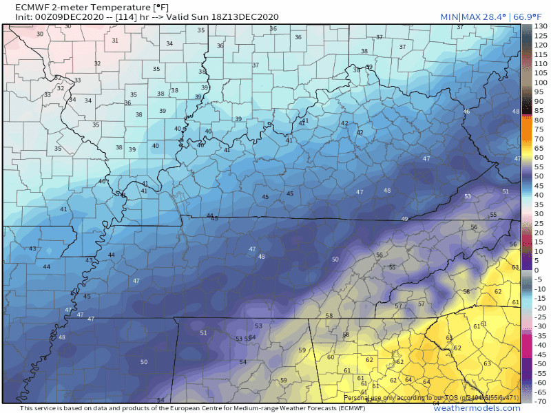
Another day, another high in the low 70s this afternoon. Above-average temps for much of the state rollover from yesterday into today, but don’t get too comfortable with these highs.
Average highs for this time of year are near the low 50s, so we’re sitting about 20° above average!
High temperatures both days will approach 70º. We will be much closer to our record high (74º, set in 1971) than we will be to the average for this time of year (50º). 2020 is going out with a bang, but then again, who’s surprised?
That’s roughly the difference between the average high temperatures for today and the high temps we’re expecting.
On average for today (December 9th), we’ll usually see high temps near 50°.
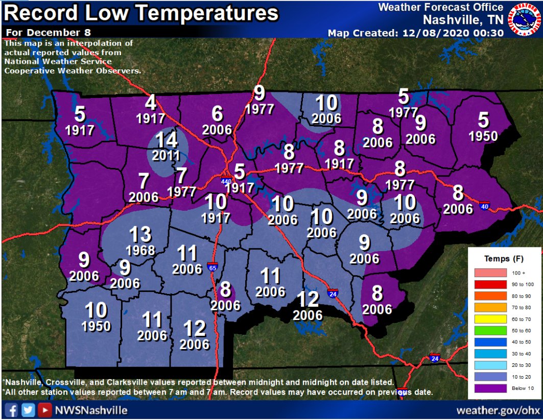
Many locations across Davidson/Williamson Counties dipped into the upper 20s this morning.
Trivia alert! In 1917 we set our record low, 5° in Nashville and 10° in Franklin.

No record lows in sight.
Clouds may clear this afternoon before it gets dark. It’ll be close. Look for mid/upper 40°s.
You must be logged in to post a comment.