
Happy Monday, Y’all!
It’s cloudy.
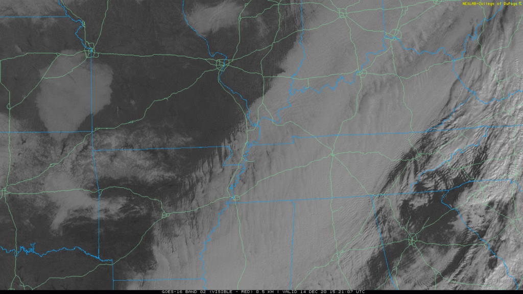
Sunshine is advancing behind a clearing line crossing the Ohio River around 10:30 AM. It may get here before dark.
Highs today will remain in the mid-40s but with that wind coming out of the northeast, real-feel temperatures will feel more like the 30s.
And we’re getting chillier from here on out. Wind chills will drop below 30° Tuesday morning, GFS model:
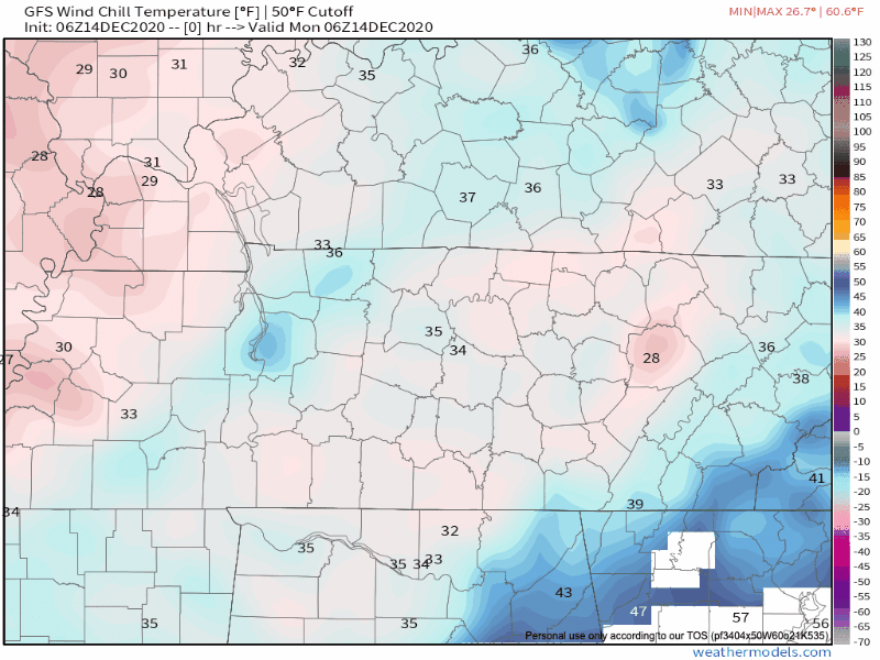
Temperatures will bottom out in the upper 20s . Some spots may hit 20°s for Davidson and Williamson County tonight.
Tuesday: A Little Sunshine, then Rain
Cool temps will stick around with us on Tuesday followed by partly cloudy skies for most of the day. Rain returns late Tuesday night into Wednesday.
Models think rain will hold off until closer to midnight Tuesday night, falling during pre-dawn hours Wednesday morning:
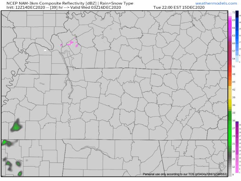
Rain should end before lunch Wednesday.
Snow expected north of us, but no wintry precipitation expected here.
Rainfall estimates less than a quarter of an inch on Wednesday.
Clearing Out, Showers Return Late Weekend.
Seasonal temperatures more into the weekend with more chilly overnight lows.
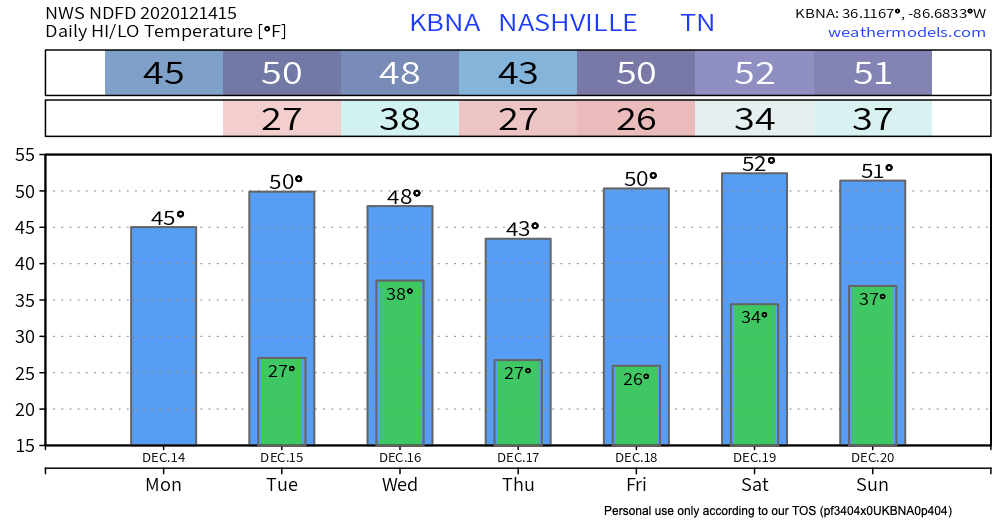
High pressure settles in on Thursday and Friday. Another frontal system will push through on Saturday bringing some chances of showers on Saturday and Sunday. Just chances, though, not sure anything will happen.
In the meantime…
As always, check back for updates to the forecast and be sure to follow @NashSevereWx on Twitter!
Categories: Forecast Blogs (Legacy)
You must be logged in to post a comment.