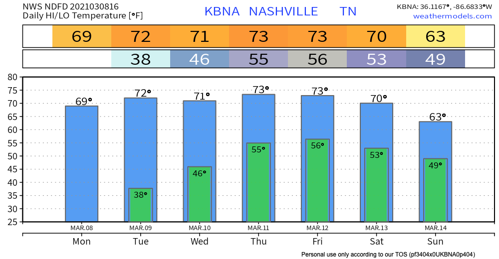

A Quiet Start to the Week
Enjoy the sunshine while it lasts…
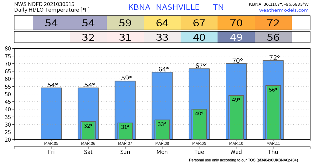
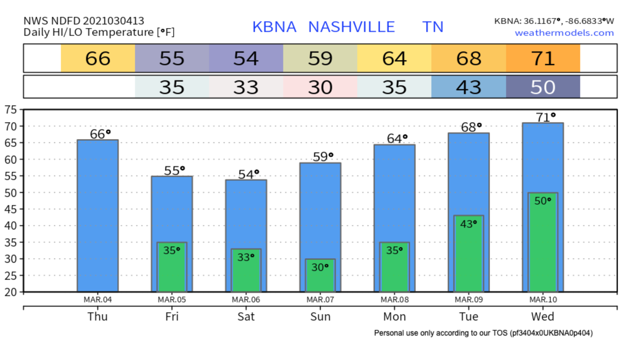
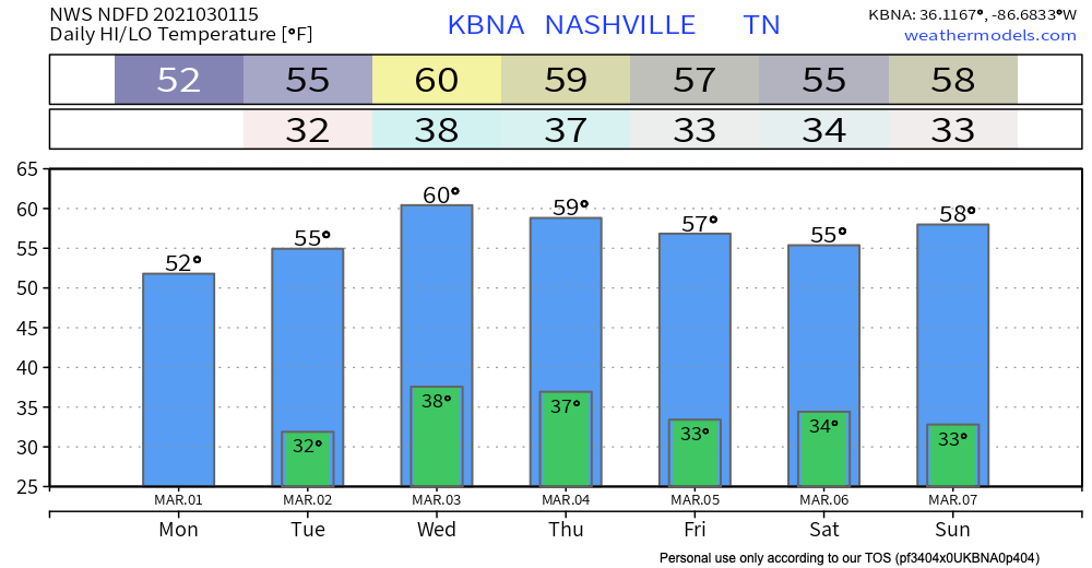
High pressure remains in store for us through most of the work week and spring-like temperatures will continue for Nashville sitting at or above 70 degrees for most of the week!

Enjoy the sunshine while it lasts…
High pressure remains in store for us through most of the work week and spring-like temperatures will continue for Nashville sitting at or above 70 degrees for most of the week!
There had been 5 straight days of rainfall. It would continue for another 6 days, setting the record in Nashville for the most consecutive days of rainfall.

This record was almost broken 23 years later. Beginning on March 7, 1978, Nashville saw 10 consecutive days of rainfall.
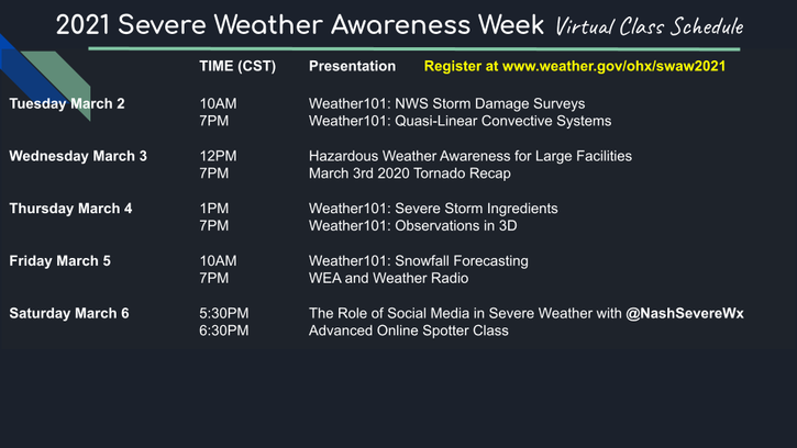
Register here for a discussion with the Nashville Severe Weather team tonight at 5:30pm hosted by the National Weather Service, Nashville as a part of severe weather awareness week.
CLICK HERE TO REGISTER
5º: the low temperature on this day in 1960
2.9 inches: snow that fell on this day in 2015
1º: the departure from normal (36º) of our low temperature this morning (37º)
80º: the high temperature on this day in 1910

Editor’s Note: On this day in 1917, Nashville received 7 1/2 inches of snow. Give yourself about 30 seconds to immerse yourself in that scene, then proceed with reading this awesome forecast.
Warming up nicely out of the 40’s today with lots of sunshine.

One year ago, many of us were beginning to understand the magnitude of what had happened. We had watched the horrific scene of a strong tornado moving through our city live on our screens hours before, but this wasn’t your average tornado video off YouTube. It was our city, our home, our friends, our neighbors.

The supercell appeared on radar a year ago tonight. By 12:33 AM Tuesday March 3, 2020, that [expletive deleted] was here. You know what happened.
I was behind screens watching radar, data, internal chat, typing furiously in surreal horror. Since then I’ve watched and read everything I could find about that tornado. I’ve been back through the radar data. I’ve reviewed the meteorology. I’ve reviewed every tweet I sent and every frame of video footage I could find. I’ve looked at, and walked in, stood in and looked up through, your damage. Many, many times. Trying to process it, to understand it, to be better. I’ve even written a retrospective.

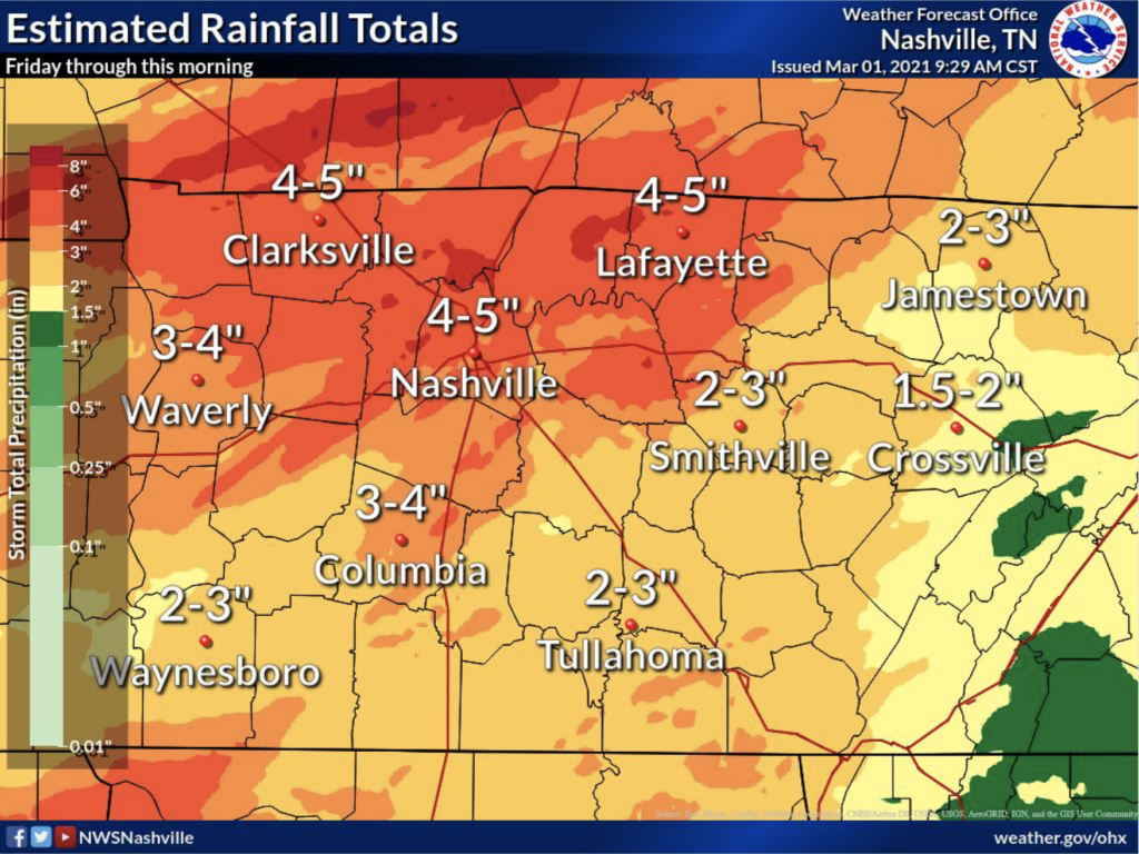
Nearly 4-5 inches of rainfall fell from last Friday to this morning in Nashville. Bit less in Will Co.
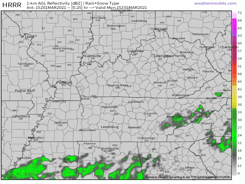
All rain today will be well south of us:
Rivers and creeks will take time to drain. Levels will slowly go down.
By the time the storm line got to us tonight, low level winds were running parallel to storm motion. Add an inversion aloft with a heavily saturated column. The trio wrecked our low-probability tornado chances.

Strong to severe storms are possible today and tonight.
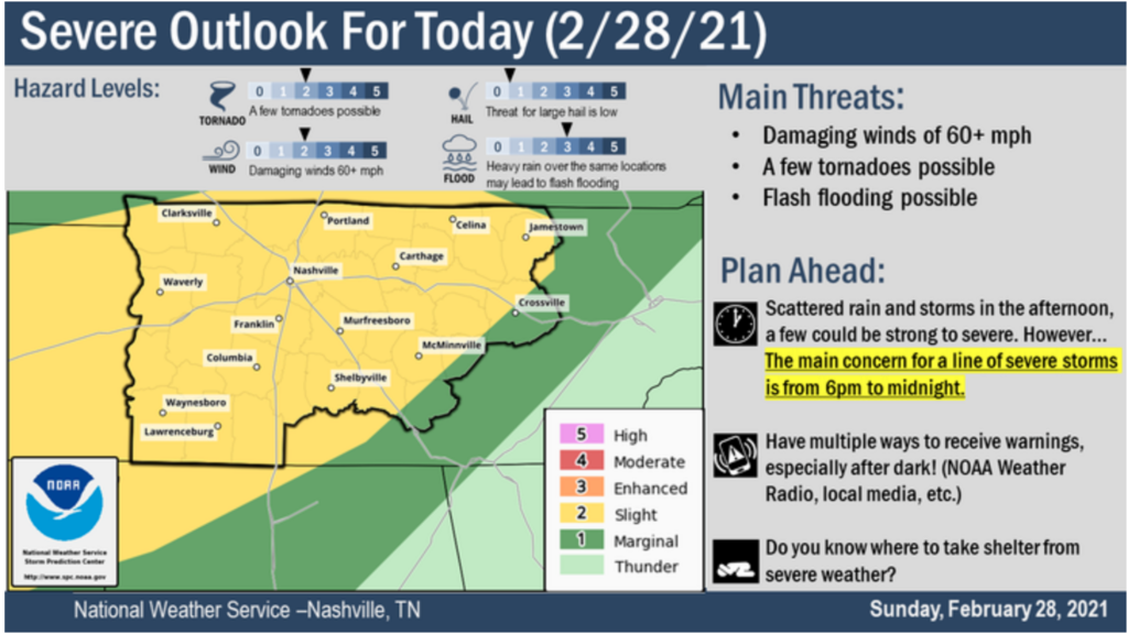
Tornadoes are possible in Middle Tennessee, including Davidson & Williamson Counties of course. That’s the area we cover.
Around lunchtime we see our atmosphere begin gathering tornadomaking ingredients.
You must be logged in to post a comment.