Heat Index > 100°, Wattery Returns Next Week, & About Microbursts

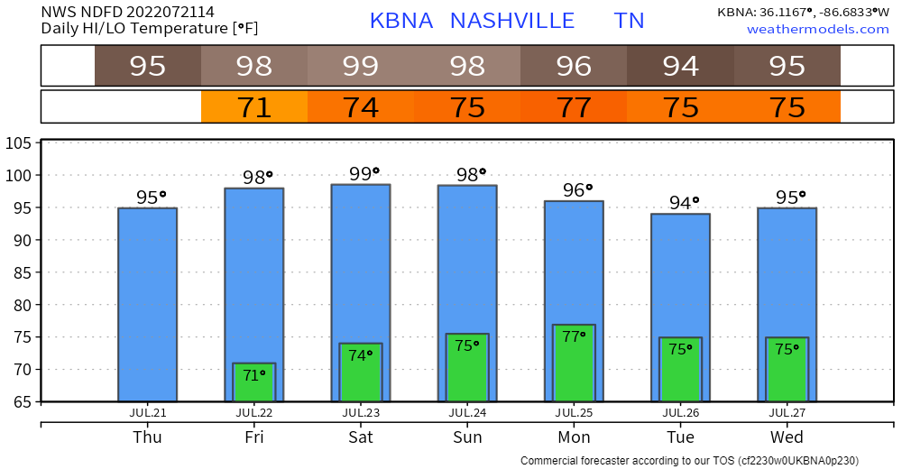
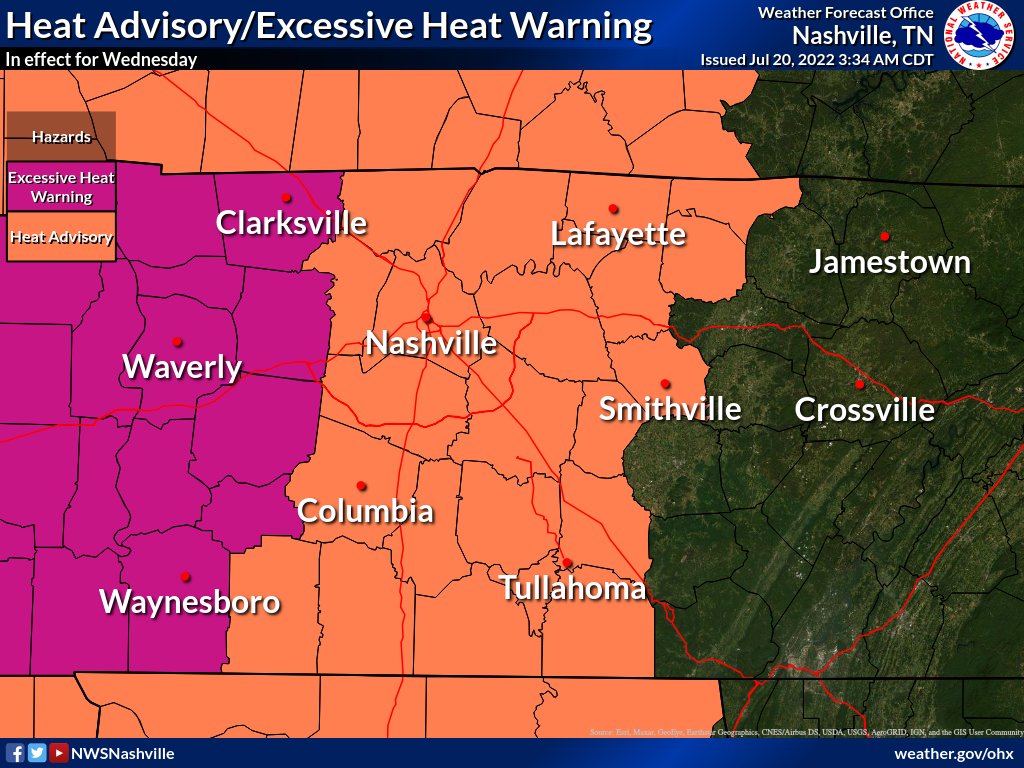
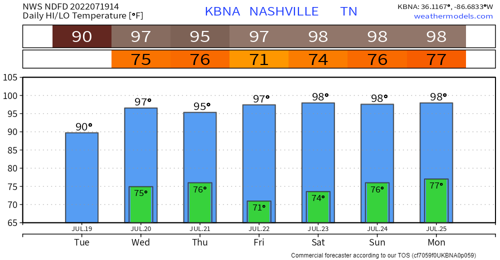
Uncomfortable dewpoints + upper 90°s temps will drive the heat index over 100° starting today, continuing at least through the weekend.

https://twitter.com/whittlz/status/1549815129851809793?s=20&t=c_u8CnIvwAMPvsILTP3bdw

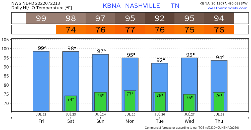
Temps “drop” Monday, but still very humid.

  • Temps just into the mid 90°s lol.
  • This reason: more clouds due to higher dewpoints should block the sun and interrupt the bake.
  • Rain and thunderstorms may develop late Monday afternoon, reducing forecast temps.

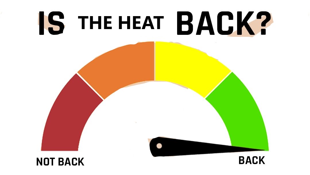
The Wattery returns next week. read more

Hot Weekend

Not much happening next several days other than it’s gonna be hot.

Dewpoints in the upper 60°s today through the weekend will be … uncomfortable. Combine that with near 100° temps and we’ll see the Heat Index approach 105°. At 105°+ NWS issues a Heat Advisory. read more

Heat Advisory + Low-Probability Of Damaging Winds Today

Some morning showers moved through this morning and left as quick as they came.

HRRR model keeps us quiet through the evening, but cannot totally rule out a few Wattery winners this afternoon. Upper 90’s + dewpoints in the low 70’s will give us a heat index in the 105°-109° range, reason for the Heat Advisory. Counties just to our west are under an Excessive Heat Warning. We’ll pass. If you have to be outside today, give your body some breaks. Heat exhaustion/stroke is no joke and it will creep up on you. read more

The Streak Ends (Probably), Heat Comes Right Back

Our streak of 28 consecutive days of reaching the 90’s looks to stop at 28. Our high temp looks to only make it to 85° today. It was a good run, some may say a great run. But all good, or bad things must come to an end. 28 days is the 5th longest streak on record. Not as cool of a streak as Cal Ripken Jr.’s or Joey Chestnut. The streak really hasn’t been cool at all, it’s just been hot. read more