

Uncomfortable dewpoints + upper 90°s temps will drive the heat index over 100° starting today, continuing at least through the weekend.
Temps “drop” Monday, but still very humid.
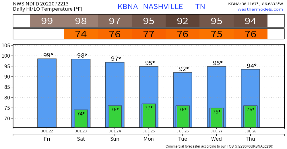
- Temps just into the mid 90°s lol.
- This reason: more clouds due to higher dewpoints should block the sun and interrupt the bake.
- Rain and thunderstorms may develop late Monday afternoon, reducing forecast temps.
The Wattery returns next week.
- Rain/Storms most likely Tuesday late afternoon/early evening, but they’re possible anytime next week.
- Models estimate a “cool front” (not that cool, really) will come by Thursday, increasing your number of Wattery tickets.
Wattery storms usually contain lightning, and often produce a microburst.
- Microbursts are what happens when a Wattery storm drops all its water, causing very strong straight line winds to spread out after the water hits the ground.
- It’s like a giant dropped water balloon.
- Here’s video of a microburst, below. Watch the balloon fall on the left, then the wind race off to the right once the balloon crashes.
- Microburst winds can be as fast as a low-end tornado, but without the upward motion of a tornado. Microburst winds toss trampolines, destroy fences, damage sheds, break windows, etc. They’re legit.
See you on the Tweeter @NashSevereWx.
Quick References:
Weather changes constantly.
Follow @NashSevereWx on Twitter for any changes to this forecast.
Live coverage during tornado and severe thunderstorm warnings.

Look good.
Support the mission.

We are 100% community supported. No ads. No subscription fees. Keep it free for everyone.


Categories: Forecast Blogs (Legacy)
You must be logged in to post a comment.