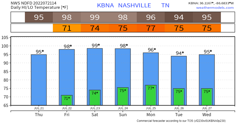
Not much happening next several days other than it’s gonna be hot.

Dewpoints in the upper 60°s today through the weekend will be … uncomfortable. Combine that with near 100° temps and we’ll see the Heat Index approach 105°. At 105°+ NWS issues a Heat Advisory.
For severe storm potential today go south, to get it Saturday, go north.

Or just stay here this weekend and bake.
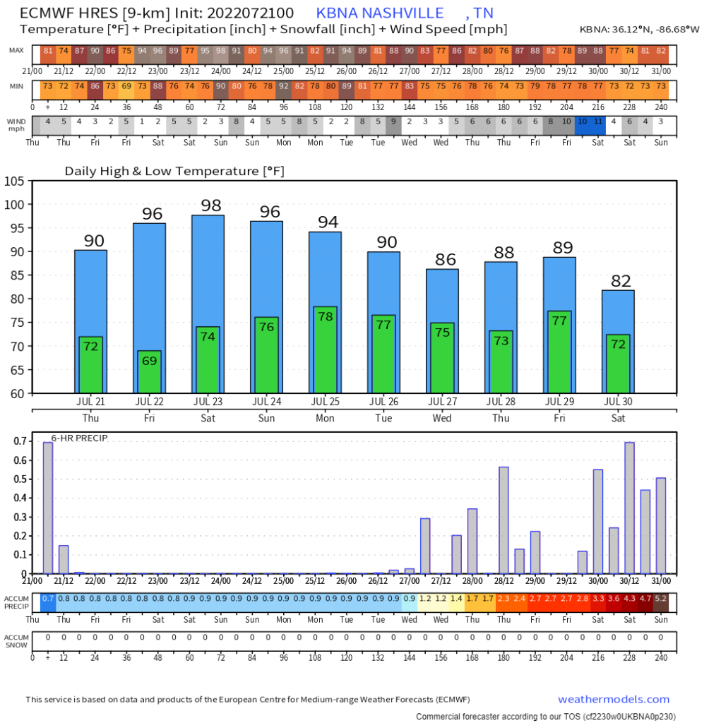
We should stay dry until Rain/Storms break off and scatter in here Monday late afternoon when humidity will get back up, and the Wattery will resume. Next week looks pretty active with several opportunities for Wattery-style afternoon storms for some, hot/dry for others.
Euro data suggests the active Wattery next week should at least take the edge of the temps, and will likely break any ideas of a new streak of consecutive 90° days.

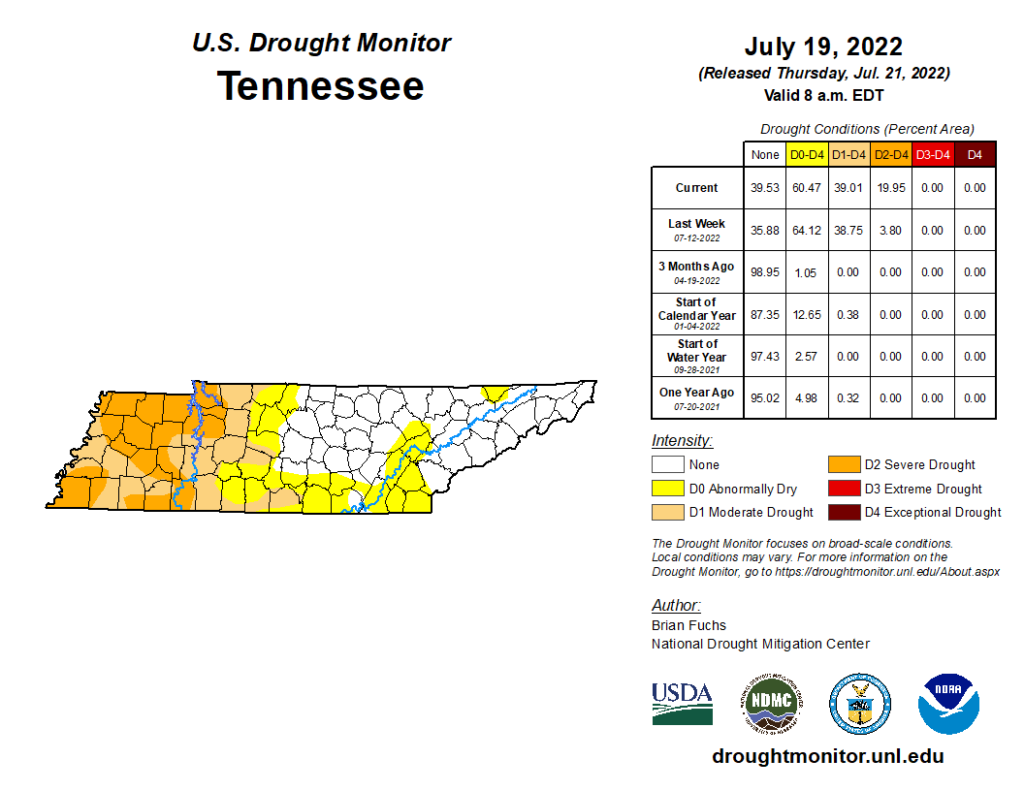
Through Tuesday July 19 most of us remained “abnormally dry” as seen below in the latest drought monitor (published this morning).

Quick References:
Weather changes constantly.
Follow @NashSevereWx on Twitter for any changes to this forecast.
We are 100% community supported. No ads. No subscription fees. Keep it free for everyone.
Categories: Forecast Blogs (Legacy)


You must be logged in to post a comment.