

Dry air is prohibiting the rain from Kentucky from moving into our area. Would not be surprised if a shower squeaked by, but won’t be anything of major consequence.
Latest HRRR model (below) runs think the rain/storms hold off until after a Nashville SC win. But models aren’t always right. Prepare and plan for the unexpected.
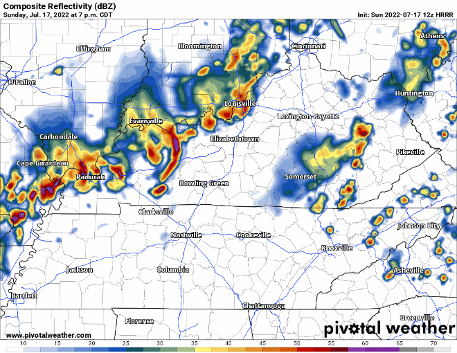
Looks like you may have a wet drive home, but majority of the rain/storms looks to hold off until around midnight.
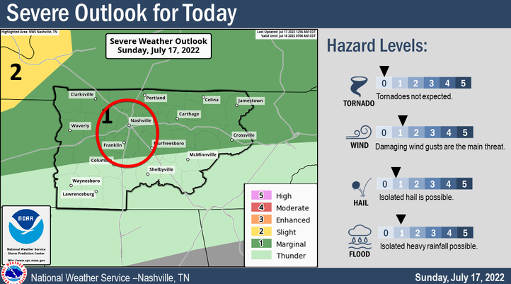
The Storm Prediction Center thinks one or two of the overnight storms could go rogue and have some damaging straight-line wind and hail. Very low probability for both. There are no concerns for tornadoes. On/off rain should last throughout the night, which may call for a Dense Dog Advisory. Prepare for a possible +1 in your sleeping arrangements.
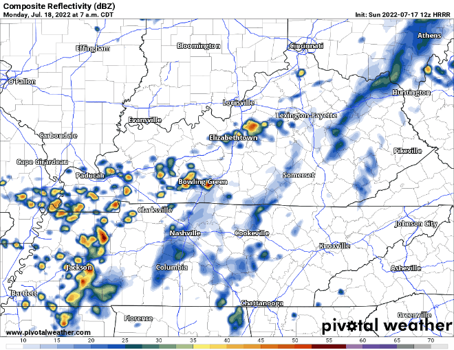
HRRR model (above) thinks activity picks back up Monday morning, with more on/off showers/lightningstorms, clearing out around dinner. No severe weather is expected with these, but wouldn’t be shocked if one or two brought some gusty winds with it.
Looks like we will manage to hit 90° today, making it the 28th consecutive day of seeing that number, tying the 5th longest streak. Tomorrow should be the first day in nearly a month where we fail to reach 90°, thanks to the rain and cloud cover.
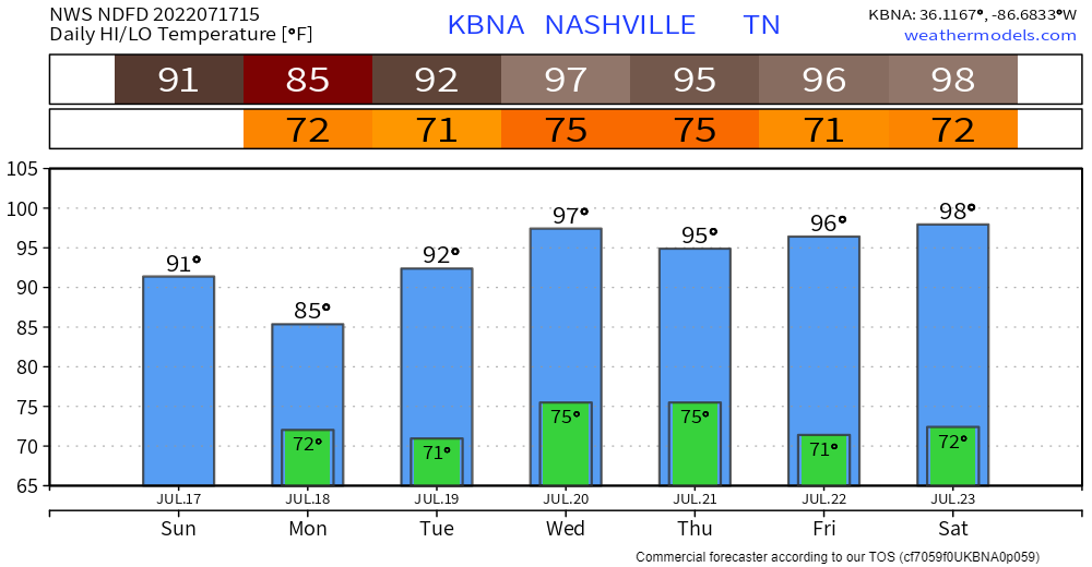
If you miss the 90’s tomorrow, don’t worry, they come back on Tuesday and stick around for at least the rest of the week. Wednesday and Thursday dewpoints will be hanging around 70°, so heat index will shoot into the 100-105 range. No thank you.
Quick References:
Weather changes constantly.
Follow @NashSevereWx on Twitter for any changes to this forecast.
Live coverage during tornado and severe thunderstorm warnings.

Look good.
Support the mission.

We are 100% community supported. No ads. No subscription fees. Keep it free for everyone.


Categories: Forecast Blogs (Legacy)
You must be logged in to post a comment.