
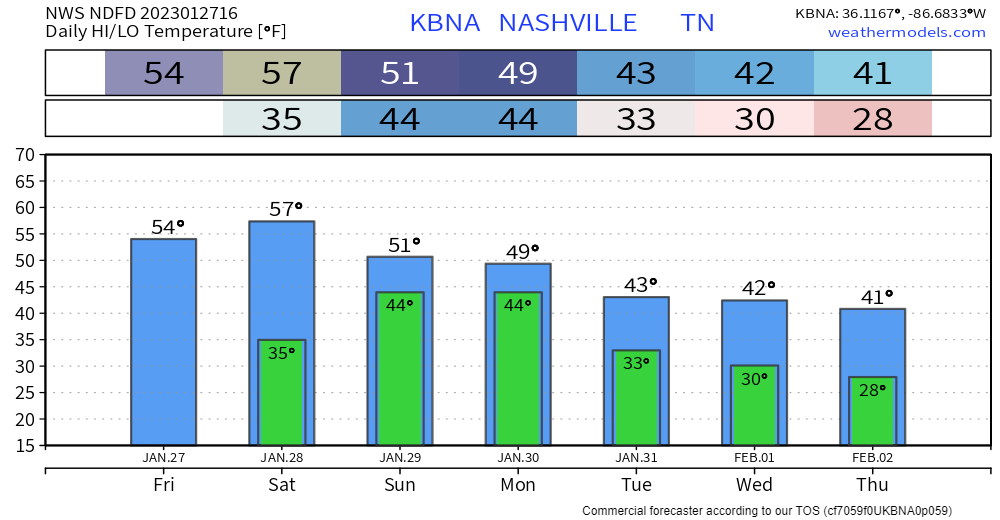
Clouds cleared out from this morning, leaving us with a cool, but at least sunny day.
The majority of Saturday will be a repeat of today.
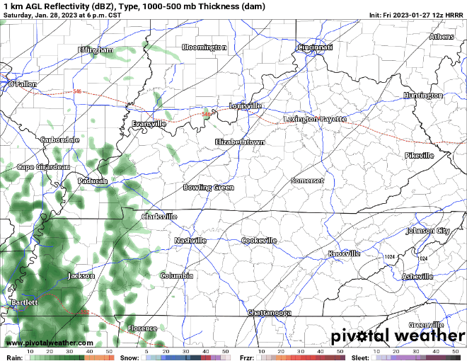
HRRR model (above) thinks rain disrupts our dry weekend Saturday night sometime after dark. Just rain, no severe weather or winter weather. Models think rain ends Sunday midday.
Next week looks confusing.
A frontal system will be hanging around us for…days.
The positioning of this is super important, we don’t know where it’ll end up. Neither do models right now. They keep going back and forth. It’s that time of the year where a few degrees can make a lot of difference.
Yes, frozen precipitation is possible, but not by any means guaranteed. This could very easily turn out to be all rain. There could also be some frozen stuff mixed in. Hopefully by Sunday the models can get into more agreement?
Models are in agreement enough for the Weather Prediction Center to outlook us with a 5-15% chance of flash flooding on Tuesday. Rainfall/precipitation totals for next week look to be 1-3″, wet week ahead. No major flooding concerns.
Quick References:
Weather changes constantly.
Follow @NashSevereWx on Twitter for any changes to this forecast.
Live coverage during tornado and severe thunderstorm warnings.

Look good.
Support the mission.

We are 100% community supported. No ads. No subscription fees. Keep it free for everyone.


Categories: Forecast Blogs (Legacy)
You must be logged in to post a comment.