
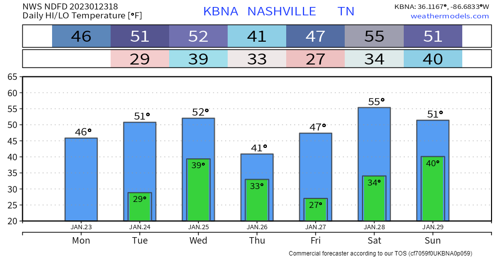
Decent day today, clouds from earlier are moving out. Temperatures are about where they ought to be for this time of year.
The majority of tomorrow will be similar to today, until some rain + non-thunderstorm wind moves in tomorrow evening.
Winds will be howling starting tomorrow evening, lasting until midday Wednesday. A Wind Advisory will be in effect from 9pm Tuesday – 3pm Wednesday. Sustained winds of 20-30mph are likely, with gusts up to 55mph possible. These is borderline High Wind Warning criteria, not your typical Wind Advisory. Secure outdoor furniture, God’s frisbees, etc.
We’re caught in between a severe risk on the Gulf coast and snow up to our north. We are left with just some plain ole’ rain.
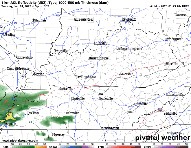
HRRR model (above) thinks rain starts around 6-8PM tomorrow evening, continuing on and off until it moves out Wednesday morning. Rainfall totals look be to around one inch, no flooding or severe concerns.
Wednesday night/Thursday we may get enough wrap around moisture to see some flurries. These will be a “oh wow that looks lovely falling” kind of thing until it hits the ground and melts. Temperatures look to stay in the mid to upper 30’s, sorry snow fans.
Friday and Saturday look dry, next rain chance looks like Sunday. Too far out to speculate on timing.
Quick References:
Weather changes constantly.
Follow @NashSevereWx on Twitter for any changes to this forecast.
Live coverage during tornado and severe thunderstorm warnings.

Look good.
Support the mission.

We are 100% community supported. No ads. No subscription fees. Keep it free for everyone.


Categories: Forecast Blogs (Legacy)
You must be logged in to post a comment.