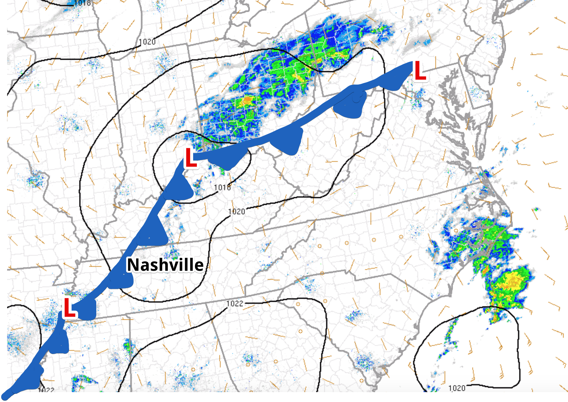
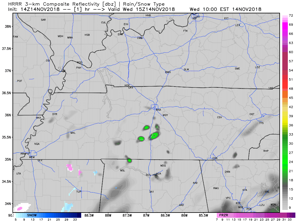
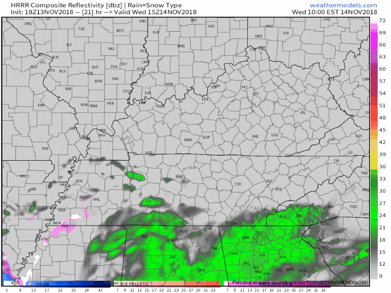
Round 1: Rain Tonight; Round 2: Rain and Some No Stick Snow Saturday

ROUND 1: Rain Tonight

Around 2 PM to 3 PM this afternoon, rain should be pushing into Williamson County and heading north into Nashville.

Rain should last until around midnight, then switch off.

This timing is from the HRRR model: read more

Nice Today, Rain Chances Increase Friday, Frozen Precip Saturday?

Today

A dome of high pressure sitting over our location is going to keep most clouds and precipitation at bay for another day. As the next weathermaker begins to organize and move towards the southeast, clouds will begin to increase. read more

Cold Mornings Ahead, Cold Rain (Snow?) Late Friday/Early Saturday

Today

Good morning Nashville! The cold front arrived last night, dropping our temperatures into the lower 40s. Expecting a high of 52º with light winds out of the northwest at 10-15 mph.

Thursday and Friday

Looking at temperatures near freezing overnight and early Thursday morning, so be sure to cover any vulnerable plants and bring your pets inside! read more

Storms Heading Out, Cold Moving In

The Severe Thunderstorm Watch has been cancelled for Davidson County and Williamson County.

Storms are moving out!

There is still some rain around. The HRRR model has all of the rain moving out of our area at about 2 AM. After that, we are seeing that cold, dry air move in. read more

Severe Thunderstorm Watch In Effect Until 0100AM

Stay Tuned at: @NashSevereWX

Significant Threat of Damaging Straight-Line Winds, Hail Threat, Smaller Tornado Threat, ETA 8-10 PM

Mesoscale Discussion In Effect

Dewpoints are already over 60° in Middle Tennessee. Temps are rising above 70°. A strong cold front sits out west with its eye on us tonight. The coming collision of cold, dry air slamming into our warm, moist airmass will happen overhead tonight. read more

Scattered Showers Today, Squall Line with Strong/Severe Storms Tuesday Night

Today

It may rain this afternoon as a front moves back and forth over Middle Tennessee today. We may see a few showers pass by (as the above model illustrates), but Williamson and Davidson Counties should be rain-free by sunset. High today: 63º. Low tomorrow morning: 57º. read more

Rainy Monday; Warm-Windy Tuesday; Strong/Severe Storms Tuesday Night; Frost Early Thursday

Clouds will gather tonight, forming light rain in the morning. Shortly before lunch, some of the rain may be heavy, at least that’s according to the HRRR model:

A few more showers are possible through the day Monday. It may be enough rain to rain out Monday night games. That will depend on the field. read more

Rainy Morning, Clouds & Off/On Rain Thru Monday, Storms Tuesday Night, & a Predictable Saturday

As I write this, light rain has arrived.

The HRRR model thinks rain will leave before lunch, leaving clouds behind for the rest of the day, with a chance of a passing shower or two by late afternoon:

read more

Warm with Increasing Clouds; Dodging Easter Sunday Rain

Nice Saturday, Then Clouds; Rain Late Tonight

Today, skies over Davidson and Williamson counties will become increasingly cloudy as another cold front approaches.

High pressure moved into our area yesterday, breaking up the clouds, but now that is moving on to the east. The advancing clouds are west of us, as seen via satellite thru 11 AM: read more