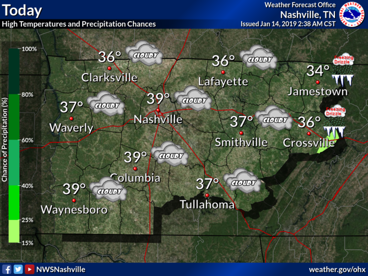
Today is going to be one of those days where you look outside and think it’s going to snow. Except it’s not. Those overcast skies are not going to budge at all today, and temperatures are staying put with the clouds.

Today is going to be one of those days where you look outside and think it’s going to snow. Except it’s not. Those overcast skies are not going to budge at all today, and temperatures are staying put with the clouds.
I don’t know if it’s going to snow this winter. Or if it does, when it will. Or how much we will get.
(Neither does your 10-45 day forecast on some weather apps, by the way. For more on that see these football analogy tweets, or just keep reading).
A very light shower is possible today, but probably not. More likely mostly cloudy, temps in the upper 40°s. Those high temps are normal for January 13.
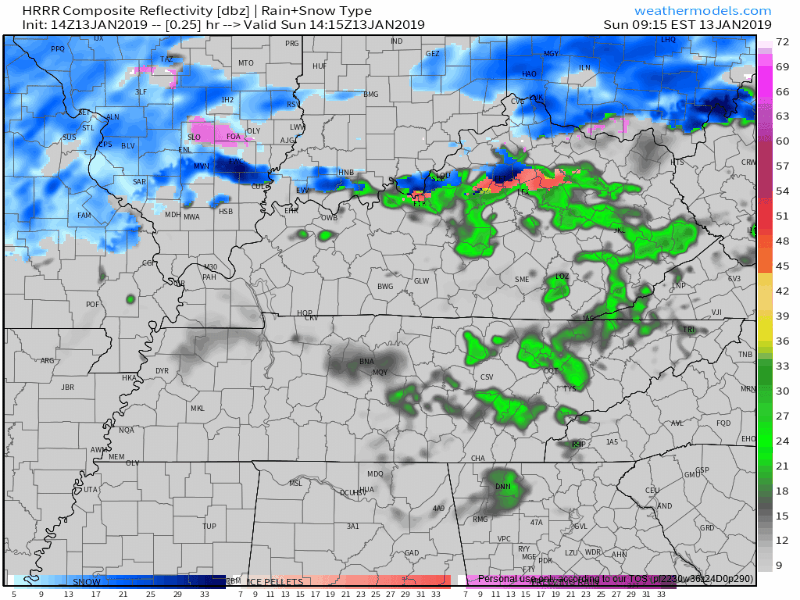
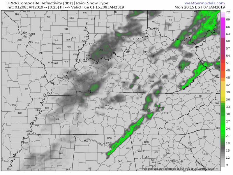
HRRR model illustrates showers wandering across Middle Tennessee:
Another weak line of showers is located to the west of Nashville, which will push east overnight.
Models do show a few rain showers possible after sunrise, with most rain east of Nashville by noon. All rain chances should be gone by late afternoon.

Clouds will be on the increase today in advance of our next weather maker that will begin to move in this evening as an upper level low begins to pass to our north. Expect our afternoon highs to reach the mid-40s as the cloud deck advances from west to east.
High-pressure is working its way into Williamson and Davidson Counties this afternoon. That is evident by the 10-15 mph winds and the clearing skies we are seeing. Afternoon high temperatures will reach the upper 40s. All in all, the only weather impact on your day will the wind, which could gust to 30 mph.

Low level clouds hanging around this morning will be present for much of the day, with some breaks allowing sunshine. The cold front arriving here this afternoon is, this morning, located in the midwest and is moving southeast. Before it arrives, we could see very light drizzle.
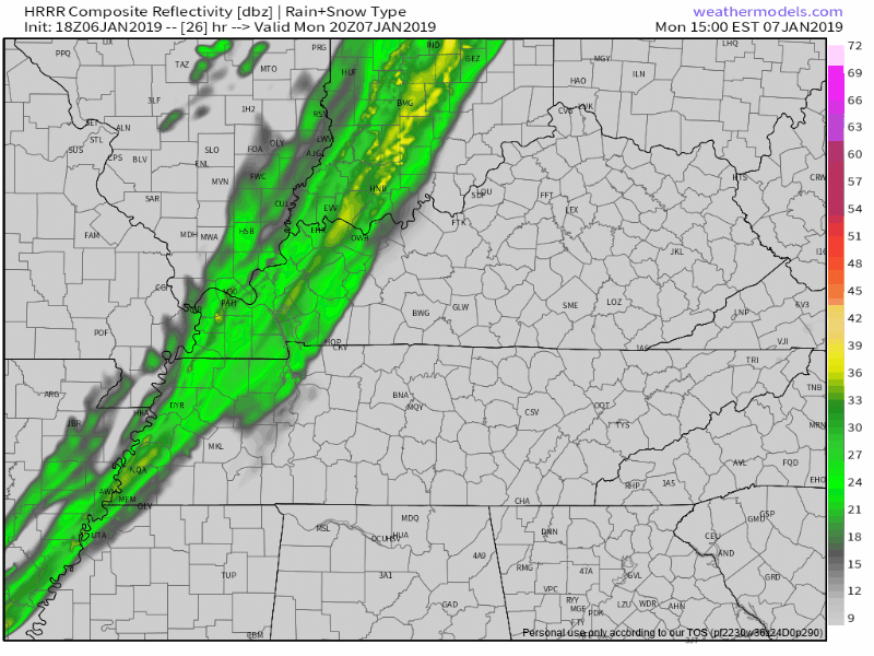
A few sprinkles are hanging around just east of Nashville at the 9 PM update. More light showers should develop overnight. Still no thunder expected with these.
HRRR has these light rain showers hanging overhead during the morning commute, but they’ll be on the way out by late morning and gone by afternoon. Cold front and dry air arrives tomorrow afternoon.
Rain should be here Monday.
HRRR model:
NAM3 model:
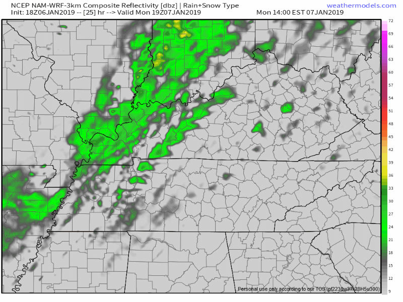
When: Although a few morning showers possible, the main rain event begins around 3-4 PM and should end a few hours later. ETA may need adjustment tomorrow morning, but models today have been consistent with these ETAs and ETDs.
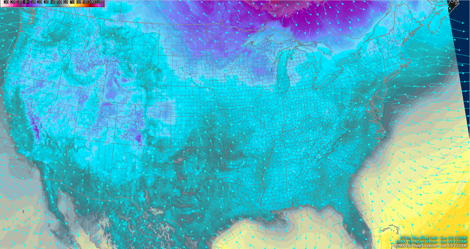
Five years ago today, January 6, 2014, 4° was the low and 20° was the high.
Today, most of the US woke up above freezing. Where were the below-freezing temps? See the purple, below: the mountains out west and the upper Midwest.
You must be logged in to post a comment.