
Five years ago today, January 6, 2014, 4° was the low and 20° was the high.
Today, most of the US woke up above freezing. Where were the below-freezing temps? See the purple, below: the mountains out west and the upper Midwest.
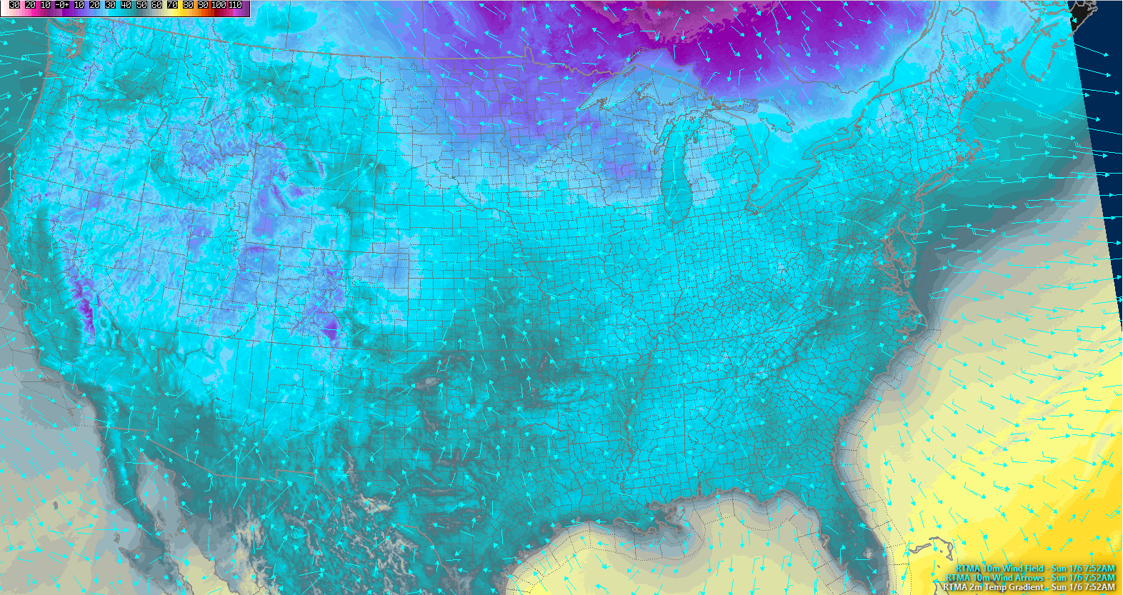
We will hit 64° this afternoon. That’s 17° above normal (46°). Sunshine first half of today, with a few clouds filing in later today.
A few sprinkles may ride in with those clouds later this afternoon, but the models right now think those showers will dry out before arriving here.
Next Rain: Monday
It’ll be very light, if anything at all.
ETA: early/mid afternoon.
Amounts: light, lasting for a few hours.
ETD: early/mid evening.
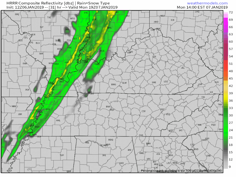
The HRRR model thinks rain arrives at 3 PM, gone by 5 PM:
Here’s the NAM3 model, which predicts rain from 3 PM until 6 PM.
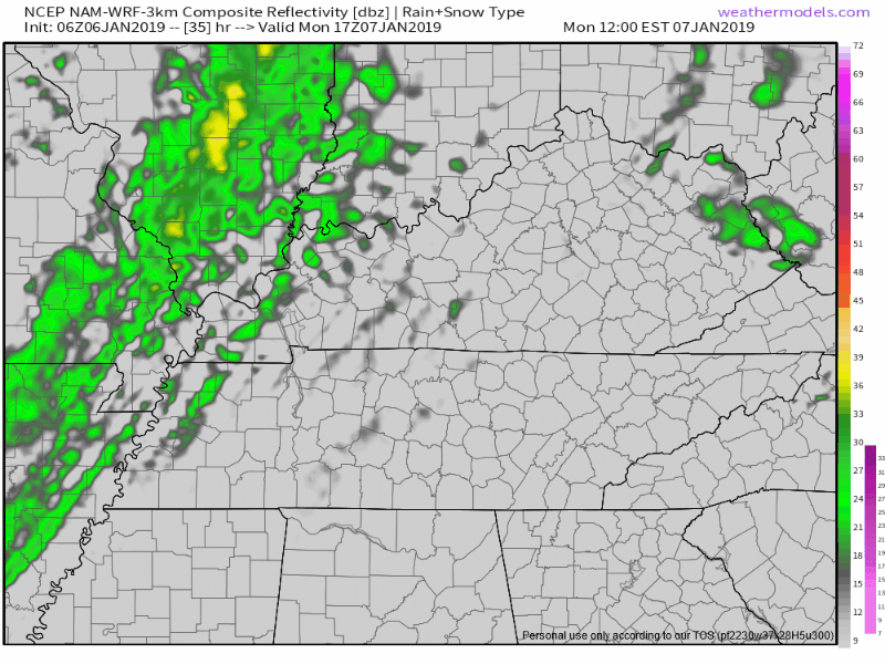
Again, this is light rain. Shouldn’t rain much/anything out. No storms. Check back tonight and tomorrow for adjustments to estimated arrival and departure times.
Mid-Week Gradual Cool Down
High temps in the 60°s Monday and Tuesday. By Wednesday, seasonal/cooler temps arrive:
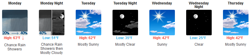
Rest of the work/school week looks cool and dry.
Next potential rain event is Saturday. GFS and Euro models (as usual) have wildly different ideas about whether it’ll even rain. Add to that low pre-sunrise temps around freezing, and really, anything is possible.

Categories: Forecast Blogs (Legacy)
You must be logged in to post a comment.