
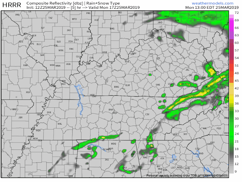
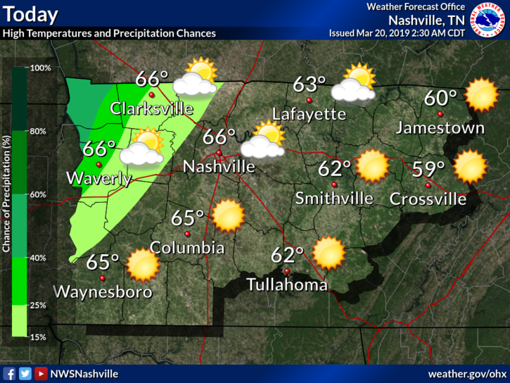
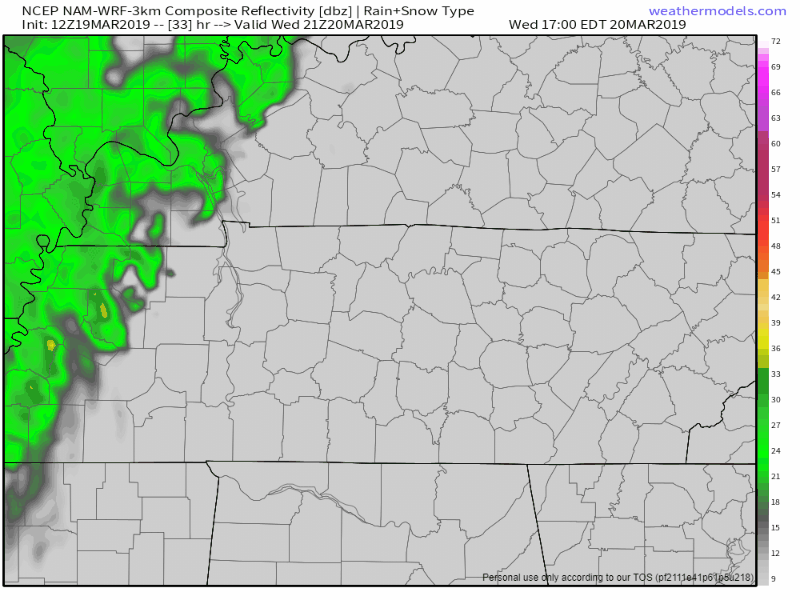
Showers Almost Done
Those pesky showers from this morning are almost done. The HRRR model suggests a few more may be possible just before sunset in Williamson and Davidson Counties.
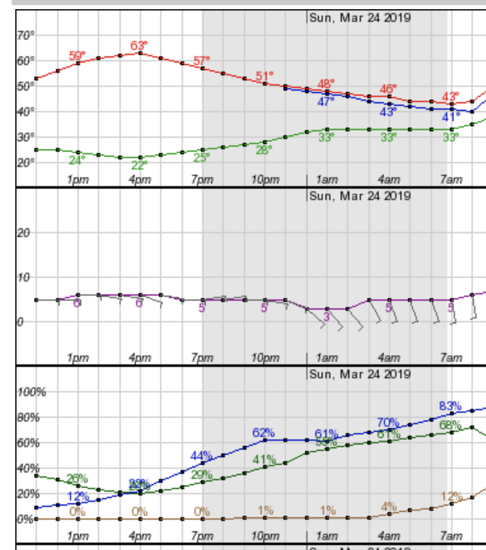
Aside from the rain, expect temperatures this afternoon to make it into the mid to upper 60s across the area, under mostly cloudy skies. Winds will be noticeable today, between 10-15 mph, with gusts to 20. Winds will turn and come out of the north tonight, dropping tonight’s temps quickly through the 50°s and tomorrow morning’s temperatures into the 30°s. Low tomorrow morning (yeah, I know the “app” strip below says Tuesday night) will be 33°.


You must be logged in to post a comment.