
Another day of beautiful, Spring-like Winter-time weather is here! Afternoon temps will warm into the upper 50°s.
With very few clouds and a light breeze, it’s going to be a pleasant day to be outdoors!
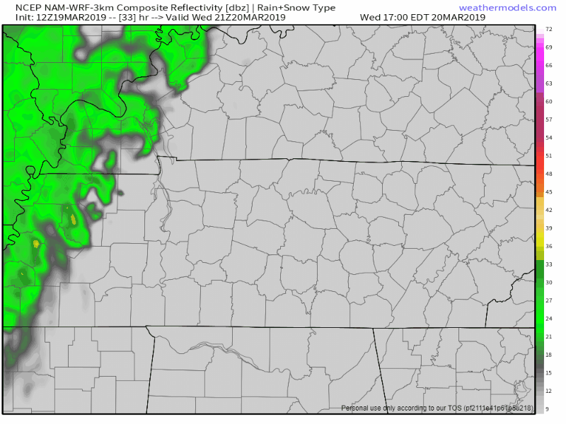
Clouds and Rain on the First Day of Spring (Wednesday)
We’ll start Wednesday with scattered clouds. Throughout the day, temps will warm to the low 60°s as clouds continue to invade, becoming overcast by sunset.
Light rain will spread over us from west to east, beginning late Wednesday evening, continuing into Thursday morning. The NAM3 model below shows what we should see through midnight Wednesday.
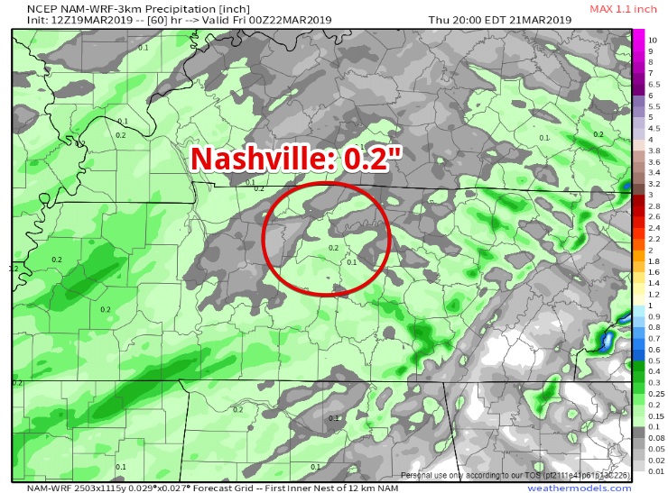
These showers will be light, with most of us seeing 0.2″ or less of rain. Rain totals should have very little impact on rivers, which will continue to recede.
Rain Ends Thursday Morning
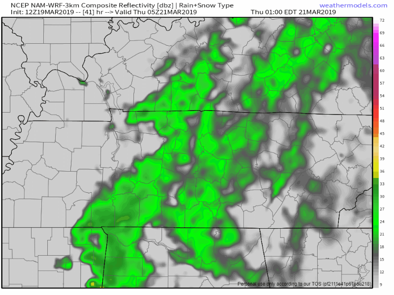
Light showers should come to an end late Thursday morning. A few drizzles are possible through the early afternoon before clouds begin breaking up late afternoon/early evening. The NAM3 model below picks back up at midnight Wednesday showing the remainder of Thursday.
Dry Friday and Saturday
Get ready for a beautiful start to the weekend!

Friday and Saturday should be dry and warm! Temps in the mid/upper 60°s for both days.
We’re watching a possible weather-maker late Sunday/early Monday. We’re still a few days out from anything reliable, but it’s something to keep an eye on. Best guess is rain chances arrive Sunday night then continue into Monday. Some storms possible late Monday, but nothing of any concern right now. NWS-Nashville noted:
Current thinking is for about 1-1.5 inches of rain with this system, so it shouldn`t have too much impact on area rivers.
In the meantime, enjoy the late-week dry weather!

Categories: Forecast Blogs (Legacy)
You must be logged in to post a comment.