
Light Afternoon Rain
ETAs
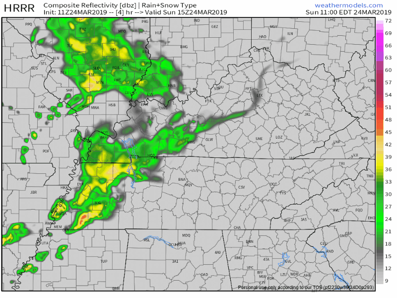
HRRR model thinks 1 PM to 2 PM, but it only lasts for an hour or so and is pretty light:
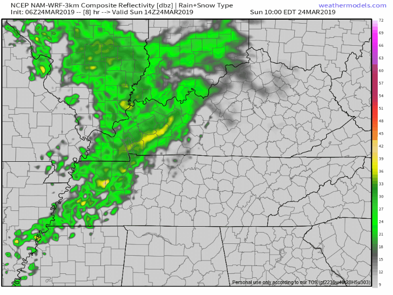
NAM3 model thinks ETA noon to 1 PM, lasting about an hour or so, maybe a little longer, still light:
How Much
I don’t think this is enough to rain out the Texas Rangers at Nashville Sounds game.
Lightning?
None expected.
Heavier Overnight-Monday Morning Rain/Storms (not severe)
A second wave of more solid precip and a few thunderstorms will develop late today and push through the midstate overnight tonight and into Monday. (NWS-Nashville)
ETAs
They’re fuzzy.
- For example, this is the 6z run of the HRRR model, which shows the time period beginning midnight, ending 1 PM Monday.
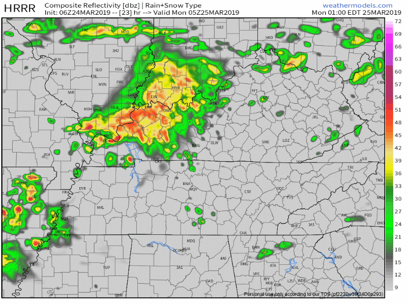
Notice overnight storms try to go north and south of us but we still get some, then storms redevelop and arrive here during lunch Monday.
- The NAM3 model disagrees.
It thinks the only storms we’ll get tomorrow are in the middle of the night, beginning around 2 AM, then nothing but a little Monday morning light rain after that:
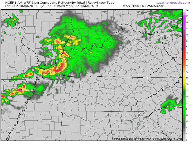
Pretty big difference here. One with heavy rain and storms during lunch Monday. Another saying nah.
- The Euro model has a third idea. It’s got some light rain in the middle of the night. Heavier showers mid-morning and again mid-afternoon.
It’s the Information Age. Not the Conclusions Age.
For now I have a nickel on some wee-hour storms, which may wake you up.
I’m hoping these models will sort this out tonight. I’ll check back in then for some answers on timing.
How Much/How Bad
Storms are possible in the middle of the night (NAM3, HRRR), the morning (HRRR, Euro), and even the afternoon (Euro). Bad storms? Meh. None expected “meteorologically” severe (58+MPH winds, large hail, tornado), although if lightning hits close by it’ll feel real-person severe. Rain will be briefly heavy for the chosen.
Storms should be brief and rain totals under a half inch.
Rain totals may cause indoor recess and/or cancel rolly ball sports fields Monday night. All depends on your patch of grass/dirt.

Rest of the Week
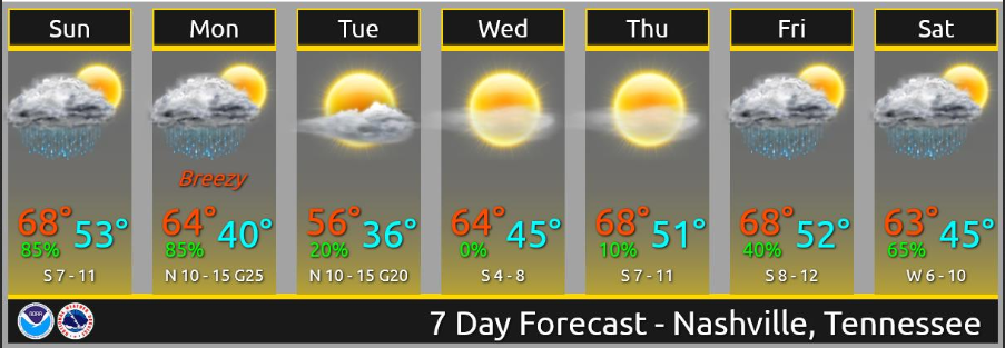
Precip might hold off until Friday night, keeping Friday dry and breezy. Still some disagreement with the details of next weekend`s system, but precip is expected to enter the forecast by Saturday morning and with a warm airmass in place, some thunder will be possible as well. (NWS-Nashville)
For fun – model accuracy at this range is poor so check back you know, closer to Saturday – I looked at the Euro model for next weekend. Saturday looks washout-level wet and maybe stormy, but not severe due to marginal instability/CAPE. Behind that, very cold air. Doesn’t look like we’re done freezing.

Categories: Forecast Blogs (Legacy)
You must be logged in to post a comment.