Another Editor’s Note Rant: Unexpected Snow?
Heard alot about “unexpected snow” today. Kinda. “Unexpected” is a fair word.
But, you should not have been unprepared, or shocked, it happened. This morning’s snow was in the range of possibility.

Another Editor’s Note Rant: Unexpected Snow?
Heard alot about “unexpected snow” today. Kinda. “Unexpected” is a fair word.
But, you should not have been unprepared, or shocked, it happened. This morning’s snow was in the range of possibility.

Editor’s Note Rant: Thank you for reading the blog.
I do not understand weather providers which speak in terms of accuracy, as if trying the hardest, or being the smartest, or looking at this data vs that data can make a forecast more or less “accurate.” We’re all working very hard at this. Everyone is smart. We are all looking at the same data. Everyone wants to get it “right.”
Windy today. High 62°.
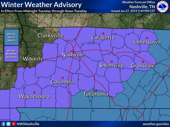
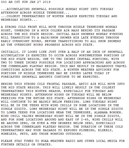
Yesterday afternoon, a Winter Weather Advisory was issued for tonight/early Tuesday morning. Winter Weather Advisories require snowfall of at least 1″.
Last night, most models trended toward less snow. NAM3, HRRR, even the GFS joined the “less snow” trend advertised by the Euro model all weekend.
It’ll be almost 60° Monday afternoon. Windy.
Monday night, warm southwest winds will turn west, then northwest, blowing in arctic air.
And with that, precip. More about this below.
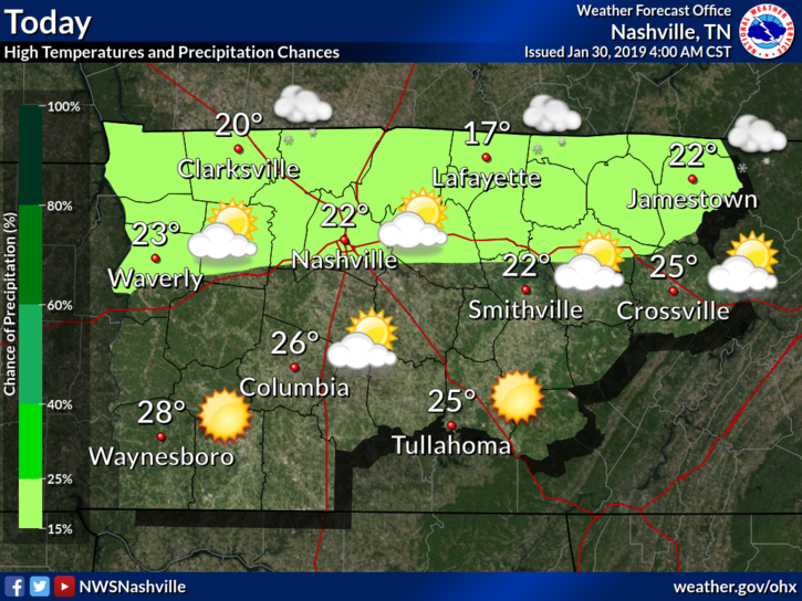
Monday night after midnight, temps will nosedive below freezing, falling to 22° around sunrise. Anything wet will freeze in the early hours of Tuesday morning.
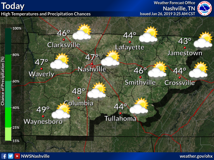
Pretty great today (high 49°) and Monday (high 58°!).
Rest of the week, not so much.
Tuesday’s snow potential + exceptionally cold temps prompted NWS-Nashville to issue this Special Weather Statement for all of Middle Tennessee:
Surface high pressure has settled over our state today bringing mostly clear skies this morning, which will become partly cloudy later today.
With few clouds in place and high pressure influence, we’ll warm into the low 40°s this afternoon.
You’re here to read about Tuesday so let’s speed through the weekend. (All quotes from NWS-Nashville).
BNA reported 36° after lunch. We won’t get much/any warmer today.
Back below freezing tonight and overnight with wind chills in the 20°s.
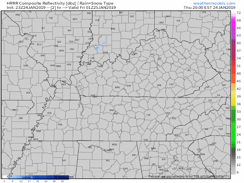
At 6PM we’re sitting at 38° and looking dry. Clouds cleared out early but they’ll soon return as a cold front approaches. There was mention of very light snow flurries earlier, but now models don’t seem to be picking them up. We might be lacking the moisture needed to get snowflakes to form.
No snow tonight.
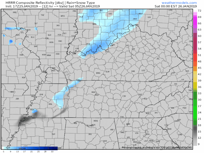
The precip moved east, faster than all models thought.
Foiled again by cold air chasing the precip.
At 7:25 PM, BNA reported 43°. At 8:05 PM, it’s 39°. And falling.
Rainwater continues running off the roads. Runoff means less water to freeze.
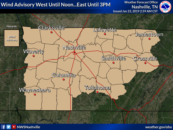
TIMING: Until 3 PM CST today
WINDS: Breezy south winds 20 to 25 mph with gusts around 40 mph.
IMPACTS: Gusty winds can cause tree and branch damage. Loose outdoor objects may be blown around. High profile vehicles, especially those traveling on east-west roadways, may experience travel difficulties.
You must be logged in to post a comment.