
You’re here to read about Tuesday so let’s speed through the weekend. (All quotes from NWS-Nashville).
BNA reported 36° after lunch. We won’t get much/any warmer today.
Back below freezing tonight and overnight with wind chills in the 20°s.
Flurries Tonight?
Clouds look to move in later today with the upper shortwave aloft, and may allow for some flurries overnight into Saturday morning. Kept mention out for now but may add to the forecast package for the afternoon.
HRRR shows a quick blast of flurries around 1 AM.
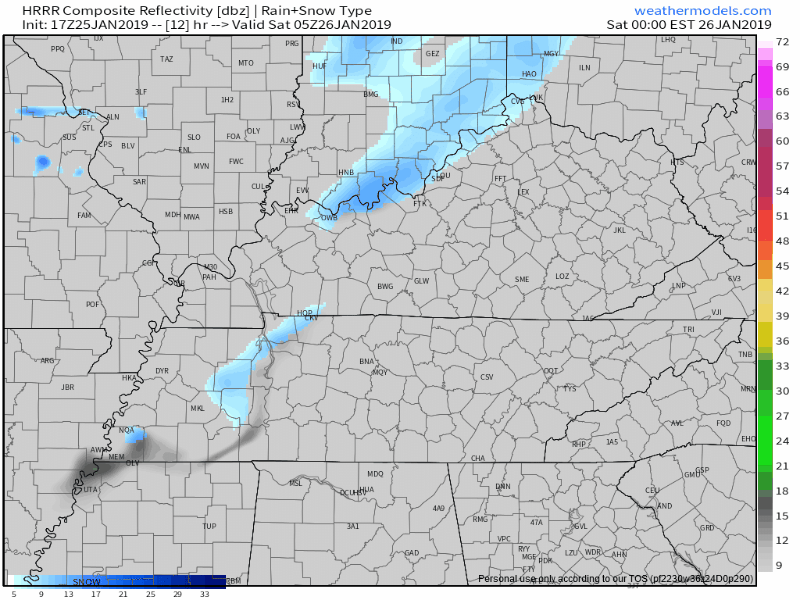
No accumulation or impact. It’s not even (currently) in the freecast package from NWS.
Sunday Morning Snow/Rain?
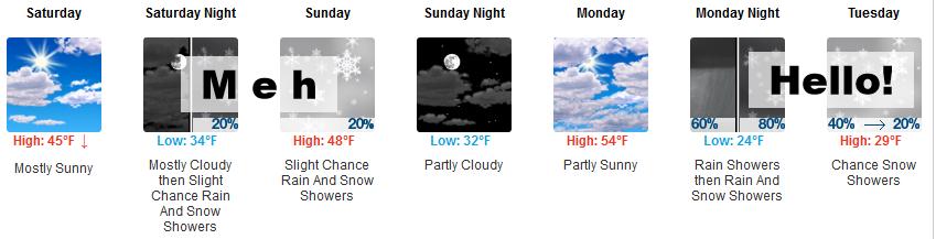
45° is Saturday’s high.
Late Saturday night another shortwave with low/no impact snow chances should pass mostly north of us. Sunday morning some precip may develop here.
The NAM3 model lays down precip along I-40 a few hours after sunrise, after temps emerge above freezing:
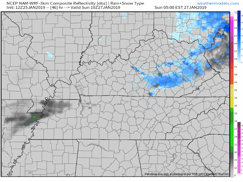
That’s rain, probably. Earlier arrival would mean a brief snowfall, but again, with temps expected over freezing Sunday morning, limited impacts are forecast. Unsure any of this will happen, though. The Euro doesn’t have any precip coming through here. Neither does GFS. Meh.
Tuesday Snow?
This morning I tweeted about the possibility of accumulating snow beginning Tuesday morning. A few lovely, once bitten, twice shy locals took to the Tweeter to @ us with “believe it when I see it” and poke fun at the usual snow disclaimers.
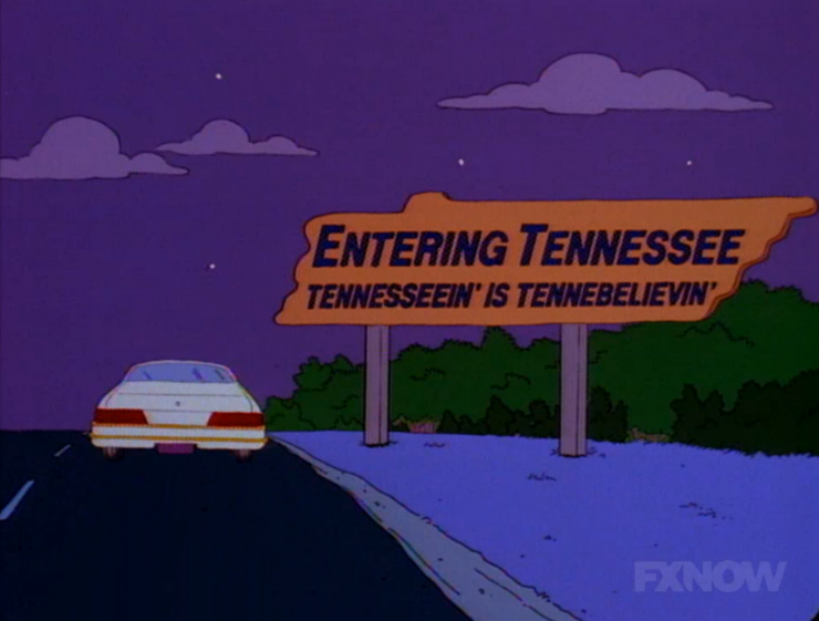
Reminded me of one of my favorite The Simpsons episodes where Bart and his buddies road trip to Knoxville.
People deal with uncertainty in their own, private ways, I guess. Some do it publicly. It’s cool. In this age of team-choosing and blind loyalty to dogma, it is good to be skeptical, as long as your skepticism seeks truth, and is not skepticism for skepticism’s sake.
GFS model
The latest run (12z) of the GFS model — which has been changing its mind and will probably change it again — thinks rain Monday night will turn to snow Tuesday morning. This isn’t the usual three-flaker, this would be an accumulating snow lasting more than a few hours Tuesday morning. First flakes splat/melt, but then we’ll dive into the 20°s and stay there all morning and all day. Accumulating snowfall should not melt Tuesday.
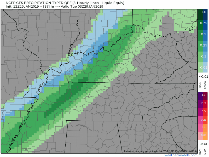
The 0z run of the GFS model (three runs ago, but the 6z run isn’t as valuable) had the same thing.
A sledable snow event.
Euro model
The Euro has been consistent for a few days. It’s well respected. Has a better track record than the GFS. It’s not perfect – no model is – but watch what it does:
Monday Night: rain.
After Midnight Tuesday Morning: rapid changeover to snow.
Tuesday AM Commute: Still snowing. At times, snowing pretty hard. And accumulating
Mid-Morning Tuesday: Snow ends.
How Much: Way too soon to speculate exact amounts. Let’s just say enough to sled. Avoid “deterministic” models someone may post — usually for clicks and shares. There’s one floating around with 8″ of snow which, while not unprecedented and no one is ruling out, isn’t part of any serious forecast right now, especially at this range. The best data is European ensemble data, and it has us around 3″.
NWS-Nashville Forecast
The afternoon forecast discussion from NWS-Nashville downplays our accumulation potential and notes potential for total snow forecast changes:
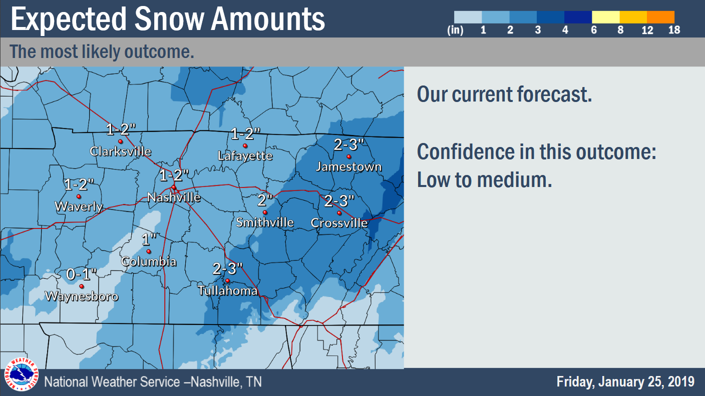
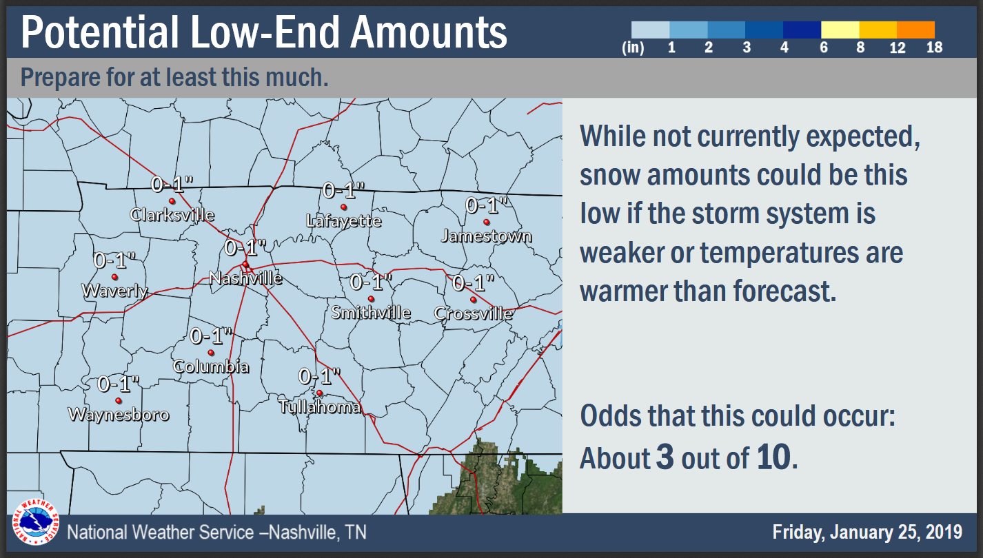
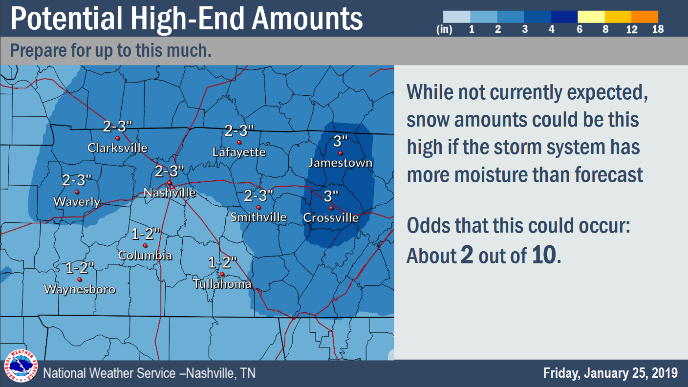
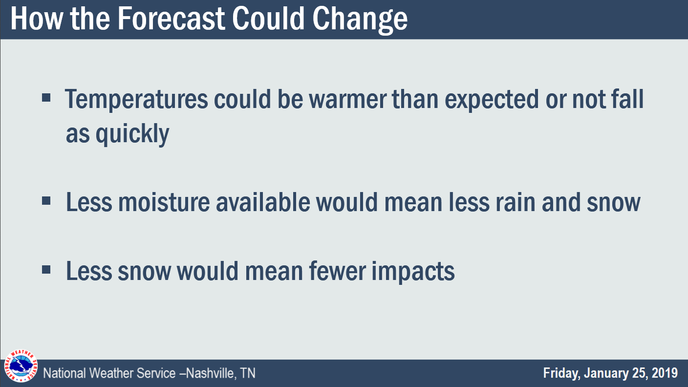
Model consensus places about an inch or less for most of the area, and up to 2 inches in the northwest (north of I-40 and west of I-65) and on the Plateau to the east. Model spread is still quite high, with a dusting or so on the low end models and around 3-4 inches in the northwest and Plateau on the high end models. Expect the storm total snow to evolve quite a bit over the weekend and hopefully consensus lines up with more confidence in the next few runs.
1″ to 2″ for most of us.
Prep for at least this much….soooo maybe nothing at all, that’s possible!
Be ready for 2″ to 3″, but odds of that right now are less likely.
Expect forecast changes. Stay informed.
If you say “Nash Severe said we’re going to get 3 inches,” you’re doing it wrong.
I think it might snow enough to sled, and I plan to spend a few minutes this weekend trying to find my sled without reinjuring my left knee. Long story, you don’t care, but I’m not spending too much time looking for it.
What Makes This Different from Prior “Events”
- Precip is almost all on the cold side of the front. Previous “events” this month had 95% of the moisture on the warm side.
- No warmup. Whereas temps quickly warmed above freezing in past “events,” that won’t happen Tuesday. In fact, we aren’t forecast to get above freezing until mid-afternoon Thursday, if at all next week.
Why You Should Pump The Party/Panic Brakes
- This is not an ideal snow setup meteorologically. I’d rather see a powerful 700mb low slowly move from Huntsville to Knoxville, putting us in its cold/wet sector. If I saw that I’d begin ordering booze, Doritos, additional sleds, hot chocolate/coffee, and I’d be sure my Fortnite account was updated. Despite being not-ideal, Tuesday’s system can produce a meaningful snowfall.
- If you’ve lived here long enough, you’ve heard this before, and we got squadoosh. Avoid confirmation bias. Remember this is predicting the future, we aren’t as good at it as we’d like to be.
- Models haven’t been super duper consistent.
We’re a long way away so Don’t Get Excited Yet.
Tennesseein’ is Tennebelievin’.
Don’t wig out. Stay updated. Relying on old information only leaves you in Tennessee, disappointed, with unmet expectations, looking up at a sad sunsphere.
Freaking Cold — More Late Week Snow?
Next week will be the coldest week so far, and by a wide margin.
Single digit wind chills Tuesday. Below zero wind chills possible overnight Tuesday into Wednesday morning.
The Euro thinks another blast of cold air arrives Friday morning, dropping wind chills near zero again Friday and Saturday mornings.
And, oh BTW, maybe more snow late next week:
it looks like yet another upper level disturbance will move across the mid state region bringing the potential of accumulating snowfall Thu night. Fri morning, and then tapering off by Fri afternoon. Again, too early to get specific with accumulation amounts, but it initially looks like the potential of accumulating snowfall with be there across mid state region.

^^Note this is from a reality TV show.

Categories: Forecast Blogs (Legacy)
You must be logged in to post a comment.