
Monday
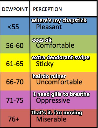
Looking to be another hot and muggy day. Dew points will reach as high as 72°, which will help the heat index climb up to 96°.
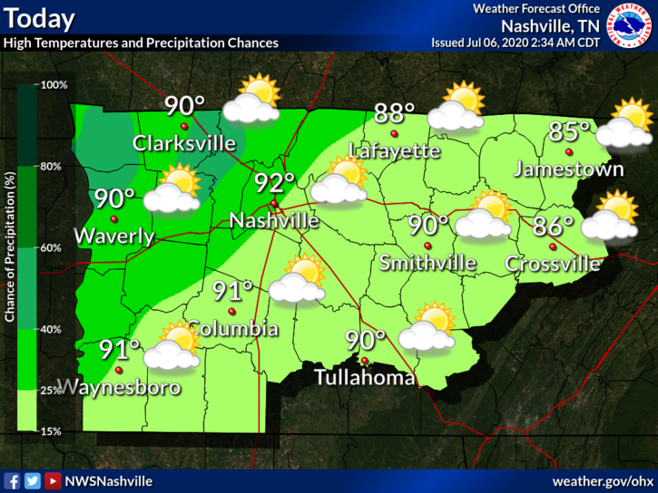
Those high dew point values don’t only help the heat index: they also help to fuel those scattered showers and storms we’ve been seeing.
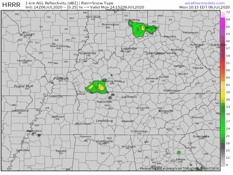
According to the HRRR, storms should begin to fire at around 3 pm, but become more widespread around 5 pm. They should be leaving the area after midnight. One could roll into your backyard, but not your friend’s house down the road.
No severe weather is currently in the forecast, but these storms could pack a punch. Lightning, gusty winds, and some localized flooding are all possible. If you have afternoon plans, make sure to keep an eye on that radar!
Looking Ahead
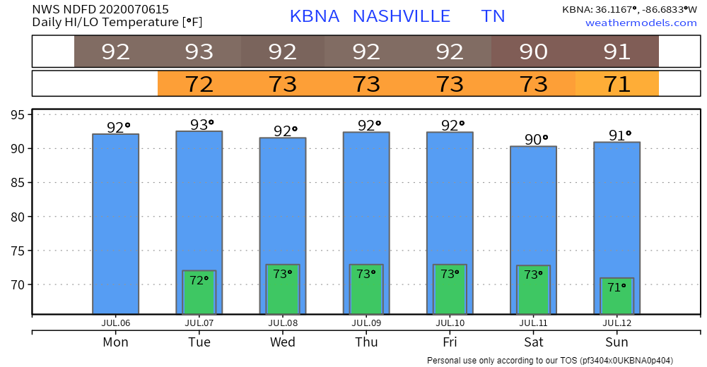
The rest of the work week is looking to follow the same trend as today: high heat index values, high humidity, and afternoon rain.

The heat index looks to be in the mid to upper 90s (and posisbly reach low 100s) for Tuesday and Wednesday.
Dew point values will stay mainly near the 72° to 73° range throughout the week. There will be a small break on Sunday, where they will drop down into the upper 60s.
With those dew points staying high, the chance of those showers and storms will linger. Although they are not in the forecast to be severe, they will still have the chance of some lightning, gusty winds, and heavy rain.
These storms are hard to pinpoint, especially this far out. Some of us will get wet, while other don’t see a drop of rain.
Did You Know?
2018 was the deadliest year on record of children dying in hot cars with 53 kids.
According to National Safety Council, over 800 kids have died since 1998 because of a vehicular heatstroke.
A quick way to make sure you take one more look in the back seat is to place something of importance back there, such as a purse or even one of your shoes. Even if you’re just running a quick errand and leave the windows cracked, it gets really hot really quick in a car.
Quick Look at the Tropics
We had our 5th (!!) storm named Sunday night: Edouard.
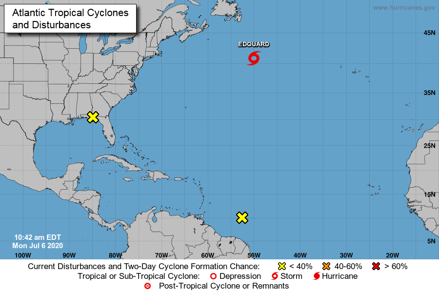
This is the earliest an E name has been given, breaking the previous record by Emily in 2005.
There are also two other disturbances to keep an eye on in the Atlantic.
Categories: Forecast Blogs (Legacy)
You must be logged in to post a comment.